St. George, Utah
St. George is a city in and the county seat of Washington County, Utah, United States. Located in the southwestern corner of the state on the Arizona border, it is the principal city of the St. George Metropolitan Statistical Area. The city lies in the northeasternmost part of the Mojave Desert, adjacent to the Pine Valley Mountains and near the convergence of three distinct geological areas: the Mojave Desert, Colorado Plateau, and Great Basin. The city is 118 miles (190 km) northeast of Las Vegas and 300 miles (480 km) south-southwest of Salt Lake City on Interstate 15.
St. George, Utah | |
|---|---|
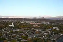
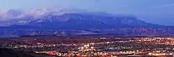 Overlook of downtown St. George and adjacent Pine Valley Mountains | |
 Flag  | |
| Nickname(s): Utah's Dixie, (the) STG | |
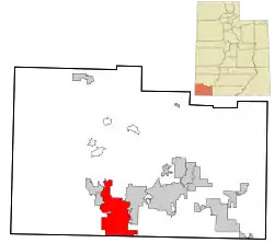 Location within Washington County | |
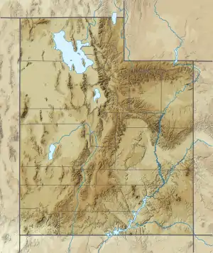 St. George Location within Utah  St. George Location within the United States | |
| Coordinates: 37°06′15″N 113°35′03″W[1] | |
| Country | United States |
| State | Utah |
| County | Washington |
| Settled | 1861 |
| Incorporated | 1862 |
| Named for | George A. Smith |
| Government | |
| • Interim mayor | Michelle Randall[2] |
| • City Manager | Adam Lenhard |
| Area | |
| • City | 78.47 sq mi (203.22 km2) |
| • Land | 78.46 sq mi (203.22 km2) |
| • Water | 0.00 sq mi (0.01 km2) 0.72% |
| Elevation | 2,700 ft (800 m) |
| Population | |
| • City | 72,897 |
| • Estimate (2019)[5] | 89,587 |
| • Rank | US: 383rd UT: 8th |
| • Density | 1,141.79/sq mi (440.85/km2) |
| • Metro | 171,700 (US: 245th) |
| • Metro density | 1,310/sq mi (510/km2) |
| Demonym(s) | St. Georgian |
| Time zone | UTC−7 (Mountain) |
| • Summer (DST) | UTC−6 (Mountain) |
| ZIP Code | 84770–84771, 84790–84791 |
| Area code(s) | 435 |
| Federal Information Processing Standards | 49-65330 |
| Geographic Names Information System feature ID | 1455098[1] |
| Website | sgcity.org |
As of the 2019 U.S Census estimates, the city had a population of 89,587, and the St. George metropolitan area had an estimated population of 171,700.[6][7] St. George is the seventh-largest city in Utah and most populous city in the state outside of the Wasatch Front.
The city was settled in 1861 as a cotton mission, earning it the nickname "Dixie". While the crop never became a successful commodity, the area steadily grew in population. Between 2000 and 2005, St. George emerged as the fastest growing metropolitan area in the United States.[8] Today, the St. George region is well known for its year-round outdoor recreation and proximity to several state parks, Zion National Park and The Grand Canyon. Dixie State University is located in St. George and is an NCAA Division 1 institution.
History
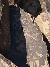
Prior to the arrival of the first European settlers, the St. George area was inhabited by the Virgin River Anasazi and later by the Southern Paiute tribe. The first Europeans in the area were part of the Domínguez–Escalante expedition in 1776.
St. George was founded as a cotton mission in 1861 under the direction of Apostle Erastus Snow. It was called Dixie by Brigham Young, who was president of The Church of Jesus Christ of Latter-day Saints (LDS Church). While early settlers cultivated cotton as a commodity crop, they did not succeed in producing it at competitive market rates; consequently, cotton farming was eventually abandoned. More important to the economy was tourism, which developed as the railroads began to carry visitors to the nearby Zion National Park.
At the outbreak of the American Civil War in 1861, Young organized the settlement of what is now Washington County.
Fearing that the war would take away the cotton supply, he began plans for raising enough in this southwestern country to supply the needs of his people. Enough favorable reports had come to him from this warm region below the rim of the Great Basin, that he was convinced cotton could be raised successfully here. At the general church conference in Salt Lake City on October 6th, 1861, about three hundred families were "called" to the Dixie mission to promote the cotton industry. Most of the people knew nothing of this expedition until their names were read from the pulpit; but in nearly every case, they responded with good will, and made ready to leave within the month's time allotted to them. The families were selected so as to ensure the communities the right number of farmers, masons, blacksmiths, businessmen, educators, carpenters, as needed.[9]
The settlement was named after George A. Smith, an LDS Church apostle.[10]
Notable events
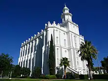
In April 1877, the LDS Church completed the St. George Utah Temple. It is the church's third and oldest continually-operating temple in the world. (The temple has been closed since November 2019 for renovation.)
The 1992 St. George earthquake destroyed three houses as well as above- and below-ground utilities, causing about US$1 million in damage.[11][12]
St. George was the location of the 1997 United States Academic Decathlon national finals.
In January 2005, a 100-year flood occurred throughout the region, due to prolonged heavy rainfall overflowing the Virgin River and Santa Clara River. One person was killed and 28 homes were destroyed by the Santa Clara River.[13][14]
Nuclear contamination
In the early 1950s, St. George received the brunt of the fallout of above-ground nuclear testing at the Yucca Flats/Nevada Test Site northwest of Las Vegas. Winds routinely carried the fallout of these tests directly through the St. George and southern Utah area. Marked increases in the frequency of cancer in the population, not limited to leukemia, lymphoma, thyroid cancer, breast cancer, melanoma, bone cancer, brain tumors, and gastrointestinal tract cancers, were reported from the mid-1950s until the early 1980s.[15][16] It is believed that much of the cast and crew of The Conqueror contracted cancer because of this.[17][18]
A 1962 United States Atomic Energy Commission report found children living in St. George, Utah, at the time of the fallout may have received doses to the thyroid of radioiodine as high as 120 to 440 rads" (1.2 to 4.4 Gy).[19]
Geography
According to the United States Census Bureau, the city has a total area of 64.9 square miles (168.0 km2), of which, 64.4 square miles (166.8 km2) of it is land and 0.5 square miles (1.2 km2) of it (0.72%) is water. St. George lies in a desert valley, with most of the city lying below 3,000 feet (900 m). Wildlife and vegetation are typical of the Mojave Desert in which it lies. It is situated near a unique geological transition zone where the Mojave, Colorado Plateau, and Great Basin all converge. The Beaver Dam Mountains, commonly referred to as Utah Hill, lie to the west, the Red Cliffs National Conservation Area and Pine Valley Mountains to the north, the western edge of the Colorado Plateau and Zion National Park to the east, and the Arizona Strip to the south. The Virgin and Santa Clara rivers flow through the St. George valley and converge near the western base of Webb Hill.
Geology
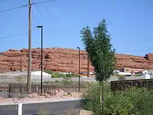
In southwestern Utah, soil and rock formations are red in appearance due to the presence of iron oxide, although portions of the older section of the city, particularly the southern part near the Virgin River, lie on floodplain alluvium, but much of St. George proper is built directly upon Jurassic, Triassic, and Permian period sedimentary bedrock.
The following formations, listed in chronological order, are within the city limits.
- Kaibab Limestone (Permian): Gray fossiliferous limestone, exposed at the center of the Virgin River anticline along Horseman Park Drive and in the low hills to the south of South Bloomington Hills.
- Moenkopi Formation (Triassic): Chocolatey-red and white banded mudstone, shale, limestone, and siltstone containing thick layers of gypsum, exposed at Bloomington, South Bloomington Hills, and the south side of Webb Hill.
- Shinarump Conglomerate (Triassic): Yellow to brown cliff-forming sandstone and conglomerate containing fossilized oyster shells and petrified wood. Forms the cliff faces north of Bloomington, on Webb Hill, and along the Virgin River south of 1450 South Street. This is actually the lowest member of the Chinle formation.
- Chinle Formation (Triassic): Purple, white, gray and locally green bentonitic shale weathering to clay. Because of the softness of the strata, structures built on this formation run a higher risk of settling or slippage. The Chinle formation underlies large portions of St. George, including North Bloomington Hills, much of Green Valley, and much of the east side of the city around Riverside Drive and Pine View High School.
- Moenave Formation (Jurassic): Red and orange sandstone, siltstone, and mudstone. There is some confusion about distinguishing between the Springdale sandstone member of the Moenave formation and the overlying Navajo sandstone, which is similar in appearance, in the St. George area. It is now generally assumed the red cliffs north of downtown (north of Red Hills Parkway) and at the Dixie Red Hills golf course are part of the Moenave formation. Other exposures include cuts into the east and west Black Hills and the southern part of the Dixie Downs neighborhood.
- Kayenta Formation (Jurassic): Red, orange, and purple sandstone, shale, and mudstone. Forms slopes below the massive Navajo sandstone in the northern part of the city including northern Dixie Downs and along Snow Canyon Parkway.
- Navajo Sandstone (Jurassic): Gray to brown, red, and (in its upper layers) white massive sandstone. Forms cliff faces above Snow Canyon Parkway and white outcrops at Winchester Hills.
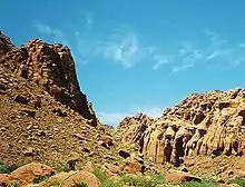
Basaltic lava flows from the Quaternary period form the black ridges to the east and west of the historic area of St. George city. The volcanic eruptions producing these flows are thought to be 1.2 million years old.
Other points of geologic interest include the Virgin River anticline; the rock has eroded away in the center, leaving sheer walls surrounding the "Purgatory Flats" area to the east of St. George. Another geologic feature is Pine Valley Mountain: composed of one solid piece of granite, it is one of the largest laccoliths in the world.
Climate
St. George's arid climate is significantly warmer on average than the rest of the state, and more closely resembles nearby Las Vegas. The climate (Köppen BWk) features hot summers and relatively mild winters. The monthly average temperature ranges from 42.4 °F (5.8 °C) in December to 87.9 °F (31.1 °C) in July. On average, there are 60 afternoons with high temperatures over 100 °F (38 °C), with an average window of June 29 through August 13, and 122 days with high temperatures over 90 °F (32 °C) with the average window fluctuating between late April and early October. There are approximately 60 mornings where the low temperature drops to the freezing mark, with the historical average window between November 12 and March 14.
The highest temperature statewide was 118 °F (48 °C), which was recorded in south St. George, near the Arizona border on July 4, 2007, breaking the previous record-holder, at 117 °F (47 °C), also set in St. George on July 5, 1985.[20] The record high minimum temperature is 89 °F (32 °C) set on July 15, 1970 and July 3, 2013. Nighttime freezes are common during the winter due to radiational cooling. Both the record low temperature of −11 °F (−24 °C) and record low maximum temperature of 17 °F (−8 °C) were set on January 22, 1937; the record low temperature occurred again on January 26, 1937, both during the record cold month of January 1937 across the Western United States.[20]
The city has abundant sunshine year-round and averages about 300 sunny days per year, with an average 8.80 inches (224 mm) of precipitation annually.[20] The wettest "rain year" has been from July 2004 to June 2005 with at least 15.66 inches (398 mm) (some days were missing) and the driest from July 1973 to June 1974 with 3.89 inches (98.8 mm). Record breaking wide spread flooding occurred during January 2005 when area creeks and rivers far exceeded their banks and washed out homes and some neighborhoods. The wettest month has been January 1993, when 4.74 inches (120 mm) fell. Precipitation is fairly evenly distributed throughout the year, except for a markedly drier period from April through June, which occurs after the Pacific storm season ends, but before the southwest monsoon begins, usually in mid-July. Precipitation mostly comes from the Pacific Ocean from late fall through early spring. The storm track usually lifts north of the city by mid-April. The monsoon brings localized and often intense thunderstorms from early July through mid-September. The greatest rainfall in 24 hours was 2.40 inches (61 mm) on August 31, 1909.[20]
The St. George valley does occasionally receive wet or slushy snowfall in the winter, but what accumulates usually melts off by the mid-to-late morning; the normal seasonal snowfall is 1.4 inches (3.6 cm).[20] The earliest snowfall was measured on October 29, 1971 and the latest on April 11, 1927.[20] The record single-day snowfall is 10.0 inches (25 cm) which was set on January 5, 1974. With the city having elevations ranging from 2700 feet to about 3500 feet, some areas such as Diamond Valley and Winchester Hills will typically receive more snowfall and colder temperatures than the rest of the lower valley. The most recent major snow event was on December 8, 2013 when between 6.0 and 8.0 inches (15 and 20 cm) virtually shut down the city, making it the third heaviest snowfall in the city's history. Also significant about the storm was how low temperatures dropped and remained that way for several days with daytime highs failing to reach the freezing mark, and one night time low temperature of 1 °F (−17 °C), recorded at the airport, was the coldest in the city in over 100 years. The remarkable, prolonged cold spell killed or severely damaged much of the area's non-native vegetation such as the Mexican fan palm trees.
| Climate data for St. George, Utah (1981–2010 normals) | |||||||||||||
|---|---|---|---|---|---|---|---|---|---|---|---|---|---|
| Month | Jan | Feb | Mar | Apr | May | Jun | Jul | Aug | Sep | Oct | Nov | Dec | Year |
| Record high °F (°C) | 72 (22) |
84 (29) |
91 (33) |
100 (38) |
108 (42) |
115 (46) |
118 (48) |
113 (45) |
109 (43) |
107 (42) |
88 (31) |
75 (24) |
118 (48) |
| Mean maximum °F (°C) | 65.2 (18.4) |
72.0 (22.2) |
81.6 (27.6) |
90.2 (32.3) |
98.8 (37.1) |
105.6 (40.9) |
110.1 (43.4) |
107.3 (41.8) |
102.6 (39.2) |
91.5 (33.1) |
76.0 (24.4) |
63.3 (17.4) |
110.3 (43.5) |
| Average high °F (°C) | 53.7 (12.1) |
58.8 (14.9) |
67.3 (19.6) |
75.2 (24.0) |
85.8 (29.9) |
95.7 (35.4) |
101.4 (38.6) |
99.1 (37.3) |
91.7 (33.2) |
77.7 (25.4) |
62.9 (17.2) |
51.9 (11.1) |
76.8 (24.9) |
| Daily mean °F (°C) | 42.4 (5.8) |
47.0 (8.3) |
54.4 (12.4) |
61.9 (16.6) |
72.3 (22.4) |
81.5 (27.5) |
87.9 (31.1) |
86.0 (30.0) |
77.5 (25.3) |
63.7 (17.6) |
50.5 (10.3) |
41.3 (5.2) |
63.9 (17.7) |
| Average low °F (°C) | 31.0 (−0.6) |
35.3 (1.8) |
41.6 (5.3) |
48.7 (9.3) |
58.7 (14.8) |
67.3 (19.6) |
74.5 (23.6) |
72.8 (22.7) |
63.2 (17.3) |
49.7 (9.8) |
38.0 (3.3) |
30.6 (−0.8) |
51.0 (10.6) |
| Mean minimum °F (°C) | 19.9 (−6.7) |
23.2 (−4.9) |
30.2 (−1.0) |
37.4 (3.0) |
44.1 (6.7) |
53.6 (12.0) |
64.8 (18.2) |
63.1 (17.3) |
51.0 (10.6) |
37.5 (3.1) |
26.5 (−3.1) |
19.8 (−6.8) |
17.0 (−8.3) |
| Record low °F (°C) | −11 (−24) |
1 (−17) |
12 (−11) |
18 (−8) |
20 (−7) |
35 (2) |
41 (5) |
43 (6) |
25 (−4) |
20 (−7) |
4 (−16) |
−4 (−20) |
−11 (−24) |
| Average precipitation inches (mm) | 1.38 (35) |
1.26 (32) |
1.18 (30) |
0.55 (14) |
0.21 (5.3) |
0.17 (4.3) |
0.48 (12) |
0.76 (19) |
0.57 (14) |
0.68 (17) |
0.71 (18) |
0.85 (22) |
8.8 (222.6) |
| Average snowfall inches (cm) | 0.7 (1.8) |
0.3 (0.76) |
0.2 (0.51) |
trace | 0.0 (0.0) |
0.0 (0.0) |
0.0 (0.0) |
0.0 (0.0) |
0.0 (0.0) |
trace | 0.1 (0.25) |
0.1 (0.25) |
1.4 (3.6) |
| Average precipitation days (≥ 0.01 in) | 5.2 | 6.1 | 5.3 | 3.6 | 2.2 | 1.5 | 2.9 | 3.5 | 2.6 | 3.7 | 3.5 | 4.5 | 44.6 |
| Average snowy days (≥ 0.1 in) | 0.2 | 0.2 | 0.1 | 0.1 | 0.0 | 0.0 | 0.0 | 0.0 | 0.0 | 0.0 | 0.1 | 0.2 | 0.9 |
| Source: NOAA (extremes 1893–present)[20] | |||||||||||||
Demographics
| Historical population | |||
|---|---|---|---|
| Census | Pop. | %± | |
| 1870 | 1,142 | — | |
| 1880 | 1,384 | 21.2% | |
| 1890 | 1,377 | −0.5% | |
| 1900 | 1,690 | 22.7% | |
| 1910 | 1,769 | 4.7% | |
| 1920 | 2,271 | 28.4% | |
| 1930 | 2,434 | 7.2% | |
| 1940 | 3,591 | 47.5% | |
| 1950 | 4,562 | 27.0% | |
| 1960 | 5,130 | 12.5% | |
| 1970 | 7,097 | 38.3% | |
| 1980 | 11,350 | 59.9% | |
| 1990 | 28,502 | 151.1% | |
| 2000 | 49,728 | 74.5% | |
| 2010 | 72,897 | 46.6% | |
| 2019 (est.) | 89,587 | [5] | 22.9% |
| U.S. Decennial Census[21] 2018 Estimate[22] | |||
As of 2015 the largest self-reported ancestry groups in St. George, Utah are:[23]
| Largest ancestries (2015) | Percent |
|---|---|
| English | 28.2% |
| German | 11.3% |
| Irish | 8.5% |
| Danish | 4.6% |
| Swedish | 4.0% |
| Italian | 3.8% |
| Scottish | 3.7% |
| Dutch | 2.4% |
| Norwegian | 1.8% |
| French (except Basque) | 1.8% |
| Swiss | 1.4% |
| Welsh | 1.2% |
| Polish | 1.2% |
| Scots-Irish | 1.0% |
In 2018, the city's population was estimated at 87,178. St. George was declared the fourth fastest-growing metropolitan area in the United States in 2018.[24][25]
As of 2018,[26] there were 27,552 households. The population density was 1,135 people per square mile. As of 2010, there were 32,089 housing units at an average density of per square mile. The city's racial makeup was 87.2% White, 0.7% African-American, 1.5% Native American, 0.8% Asian, 1.0% Pacific Islander, and 8.9% from other races. 12.8% of the population was Hispanic or Latino of any race.
As of the 2000 census, there were 17,367 households, out of which 34.2% had children under the age of 18 living with them, 63.6% were married couples living together, 8.6% had a female householder with no husband present, and 24.9% were non-families. 19.4% of all households were made up of individuals, and 10.2% had someone living alone who was 65 years old or older. The average household size was 2.81 individuals and the average family size was 3.21.
In the city, the age distribution of the population showed 28.4% under the age of 18, 13.7% from 18 to 24, 22.0% from 25 to 44, 16.8% from 45 to 64, and 19.3% who were 65 years of age or older. The median age was 31 years. For every 100 females, there were 94.5 males. For every 100 females age 18 and over, there were 91.2 males.
The median income for a household in the city was $36,505, and the median income for a family was $41,788. Males had a median income of $31,106 versus $20,861 for females. The per capita income for the city was $17,022. About 7.4% of families and 11.6% of the population were below the poverty line, including 14.4% of those under age 18 and 4.4% of those age 65 or over. A significant portion of the over 65 population was "snowbirds", who live in St. George during the winter.
Religion
Approximately 78.0% of St. George's residents identify as religious; below are stats as of 2014:[27]
- 70.4% LDS Church
- 4.4% Catholic
- 0.6% Baptist
- 0.5% Lutheran
- 0.4% Southern Baptist
- 0.3% Presbyterian
- 0.2% Episcopalian
- 0.2% United Methodist
- 0.2% Assemblies of God
- 1.0% Other
Government
Local government
The St. George city government has a council-manager form of government, with five representatives elected from single-member districts. The mayor, elected at-large, also serves as a member on the City Council. The Council hires a city manager to deal with regular operations.[28] As of January 2014, the mayor of St. George is Jon Pike. The city manager is Adam Lenhard.
Council members are Jimmy Hughes, Michele Randall, Dannielle Larkin, Gregg McArthur, and Bryan Smethurst. City Council meetings are held on the first and third Thursdays of each month at the City Council Chambers.[29]
The U.S. Federal Courthouse, Washington County Justice Court, Juvenile Court and the Fifth District Courthouse are downtown.
Infrastructure
Healthcare
Dixie Regional Medical Center is an Intermountain Health Care hospital and is the only 24-hour trauma center between Las Vegas and the Wasatch Front, serving the tri-state region of southern Utah, northwest Arizona and southeastern Nevada.[30]
Utilities
St. George is served by City of St. George Power, which serves most of the city, and Dixie Power, which serves southern areas of the city. Rocky Mountain Power serves parts of the greater St. George area.
Arts and culture
The City of St. George sponsors Art in the Park and Concerts in the Park series held at Vernon Worthen Park, which features a variety of musical acts and culinary booths. The city is home to the Southwest Symphony Orchestra and Southern Utah Heritage Choir. 'Art Around the Corner' features many outdoor sculptures and statues depicting both local cultural flair as well as a broad array of ever-changing pieces from all over the globe for a temporary display throughout the growing Arts District in historic downtown. Art galleries are abundant throughout the city and southwestern Utah. Some notable yearly events include The St. George Arts Festival held each spring, featuring local, national, and international artists; the St. George Parade of Homes; the Dixie Roundup Rodeo; St. George Marathon; St. George Ironman and the Huntsman World Senior Games.
Economy

SkyWest Airlines is headquartered in St. George, and is the primary airline provider at the city's regional airport.[31] Walmart has a distribution center just outside the city and Family Dollar recently opened a distribution center in the Fort Pierce Industrial Park to better serve the southwest region of the U.S.
The Washington County School District main offices are based in the city.[32]
The Cafe Rio restaurant chain was started in St. George in 1997.[33]
The local economy is largely based in tourism and new home construction and manufacturing. Over a dozen golf courses offering year-round golfing, and various world-recognized events also make for large contributors to the city's economy.
Transportation
Airport
St. George Regional Airport is seven miles southeast of downtown St. George, off Southern Parkway (SR-7). It opened in January 2011, replacing the previous municipal airport which was on a land-locked mesa near downtown and thus could not be expanded for anticipated population growth.
Domestic flights
- American Airlines, Phoenix daily.[34][35]
- Delta Air Lines, Salt Lake City daily.[34][35]
- United Airlines, Denver and Los Angeles daily.[34][35]
The Union Pacific line between Salt Lake City and Las Vegas is about 60 miles (97 km) north and west of the city.
SunTran is the local public transit system and operates seven fixed-routes with about 200 bus stops serving most areas of St. George, Washington and Ivins.[36] Rent-A-Bike and 'Spin' scooters are available for rated use in numerous locations city-wide.
Greyhound serves St. George on its Denver-Las Vegas and Salt Lake City-Las Vegas routes.[37][38] Greyhound connects with Amtrak's California Zephyr in Salt Lake City.[39] St. George is also served by the bus company Tufesa and the shuttle companies Salt Lake Express and St. George Shuttle.[40][41]
Major highways
![]() Interstate 15 runs north-south through the area, connecting the city with Las Vegas (117 miles) to the southwest, Cedar City (50 miles) and Salt Lake City (300 miles) to the north. St. George is served directly by exits 2, 4, 5, 6, 8 and 10.
Interstate 15 runs north-south through the area, connecting the city with Las Vegas (117 miles) to the southwest, Cedar City (50 miles) and Salt Lake City (300 miles) to the north. St. George is served directly by exits 2, 4, 5, 6, 8 and 10.
The western terminus of Interstate 70, approximately 125 miles (201 km) to the north, connects the city with Denver (629 miles) via I-15.
Access to Interstate 40 via U.S. Route 93, 120 miles (190 km) to the southwest, connects the city with Phoenix (421 miles).
Sports
The St. George community has been the home to two minor-league independent baseball teams. The first, the St. George Pioneerzz (originally the Zion Pioneerzz) who played in the independent Western Baseball League from 1999 to 2001, winning the league championship in 2000. A new franchise, managed by former major league player Darell Evans, was awarded to Utah's Dixie in 2007. The team, the St. George Roadrunners, played in the independent Golden Baseball League before being taken over by the league and moved to Henderson, Nevada in 2010.
St. George area high schools; Crimson Cliffs, Dixie, Desert Hills, Pine View, and Snow Canyon all play in 4A state competition as part of 4A Region 9 with nearby Hurricane High School in Hurricane, and Canyon View and Cedar high schools in Cedar City.[42] Dixie State University participates in the NCAA Division II Rocky Mountain Athletic Conference. In January 2019, Dixie State announced they were reclassifying to NCAA Division I and joining the Western Athletic Conference.[43] Former DSU athletes include Corey Dillon, Anton Palepoi, Reno Mahe, and Scott Brumfield, who all later played in the NFL and Marcus Banks, Lionel Hollins, Keon Clark, and Mo Baker were Dixie players who later played in the NBA. Dixie State athletes are called Trailblazers (formerly The Rebels and Red Storm), and former Rebels Bradley Thompson and Brandon Lyon later played in major league baseball while Bruce Hurst of Dixie High School later played for the Boston Red Sox a pitcher, and then ended up managing the now retired Zion Pioneerzz for its inaugural 1999 season (1999).
Rankings
Parks and recreation
The St. George area is home to many diverse neighborhood and city parks, over a dozen award-winning golf courses and recreation areas, and a 60-mile plus urban trail system interlinking neighborhoods, parks and communities throughout the area.[47] Notable parks and sites include the Canyons Softball Complex; Little Valley Softball Complex; Pioneer Park; Tonaquint Nature Center; nationally-recognized Snake Hollow bike park; three local skate parks; Legacy Regional Park and fairgrounds is just east of the city in Hurricane. The St. George area has several public recreation centers; the St. George Rec Center; Washington City Rec Center and the Sand Hollow Aquatics Center.[48][49] St. George is fast-becoming a popular rock climbing and mountain biking destination.[50]
Media
Radio
| Call sign | Frequency | City of License | Owner | Format | Notes | |
|---|---|---|---|---|---|---|
| KDXU | 890 AM & 94.9 FM | St. George | Cherry Creek Radio | Talk radio | ||
| KLGU | 90.3 FM | St. George | Educational Media Foundation | Christian contemporary | ||
| KXBN | 92.1 FM | Cedar City | Cherry Creek Radio | Top 40/Contemporary Hit Radio | ||
| KXLI | 94.5 FM | Moapa, Nevada | Radio Activo Broadcasting | Spanish | ||
| KXDS | 91.3 & 94.9 FM | St. George | Dixie State University | Variety (radio) | ||
| KZHK | 95.9 FM | St. George | Canyon Media | Classic rock | ||
| KCLS | 96.3 FM | St. George | Canyon Media | Active Rock | ||
| KYLI | 96.7 FM | Bunkerville, Nevada | Aurora Media | Dance Top 40 | Jelli-programmed; focused on Las Vegas, Nevada | |
| KRQX | 98.9 FM | St. George | Redrock Broadcasting | Classic Hits | ||
| KONY | 99.9 FM | St. George | Canyon Media | Country music | ||
| KFUR-LP | 101.1 FM | St. George | Latinos Unidos Broadcasting | Regional Mexican | ||
| K272AQ | 102.3 FM | St. George | Cherry Creek Radio | Oldies | Repeater of KXFF, Colorado City, Arizona | |
| K279BN | 103.7 FM | St. George | Southwest Media | Oldies | Repeater of KJUL, Las Vegas, Nevada | |
| KURR | 103.1 FM | St. George | Redrock Broadcasting | Top 40 | ||
| KUTQ | 102.3 FM | St. George | Redrock Broadcasting | Country music | ||
| KZYN | 104.1 FM | St. George | Redrock Broadcasting | Adult Alternative | ||
| KPLD | 94.1 & 105.1 | St. George | Canyon Media | Hot adult contemporary | ||
| KWBR-LP | 105.7 FM | St. George | Association of Community Resources and News | Smooth Jazz | ||
| KIYK | 107.3 FM | St. George | Cherry Creek Radio | Hot adult contemporary | ||
| KHKR | 1210 AM | St. George | Cherry Creek Radio | Sports radio | ||
| KZNU | 1450 AM-93.1 FM | St. George | Canyon Media | Talk radio | – |
Newspapers
- The Spectrum, which is owned by Gannett, is the local daily newspaper.
- The Independent newspaper offers a monthly print edition featuring local news, arts, entertainment & events coverage. It also provides free online daily news and an online community events calendar.
- St. George News (stgnews.com) is free-access online news.
- Southern Utah Weekly is a weekly newspaper
The Salt Lake Tribune, Deseret Morning News, Las Vegas Review-Journal and Las Vegas Sun are also widely distributed in St. George and offer home delivery.
Other publications include; St. George Magazine, a monthly magazine covering a variety of local content, and View On Southern Utah is a magazine offering a variety of content for the southern Utah, southern Nevada and northwestern Arizona area.
Television
St. George has only one television station licensed to the city, KMYU Channel 12, a MyNetworkTV affiliate.[51] It is carried in HD on Dish Network and DirecTV, as well as on Comcast Ch. 643 in Salt Lake City, and on Ch. 20 on local cable, TDS Communications, formerly Baja Broadband. KMYU (known as My Utah TV[52]) is sister station to KUTV-DT, and is operated out of KUTV's offices in Salt Lake City, although the station has a news bureau with a reporter and photographer based in St. George.
Also in St. George are the offices of Cedar City, Utah-licensed[51] KCSG Channel 14, a MeTV affiliate, which broadcasts local news. The city also receives local TV channels from Salt Lake City with broadcast translators in the St. George area.
The Las Vegas NBC affiliate, KSNV-DT, has a local translator owned by Cherry Creek Radio, KVBT-LP channel 41, on which some of its programming airs two hours later than the same programming broadcast on Salt Lake City NBC affiliate KSL-TV.
Education
St. George is home to Dixie State University,[53] a four-year institution, of about 10,000 students (as of 2018), and Dixie Technical College[54] with 4,920 post-secondary and 292 secondary students (as of 2018). Dixie Technical College opened a new main campus on the site of the old St. George Airport in 2018.[55] In addition to these institutions, the city is also home to Rocky Vista University College of Osteopathic Medicine as well as College Education Centers of University of Phoenix and Stevens-Henager College.
Public schools

The city of St. George is a part of the Washington County School District. St. George has four public high schools: Dixie High School, Pine View High School, Desert Hills High School, and Snow Canyon High School, as well as Millcreek Alternative High School. The city has four middle schools, three intermediate schools and twelve elementary schools. The high schools include grades 10 to 12, middle schools grades 8 to 9, and intermediate schools grades 6 to 7 and each set of high, middle, and intermediate school shares the same coverage zone. The intemediate school associated with Snow Canyon High School is in neighboring Santa Clara.
Crimson Cliffs High School, Crimson Cliffs Middle School and Washington Fields Intermediate School were recently opened in neighboring Washington City. Their coverage zone extends into eastern St. George.
The Southern Utah Center for Computer, Engineering, and Science Students (SUCCESS) is an early college high school located on the Dixie State University campus.
Neighboring Ivins is home to Utah's first charter high school, Tuacahn High School for the Performing Arts, which provides an alternative education with no tuition costs to any Utah resident.
Notable people
- Robert Adamson (b. 1985), actor (Lincoln Heights)
- Jay Don Blake (b. 1958), professional and NCAA champion golfer [56]
- Wilford Brimley, American actor and singer
- Juanita Brooks, Mormon writer, editor and historian
- Howard Cannon, former United States Senator from Nevada
- Asia Carrera, adult film star[57]
- LaVell Edwards (1930–2016), former BYU football coach [58]
- Jada Facer, actress and singer
- Dia Frampton, runner-up in inaugural season of The Voice
- Orval Hafen, lawyer, legislator, and community advocate
- Tracy Hickman, fantasy author[59]
- Jeffrey R. Holland, LDS general authority[60]
- Bruce Hurst (b. 1958), former Major League Baseball pitcher[61]
- Doug Jolley (b. 1979), NFL tight end[62]
- Steven Koecher, living in St. George at the time he disappeared.
- Meg and Dia, rock group
- The Piano Guys, classical music group, formed in 2010
- Amanda Righetti (b. 1983), actress (The OC, Reunion, The Mentalist)
- Gaskell Romney (1871–1955), Mormon leader, father of George W. Romney, grandfather of Mitt Romney
- Miles Romney (1806–1877), settler, Mormon leader
- Miles Park Romney (1843–1904), attorney, police chief
- J. Edwin Seegmiller (1923–1986), physician and medical researcher, National Academy of Sciences, faculty member UCSD Medical School
- Steven E. Snow, (b. 1949), lawyer, LDS general authority, Church Historian and Recorder
- John "Cat" Thompson (1906–1990), basketball player; member of the Basketball Hall of Fame
- Tanya Tucker (b. 1958), country music singer, raised in St. George[63]
- Brendon Urie, singer-songwriter, musician, multi-instrumentalist, lead vocalist of Panic! at the Disco
Suburbs
References
- U.S. Geological Survey Geographic Names Information System: St. George, Utah
- "St. George City Council elects interim mayor". Retrieved 2021-01-20.
- "2019 U.S. Gazetteer Files". United States Census Bureau. Retrieved August 7, 2020.
- "U.S. Census website". United States Census Bureau. Retrieved October 6, 2019.
- "Population and Housing Unit Estimates". United States Census Bureau. May 24, 2020. Retrieved May 27, 2020.
- "Census: Southern Utah growing". The Spectrum & Daily News. Archived from the original on 2020-02-14. Retrieved 2019-04-21.
- "Resident Population in St. George, UT (MSA) (STGPOP)". Federal Reserve Bank of St. Louis. Federal Reserve Bank of St. Louis. 2019-01-01. Retrieved 2020-07-11.
- https://www.census.gov/prod/2006pubs/smadb/smadb-06appe.pdf
- Under Dixie Sun, 1950, Washington County Chapter, Daughters Utah Pioneers, pp 293–294. Printed by Garfield County News, Panguitch Utah.
- Lynn Arave, "St. George likely named after an LDS apostle", Deseret Morning News, 8 July 2007
- Associated Press (May 15, 1994). "'92 quake left St. George virtually unshaken". Deseret News. Retrieved March 18, 2020.
- Christenson, Gary E., ed. (1995). The September 2, 1992 ML 5.8 St. George Earthquake, Washington County, Utah (PDF). Utah Geological Survey. ISBN 1-55791-367-6. Archived (PDF) from the original on December 13, 2016. Retrieved March 18, 2020.
- "City of St. George, Utah :: Flood Pictures". sgcity.org. January 2005. Retrieved January 2, 2011.
- "Flooding and streamflow in Utah during water year 2005" (PDF). Retrieved April 7, 2014.
- Johnson, Carl (1984). "Cancer Incidence in an Area of Radioactive Fallout Downwind From the Nevada Test Site". Journal of the American Medical Association. 251 (2): 230–6. doi:10.1001/jama.1984.03340260034023. PMID 6690781.
- Falk, Jim (1982). Global Fission: The Battle Over Nuclear Power, p. 134.
- The Conqueror Production and Cancer Controversy
- Domagoj Valjak (2018-02-19). "John Wayne, Susan Hayward, and 90 other people developed cancer after filming "The Conqueror" near a nuclear testing site". The Vintage News. Retrieved 2020-07-08.
- Pat Ortmeyer and Arjun Makhijani. The Bulletin of the Atomic Scientists, November/December 1997, via October 31, 2007, retrieval.
- "NowData - NOAA Online Weather Data". National Oceanic and Atmospheric Administration. Retrieved July 18, 2013.
- "Census of Population and Housing". Census.gov. Retrieved June 4, 2015.
- "Population Estimates". United States Census Bureau. Retrieved October 6, 2019.
- Bureau, U.S. Census. "U.S. Census website". United States Census Bureau. Retrieved 2018-12-14.
- https://www.fox13now.com/2015/03/30/st-george-ranked-5th-fastest-growing-area-in-the-country/%5B%5D
- Colorado's Greeley, Florida's Palm Coast, Fastest-Growing Metro and Micro Areas Archived March 28, 2010, at the Wayback Machine. U.S. Census Bureau News.
- "City and Town Population Totals: 2010-2018". United States Census Bureau. Retrieved October 6, 2019.
- "Bestplaces.net
- "Code Book Viewer". www.sterlingcodifiers.com.
- "City of St. George | Welcome!". Sgcity.org. Retrieved 2013-03-29.
- "SkyWest Airlines corporate website". Retrieved February 9, 2013.
- "Washington County School District website". Archived from the original on January 28, 2013. Retrieved 9 February 2013.
- "Cafe Rio corporate website". Archived from the original on January 11, 2013. Retrieved February 9, 2013.
- "St. George Municipal Airport". FlightView. OAG. Retrieved February 22, 2017.
- DeMille, David. "St. George Regional Airport adds flight to Phoenix". The Spectrum. USA Today. August 11, 2016.
- "suntran web page". City of St. George website. Retrieved February 15, 2013.
- "Greyhound DENVER - GRAND JUNCTION - LAS VEGAS" (PDF).
- "SALT LAKE CITY - LAS VEGAS" (PDF).
- "Amtrak". www.amtrak.com.
- "Salt Lake Express - Shuttle & Charter Services". Salt Lake Express.
- St. George Shuttle
- https://www.uhsaa.org/realignment/2017-19Regions.pdf
- "Dixie State University to join Western Athletic Conference, ascend to NCAA's top division".
- "Study: St. George, Utah Ranked Most Secure Place To Live". Insurance Journal. 4 December 2006.
- "St. George, UT". Forbes.
- "Crime statistics: Study ranks St. George area in Top 10 safest metros in West". stgeorgeutah.com.
- "Trails". SGCity.org. November 6, 2007. Retrieved March 29, 2013.
- SGCity.org
- "Washington City Community Center - Washington City Utah - Where Dixie Begins". Washingtoncity.org. Retrieved March 29, 2013.
- Passey, Brian. "Rock on: Southern Utah grows as climbing destination". The Spectrum & Daily News. Retrieved 2020-04-27.
- "Utah Full Power Broadcast TV Stations – Online Public Inspection Files". communitymediadatabase.org.
- Group, Sinclair Broadcast (December 14, 2018). "Salt Lake City News, Weather, Sports". KMYU.
- "Dixie State University". Dixie.edu. Retrieved March 29, 2013.
- http://www.utech.edu/assets/docs/Annual%20Report%202018%20(December%20Release).pdf
- "Dixie Tech celebrates permanent campus with ribbon-cutting".
- Washington County Document Search
- County property record
- Washington County Document Search
- "My History". The Worlds and Works of Tracy Hickman. Retrieved 2011-01-02.
- "信誉网站大全". 815385.com. Archived from the original on July 1, 2006.
- "Bruce Hurst". IMDb.
- Biography NFL Players Association (NFLPlayers.com)
- "AboutTanya Tucker". tanyatucker.com. Archived from the original on 2018-12-15. Retrieved 2018-12-14.
External links
| Wikimedia Commons has media related to St. George, Utah. |
| Wikivoyage has a travel guide for St. George (Utah). |
- Official website
- Visit St George
- Hollywood and the downwinders still grapple with nuclear fallout
- George A. Smith Papers at University of Utah Digital Library, Marriott Library Special Collections
Places adjacent to St. George, Utah | |
|---|---|
Municipalities and communities of Washington County, Utah, United States | ||
|---|---|---|
| Cities | 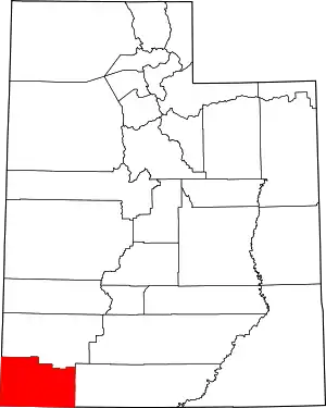 Map of Utah highlighting Washington County | |
| Towns | ||
| CDPs | ||
| Unincorporated communities | ||
| Ghost towns | ||
| Indian reservation | ||
| Footnotes | ‡This populated place also has portions in an adjacent county or counties | |
| ||
Salt Lake City (capital) | |||||||||||||
| Topics |
|  | |||||||||||
| Society |
| ||||||||||||
| Regions | |||||||||||||
| Largest cities |
| ||||||||||||
| Counties | |||||||||||||
| Attractions |
| ||||||||||||
| Flora and fauna | |||||||||||||
| Authority control |
|---|