Icknield
Icknield is a parliamentary ward in the town of Luton, Bedfordshire, England. The ward takes its name from the Icknield Way, a pre-Roman road which passes through Luton. Situated towards the northeast of Luton, the ward is made up of parts of Runfold and Warden Hill, as well as Bushmead.
| Icknield | |
|---|---|
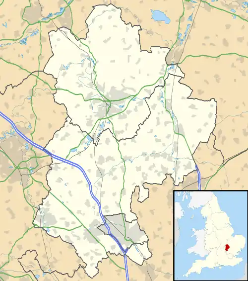 Icknield Location within Bedfordshire | |
| Population | 7,556 (est.).[1] |
| OS grid reference | TL082250 |
| Unitary authority | |
| Ceremonial county | |
| Region | |
| Country | England |
| Sovereign state | United Kingdom |
| Post town | LUTON |
| Postcode district | LU3 |
| Dialling code | 01582 |
| Police | Bedfordshire |
| Fire | Bedfordshire and Luton |
| Ambulance | East of England |
| UK Parliament | |
Politics
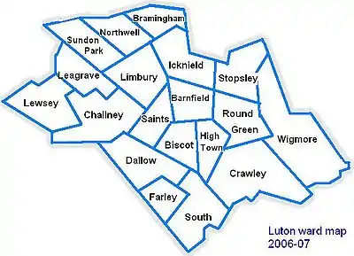
Map of Luton showing Icknield
Icknield ward is represented by Cllr Asif Masood (Labour) and Cllr Jeff Petts (Conservative).[2]
The ward forms part of the parliamentary constituency of Luton North and the MP is Sarah Owen (Labour).
Local Attractions
| Key | |
| Abbey/Priory/Cathedral | |
| Accessible open space | |
| Amusement/Theme Park | |
| Castle | |
| Country Park | |
| English Heritage | |
| Forestry Commission | |
| Heritage railway | |
| Historic House | |
| Mosques | |
| Museum (free/not free) | |
| National Trust | |
| Theatre | |
| Zoo | |
References
| Places |
| |||||
|---|---|---|---|---|---|---|
| Amenities | ||||||
| Culture & Sport | ||||||
| Education |
| |||||
| Politics | ||||||
| Transport | ||||||
| Media | ||||||
| ||||||
This article is issued from Wikipedia. The text is licensed under Creative Commons - Attribution - Sharealike. Additional terms may apply for the media files.