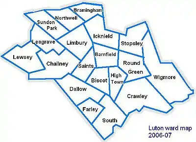
Round Green
Round Green is a suburb in the north-east of Luton. The area is roughly bounded by Bradgers Hill to the north, People's Park, Richmond Hill and Turners Road South to the south, Wardown Crescent and Elmwood Crescent to the west, and Vauxhall Way to the east.
| Round Green | |
|---|---|
 The Jolly Topers public house, Hitchin Road | |
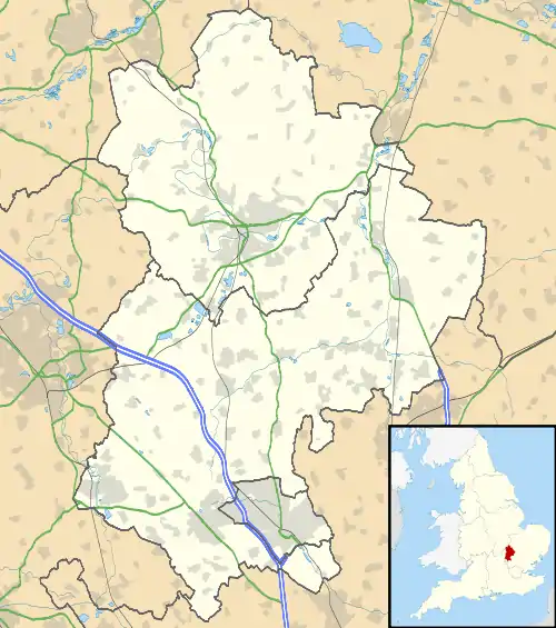 Round Green Location within Bedfordshire | |
| Population | 11,950 [1] |
| OS grid reference | TL095225 |
| Unitary authority | |
| Ceremonial county | |
| Region | |
| Country | England |
| Sovereign state | United Kingdom |
| Post town | LUTON |
| Postcode district | LU2 |
| Dialling code | 01582 |
| Police | Bedfordshire |
| Fire | Bedfordshire and Luton |
| Ambulance | East of England |
| UK Parliament | |
History
Formerly a small hamlet between Biscot, Leagrave and Stopsley, Round Green is one of the oldest parts of Luton, with references to the area dating back to 1170.
The area originally called Cowridge End stretches from what is now Old Bedford Road up to Birchen Grove in the North and down to Crawley Green in the south. The area was officially assumed into the boundary of Luton in 1933.
In 1908, the Luton Tram Service started up, with route one terminating at Round Green (starting out in Park Street). The tram service in the town was short-lived, and in 1931 the council decided to replace the trams with buses.[2]
Culture and community
Architecture and historic buildings
There is a Grade II-listed water tower on Hart Lane which is one of the most prominent points on Luton's skyline if looking eastwards from the centre. The building was erected in 1900 following a drought that affected the Stopsley area and is a counterpart to a similarly aged water town on West Hill Road in New Town.
Groups and societies
The Luton Co-Operative Club is based on Stockingstone Road and is a member's club featuring a bar and sports facilities.[3]
Parks and open spaces
There are relatively few parks and open spaces in the Round Green area due to the proximity of People's Park in High Town and other large spaces in the Crawley area. There is a small children's play area situated between Abbots Wood Road and Hart Lane which also serves as the largest green space as well as a wooded area at the northernmost point of Hitchin Road.
Pubs and bars
The Hitchin Road roundabout is home to the only trading pub in the area, The Jolly Topers, which has stood on the junction since the 18th century.[4] The Jolly Topers has long been a central core of the Round Green community and has been the site of many inquests in the early years of the business.[5] Historically, a large horse-chestnut tree stood next to the roundabout outside the Jolly Topers pub; it had presided over the area for 150 years. However, in 2001, after heavy winds blew down its branches, it was deemed hazardous to leave standing. The tree was taken down and has recently been replaced.
Roughly 20 meters away on the other side of the roundabout was the site of The Round Green Tavern which closed in the late 2010s and has since been repurposed as an estate agents office and residential properties. Meters away from the Round Green Tavern was the site of the Royal Oak pub which closed in the late 2000s and is now a veterinarian clinic.[6]
The Somerset Tavern on the corner of Somerset Avenue and Crawley Green Road was another large pub in the area which has also closed, being renovated into residential flats in the late 2000s.
Education
There is one primary school in Round Green, Richmond Hill West School on Sunridge Avenue. The school is the east site of the Richmond Hill Primary School (the other being in the Wigmore area) and is a Special Education-focused school.
There are no secondary schools in Round Green; most of the area is within the catchment areas of either Stopsley High School or Ashcroft High School.
Religious sites
Churches
Both St. Anne's Church and St. Christopher's Church unusually share equal standing within the Parish of St. Annes, which is within the Diocese of St Albans.
Former sites
- A methodist chapel was situated on the junction of Ramridge Road and Hitchin Road opposite the Jolly Topers public house until at least 1901. The building was on the site of the Round Green Tavern which ceased business in the late 2010s.[10]
- Two more Methodist chapels existed on a site in Turners Road South. The first existed between 1911 and 1957 before a more modern chapel building emerged in 1959, connected to the 1911 building. The church as a whole was closed in 1997 and the modern chapel building was demolished shortly after. The 1911 structure still stands to this day and was most recently used as a nursery.[11]
Sport and leisure
Luton Indoor Bowling Club is based just off Stockingstone Road in their purpose-built indoor bowling facility. The club was established in 1988 and their building was officially opened by Diana, Princess of Wales in the same year. [12]
Next to Luton Indoor Bowling Club is another bowling green - an outdoor facility operated by the Co-Op Luton Bowls Club.[13]
Politics
Round Green is part of the larger Round Green ward, which also contains parts of Ramridge End and Tin Town. The Councillors for Round Green ward are Cllr David Chapman (Liberal Democrats), Cllr Mark Rivers (Labour) and Cllr Tahmina Saleem (Labour).[14]
The ward forms part of the parliamentary constituency of Luton South and the MP is Rachel Hopkins (Labour).
Local attractions
| Key | |
| Abbey/Priory/Cathedral | |
| Accessible open space | |
| Amusement/Theme Park | |
| Castle | |
| Country Park | |
| English Heritage | |
| Forestry Commission | |
| Heritage railway | |
| Historic House | |
| Mosques | |
| Museum (free/not free) | |
| National Trust | |
| Theatre | |
| Zoo | |
Local newspapers
Two weekly newspapers cover Round Green, although they are not specific to the area.
They are the:
References
| Wikimedia Commons has media related to Round Green. |
- Luton Borough Council, Population Estimates and Forecasts, estimate for Round Green ward in 2007. The count in the 2001 Census was 10,868.
- History of the trams in Luton
- http://coopsportsandsocial.co.uk/the-club/
- Jolly Topers - Round Green Luton Bedfordshire
- http://bedsarchives.bedford.gov.uk/CommunityArchives/Luton/LicensedinLuton/TheJollyTopersPublicHouseStopsley.aspx
- http://bedsarchives.bedford.gov.uk/CommunityArchives/Luton/LicensedinLuton/TheRoyalOakPublicHouseRoundGreenStopsley.aspx
- https://directory.luton.gov.uk/kb5/luton/directory/service.page?id=2xB4rFc72zI
- https://www.stalbans.anglican.org/venue/st-christophers-church-luton/
- http://www.parohialuton.co.uk/
- http://bedsarchives.bedford.gov.uk/CommunityArchives/Luton/NonconformityinLuton/TheWesleyanMethodistChapelRoundGreen.aspx
- http://bedsarchives.bedford.gov.uk/CommunityArchives/Luton/NonconformityinLuton/TheWesleyanMethodistChapelRoundGreen.aspx
- http://www.luton-ibc.org.uk/club-officials/
- https://www.bowlsengland.com/club/co-op-luton/
- https://democracy.luton.gov.uk/cmis5public/Councillors.aspx
- Local History Book - The Story of Round Green by Barbara M. Benson