Idaho State Highway 128
State Highway 128 (SH-128) is a 2.198-mile-long (3.537 km) state highway in the U.S. state of Idaho, serving the city of Lewiston in Nez Perce County. The highway travels east along the Clearwater River within Lewiston from Washington State Route 128 (SR 128) to U.S. Route 12 (US-12).
| ||||
|---|---|---|---|---|
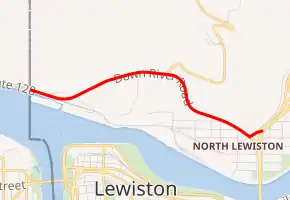
A map of northern Lewiston with SH-128 highlighted in red | ||||
| Route information | ||||
| Maintained by ITD | ||||
| Length | 2.198 mi[1] (3.537 km) | |||
| Major junctions | ||||
| West end | ||||
| East end | ||||
| Location | ||||
| Counties | Nez Perce | |||
| Highway system | ||||
| ||||

Route description
SH-128 begins at the eastern terminus of SR 128 at the Washington–Idaho state line that separates the cities of Clarkston and Lewiston. The highway travels east along the Clearwater River as the Down River Road through an industrial park located in northern Lewiston. SH-128 intersects its spur route and turns northeast towards its eastern terminus, an intersection with US-12 eastbound.[1][2]
To the north of the highway is Lewiston Hill. The Old Spiral Highway has its southern terminus at an intersection with SH-128.
Every year, the Idaho Transportation Department (ITD) conducts a series of surveys on its highways in the state to measure traffic volume. This is expressed in terms of average annual daily traffic (AADT), which is a measure of traffic volume for any average day of the year. In 2011, ITD calculated that 4,702 vehicles per day used SH-128 between the Washington state line and US-12.[3]
Spur route
| |
|---|---|
| Location | Lewiston, Idaho |
| Length | 0.130 mi[1] (0.209 km) |
SH-128 has a short, 0.130-mile-long (0.209 km) spur route near its eastern terminus at US-12 in Lewiston.[1] The spur route travels southeast from SH-128 to US-12 westbound and serves as an extension of the intersection of the two highways to the north.[4]
Major intersections
The entire route is in Lewiston, Nez Perce County.
| mi[1] | km | Destinations | Notes | ||
|---|---|---|---|---|---|
| 0.000 | 0.000 | Western terminus, Washington state line | |||
| 2.093 | 3.368 | ||||
| 2.198 | 3.537 | Eastern terminus | |||
| 1.000 mi = 1.609 km; 1.000 km = 0.621 mi | |||||
References
- Milepost Log: State Highway 128, Idaho Transportation Department, August 30, 2011, archived from the original on June 6, 2012, retrieved February 22, 2013
- Google (February 22, 2013). "State Highway 128" (Map). Google Maps. Google. Retrieved February 22, 2013.
- Highway Data Quest, Idaho Transportation Department, November 8, 2011, archived from the original on September 19, 2012, retrieved February 22, 2013
- Google (February 22, 2013). "State Highway 128 Spur" (Map). Google Maps. Google. Retrieved February 22, 2013.
