Idaho State Highway 54
State Highway 54 (SH-54) is a 15.510-mile-long (24.961 km) state highway in Idaho from SH-41 to near Bayview.
| ||||
|---|---|---|---|---|
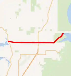
SH-54 highlighted in red | ||||
| Route information | ||||
| Maintained by ITD | ||||
| Length | 15.510 mi[1] (24.961 km) | |||
| Major junctions | ||||
| West end | ||||
| East end | Main Avenue / Hudson Bay Road in Bayview | |||
| Highway system | ||||
| ||||

Route description
SH-54 begins at an intersection with SH-41 in the town of Spirit Lake. The route travels east out of the town, passing by Timberlake High School. SH-54 enters the city of Athol briefly, intersecting with US 95. At Smylie Boulevard, the road continues east, turning northeast at a circular intersection with Good Hope Road, where it enters Farragut State Park. SH-54 continues near Lake Pend Oreille, where it turns north into the town of Bayview. The road makes a brief turn to the east before terminating at Main Street on the shores of Scenic Bay.[2][1]
Junction list
The entire route is in Kootenai County.
| Location | mi[1] | km | Destinations | Notes | |
|---|---|---|---|---|---|
| | 0.000 | 0.000 | |||
| Athol | 7.900 | 12.714 | |||
| Bayview | 15.510 | 24.961 | Main Avenue / Hudson Bay Road | ||
| 1.000 mi = 1.609 km; 1.000 km = 0.621 mi | |||||
References
- Staff (December 18, 2006). "State Highway 54". Idaho Transportation Department. Archived from the original on December 13, 2012. Retrieved November 27, 2012.
- Google (November 27, 2012). "SH-54" (Map). Google Maps. Google. Retrieved November 27, 2012.
This article is issued from Wikipedia. The text is licensed under Creative Commons - Attribution - Sharealike. Additional terms may apply for the media files.
