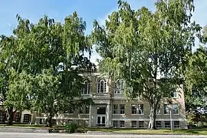
Kootenai County, Idaho
Kootenai County (/ˈkuːtniː/ KOOT-nee) is located in the U.S. state of Idaho. In 2018, the United States Census Bureau estimated the county's population at 161,505,[1] making it the third-most populous county in Idaho. The county seat and largest city is Coeur d'Alene.[2] The county was established in 1864 and named after the Kootenai tribe.
Kootenai County | |
|---|---|
 | |
 Seal | |
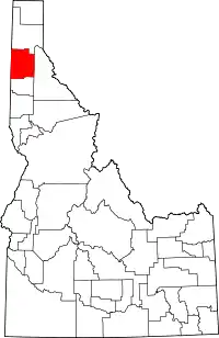 Location within the U.S. state of Idaho | |
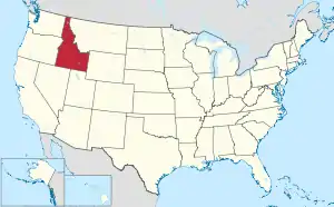 Idaho's location within the U.S. | |
| Coordinates: 47°41′N 116°42′W | |
| Country | |
| State | |
| Founded | December 22, 1864 |
| Named for | Kootenai tribe |
| Seat | Coeur d'Alene |
| Largest city | Coeur d'Alene |
| Area | |
| • Total | 1,316 sq mi (3,410 km2) |
| • Land | 1,244 sq mi (3,220 km2) |
| • Water | 71 sq mi (180 km2) 5.4% |
| Population (2010) | |
| • Total | 138,494 |
| • Estimate (2019) | 165,697 |
| • Density | 110/sq mi (41/km2) |
| Time zone | UTC−8 (Pacific) |
| • Summer (DST) | UTC−7 (PDT) |
| Congressional district | 1st |
| Website | www |
Kootenai County is coterminous with the Coeur d'Alene metropolitan area, which along with the Spokane metropolitan area comprises the Spokane–Coeur d'Alene combined statistical area.
History
Natives and Early European Activity
The Coeur d'Alene region takes its name from that given the local natives by French fur trappers. The tribe initially consisted of three bands that inhabited the areas surrounding Coeur d'Alene Lake and the Coeur d'Alene River. Canadian fur trade came to the region starting in 1809, marking the tribe's first contact with Europeans. Christian missionaries would follow with the first Christian meeting officiated by Father Nicolas Pointe on the north bank of Coeur d'Alene Lake at its junction with the Spokane River on December 2, 1842.[3] The St. Joseph mission was initially established northwest of St. Maries in 1844 before being renamed Mission of the Sacred Heart at its relocation to the Cataldo site in 1846. Construction of Idaho's oldest structure commenced with construction of the mission church being completed by 1855. The mission headquarters was moved to DeSmet in 1877.[4]
The Mullan Road was constructed through the area in 1859 with the route originally running on the southern side of Coeur d'Alene Lake. A route on the northern side of Coeur D'Alene Lake commenced in 1861. Mullan's men celebrated Independence Day of 1861 at Fourth of July Canyon east of Coeur d'Alene.[5][6]
Kootenai County Settled, Fails to Organize
The Idaho Territorial Legislature created Kootenai County on December 22, 1864. A county government was not immediately organized as a result of lack of significant settlement in the region. Kootenai County contained 81 residents at the 1864 Census of Idaho Territory.[7][8] Rathdrum was the first of the present incorporated cities to experience settlement starting in 1861. It became a stagecoach stop and later the Kootenai County seat.[9] At the 1870 census, the region was reported under Nez Perce County as the Kootenai District with 31 residents.[10] Post Falls was settled in 1871 while Camp Coeur d'Alene was established in 1878. The camp became a Fort in 1879 and the town of Coeur d'Alene grew up around the fort.[11] Dalton Gardens, Hayden, and Hayden Lake were also settled around this time.[12]
Kootenai County Organized
After almost 17 years of existence, Kootenai County finally organized on July 9, 1881.[13] The county's importance grew as a result of completion of the Northern Pacific Railway in 1882 to Rathdrum as well as discovery of gold on the Coeur d'Alene River in neighboring Shoshone County in 1883. Existing settlements grew and new ones were established as a result. Settlement commenced on the railroad at Athol in 1882 and Harrison in 1890.
Development of Cities
Continued population growth led to the development of cities. In 1899, Harrison was the county's first city to incorporate.[14] Coeur d'Alene, Spirit Lake, and Athol followed in 1906, 1908, and 1909.[15] Incorporation of Rathdrum Post Falls, and Worley occurred prior to 1920.[16] Clarksville, Hayden Lake, Huetter, State Line, and Eddiville were all incorporated in 1947.[17] Hayden, Dalton Gardens, and Fernan Lake incorporated after 1950.[18] Eddiville and Clarksville were dis-incorporated prior to 1970.
County Boundary History
At the time of the Coeur d'Alene Mission's establishment, the territory of Kootenai County was claimed by both the United States and Britain. The government of Oregon Country established four districts on July 5, 1843 and Kootenai's territory was within the boundary of the Clackamas District that later became Clackamas County under Oregon Territory. Washington Territory was established March 2, 1853. Kootenai's territory fell under Walla Walla County starting 1864, followed by Spokane County in 1858. Idaho Territory was established March 3, 1863, resulting in Kootenai County's territory not falling under any county's jurisdiction. On February 2, 1864, it was attached jurisdictionally to Nez Perce County, but remained outside of that county's boundary. The Counties of Kootenai and Lah-Toh were created on December 22, 1864 with Lah-Toh covering Kootenai's present territory. Both counties failed to organize and by 1867, Lah-Toh was abolished and its territory transferred to Kootenai County. Bonner was partitioned off in 1907 and Benewah partitioned in 1915 to give Kootenai its present boundary. In 1905, the legislature attempted to abolish Kootenai County and create the counties of Lewis and Clark in its place. The act was declared unconstitutional by the Idaho Supreme Court.[19]
Geography

According to the U.S. Census Bureau, the county has a total area of 1,316 square miles (3,410 km2), of which 1,244 square miles (3,220 km2) is land and 71 square miles (180 km2) (5.4%) is water.[20] The county water area includes Lake Coeur d'Alene and the southernmost portion of Lake Pend Oreille. Kootenai County is part of the Inland Empire in the Idaho Panhandle.
Adjacent counties
- Bonner County – north
- Shoshone County – east
- Benewah County – south
- Spokane County, Washington – west
National protected areas
- Coeur d'Alene National Forest (part)
- Kaniksu National Forest (part)
Demographics
| Historical population | |||
|---|---|---|---|
| Census | Pop. | %± | |
| 1880 | 518 | — | |
| 1890 | 4,108 | 693.1% | |
| 1900 | 10,216 | 148.7% | |
| 1910 | 22,747 | 122.7% | |
| 1920 | 17,878 | −21.4% | |
| 1930 | 19,469 | 8.9% | |
| 1940 | 22,283 | 14.5% | |
| 1950 | 24,947 | 12.0% | |
| 1960 | 29,556 | 18.5% | |
| 1970 | 35,332 | 19.5% | |
| 1980 | 59,770 | 69.2% | |
| 1990 | 69,795 | 16.8% | |
| 2000 | 108,685 | 55.7% | |
| 2010 | 138,494 | 27.4% | |
| 2019 (est.) | 165,697 | 19.6% | |
| U.S. Decennial Census[21] 1790–1960[22] 1900–1990[23] 1990–2000[24] 2010–2018[1] 2019[25] | |||
2000 census
As of the census of 2000, there were 108,685 people, 41,308 households, and 29,659 families living in the county. The population density was 87 people per square mile (34/km2). There were 46,607 housing units at an average density of 37 per square mile (14/km2). The racial makeup of the county was 95.84% White, 0.17% Black or African American, 1.23% Native American, 0.50% Asian, 0.07% Pacific Islander, 0.59% from other races, and 1.60% from two or more races. 2.33% of the population were Hispanic or Latino of any race. 23.2% were of German, 11.9% English, 10.9% Irish, 9.4% American and 6.1% Norwegian ancestry. 96.6% spoke English and 1.7% Spanish as their first language.
There were 41,308 households, out of which 34.90% had children under the age of 18 living with them, 58.60% were married couples living together, 9.20% had a female householder with no husband present, and 28.20% were non-families. 21.90% of all households were made up of individuals, and 8.30% had someone living alone who was 65 years of age or older. The average household size was 2.60 and the average family size was 3.03.
In the county, the population was spread out, with 27.10% under the age of 18, 8.70% from 18 to 24, 28.00% from 25 to 44, 23.90% from 45 to 64, and 12.30% who were 65 years of age or older. The median age was 36 years. For every 100 females there were 98.10 males. For every 100 females age 18 and over, there were 94.90 males.
The median income for a household in the county was $37,754, and the median income for a family was $42,905. Males had a median income of $33,661 versus $22,113 for females. The per capita income for the county was $18,430. About 7.70% of families and 10.50% of the population were below the poverty line, including 12.90% of those under age 18 and 7.30% of those age 65 or over.
2010 census
As of the 2010 United States Census, there were 138,494 people, 54,200 households, and 37,316 families living in the county.[26] The population density was 111.3 inhabitants per square mile (43.0/km2). There were 63,177 housing units at an average density of 50.8 per square mile (19.6/km2).[27] The racial makeup of the county was 94.5% white, 1.3% American Indian, 0.7% Asian, 0.3% black or African American, 0.1% Pacific islander, 0.8% from other races, and 2.4% from two or more races. Those of Hispanic or Latino origin made up 3.8% of the population.[26] In terms of ancestry, 25.9% were German, 15.2% were Irish, 13.9% were English, 12.5% were American, and 6.7% were Norwegian.[28]
Of the 54,200 households, 32.8% had children under the age of 18 living with them, 53.9% were married couples living together, 10.0% had a female householder with no husband present, 31.2% were non-families, and 24.3% of all households were made up of individuals. The average household size was 2.53 and the average family size was 2.99. The median age was 38.9 years.[26]
The median income for a household in the county was $46,336 and the median income for a family was $55,840. Males had a median income of $43,503 versus $29,950 for females. The per capita income for the county was $24,418. About 8.8% of families and 11.9% of the population were below the poverty line, including 15.3% of those under age 18 and 7.7% of those age 65 or over.[29]
Past Elections
| Year | Republican | Democratic | Third parties |
|---|---|---|---|
| 2020 | 70.2% 62,837 | 27.2% 24,312 | 2.6% 2,362 |
| 2016 | 67.0% 44,449 | 24.5% 16,264 | 8.5% 5,597 |
| 2012 | 65.1% 39,381 | 31.2% 18,851 | 3.8% 2,273 |
| 2008 | 61.4% 38,387 | 35.4% 22,120 | 3.2% 2,028 |
| 2004 | 66.3% 36,173 | 32.2% 17,584 | 1.6% 846 |
| 2000 | 64.3% 28,162 | 30.8% 13,488 | 4.9% 2,162 |
| 1996 | 47.8% 18,740 | 34.8% 13,627 | 17.4% 6,819 |
| 1992 | 36.0% 13,065 | 31.8% 11,553 | 32.2% 11,710 |
| 1988 | 55.6% 15,093 | 42.8% 11,621 | 1.5% 416 |
| 1984 | 64.9% 17,330 | 33.7% 9,004 | 1.3% 355 |
| 1980 | 63.3% 17,022 | 28.0% 7,521 | 8.8% 2,369 |
| 1976 | 57.8% 10,493 | 39.8% 7,225 | 2.4% 441 |
| 1972 | 61.3% 9,958 | 31.8% 5,162 | 6.9% 1,118 |
| 1968 | 48.0% 7,092 | 42.0% 6,207 | 10.0% 1,472 |
| 1964 | 42.6% 6,096 | 57.4% 8,215 | |
| 1960 | 46.4% 6,704 | 53.6% 7,744 | |
| 1956 | 54.4% 7,330 | 45.6% 6,149 | |
| 1952 | 56.9% 7,272 | 42.4% 5,414 | 0.7% 88 |
| 1948 | 41.6% 4,265 | 51.5% 5,284 | 7.0% 713 |
| 1944 | 42.9% 4,388 | 56.7% 5,792 | 0.4% 42 |
| 1940 | 41.4% 4,333 | 57.3% 5,997 | 1.3% 132 |
| 1936 | 28.7% 2,586 | 63.9% 5,752 | 7.4% 661 |
| 1932 | 34.1% 2,813 | 57.4% 4,743 | 8.5% 706 |
| 1928 | 69.9% 4,973 | 28.4% 2,020 | 1.7% 121 |
| 1924 | 44.8% 3,289 | 44.4% 3,256 | 10.8% 790 |
| 1920 | 65.9% 3,518 | 34.1% 1,818 | |
| 1916 | 42.7% 2,741 | 44.5% 2,855 | 12.9% 826 |
| 1912 | 23.5% 1,690 | 34.8% 2,506 | 41.7% 3,004[32] |
| 1908 | 55.0% 4,407 | 27.5% 2,206 | 17.4% 1,396 |
| 1904 | 67.6% 4,165 | 19.1% 1,178 | 13.4% 823 |
| 1900 | 44.0% 1,472 | 56.0% 1,871 | |
| 1896 | 18.8% 334 | 80.5% 1,432 | 0.7% 13 |
| 1892 | 48.0% 713 | 52.1% 774 |
March 10 2020 Presidential Primary Results:
Current Political Races
Communities
Cities
Census-designated places
Unincorporated communities
Footnotes
- "2018 county population estimate". United States Census Bureau. Retrieved July 10, 2019.
- "Find a County". National Association of Counties. Archived from the original on May 31, 2011. Retrieved June 7, 2011.
- "Idaho State Historical Society Reference Series: Idaho Fur Trade" (PDF). Idaho State Historical Society Reference Series. Retrieved 22 February 2017.
- "Idaho State Historical Society Reference Series: Coeur d'Alene Mission" (PDF). Idaho State Historical Society Reference Series. Retrieved February 22, 2017.
- "Idaho State Historical Society Reference Series: The Mullan Road in Idaho" (PDF). Idaho State Historical Society Reference Series. Retrieved February 22, 2017.
- "Idaho State Historical Society Reference Series: The Mullan Tree" (PDF). Idaho State Historical Society. Retrieved February 22, 2017.
- "Idaho State Historical Society Reference Series: Census of 1864" (PDF). Idaho State Historical Society. Archived from the original (PDF) on February 9, 2017. Retrieved February 22, 2017.
- "Idaho State Historical Society Reference Series: Idaho Indian Reservations" (PDF). Idaho State Historical Society. Archived from the original (PDF) on February 9, 2017. Retrieved February 22, 2017.
- "Rathdrum History". rathdrum.org. Retrieved 22 February 2017.
- Ninth Census--Volume I (PDF). Washington: Government Printing Office. 1872. p. 108. Retrieved 22 February 2017.
- "Idaho State Historical Society Reference Series: Fort Sherman" (PDF). Idaho State Historical Society. Retrieved February 22, 2017.
- "History of Kootenai County". Kootenai County, Idaho. Retrieved February 22, 2017.
- "Idaho State Historical Society Reference Series: Counties Which no Longer Exist" (PDF). Idaho State Historical Society. Retrieved February 22, 2017.
- "North Idaho History". The Guide to North Idaho. Retrieved February 22, 2017.
- Thirteenth Census of the United States Taken in the Year 1910 (PDF). Washington: Government Printing Office. 1913. pp. 416–417. Retrieved February 22, 2017.
- Fourteenth Census of the United States Taken in the Year 1920 (PDF). Washington: Government Printing Office. 1921. p. 391. Retrieved 22 February 2017.
- Census of Population: 1950 (PDF). Washington: United States Government Printing Office. 1952. pp. 12–17. Retrieved February 22, 2017.
- Census of Population: 1960 (PDF). Washington: U.S. Government Printing Office. 1963. pp. 14–17. Retrieved 22 February 2017.
- Idaho Atlas of Historical County Boundaries. Chicago: The Newberry Library. 2010. pp. 117–121, 210–214, 227, 232–236, 243, 245.
- "US Gazetteer files: 2010, 2000, and 1990". United States Census Bureau. February 12, 2011. Retrieved April 23, 2011.
- "U.S. Decennial Census". United States Census Bureau. Retrieved June 30, 2014.
- "Historical Census Browser". University of Virginia Library. Retrieved June 30, 2014.
- "Population of Counties by Decennial Census: 1900 to 1990". United States Census Bureau. Retrieved June 30, 2014.
- "Census 2000 PHC-T-4. Ranking Tables for Counties: 1990 and 2000" (PDF). United States Census Bureau. Retrieved June 30, 2014.
- https://www.census.gov/quickfacts/fact/table/kootenaicountyidaho/PST045219
- "DP-1 Profile of General Population and Housing Characteristics: 2010 Demographic Profile Data". United States Census Bureau. Archived from the original on February 13, 2020. Retrieved January 9, 2016.
- "Population, Housing Units, Area, and Density: 2010 – County". United States Census Bureau. Archived from the original on February 13, 2020. Retrieved January 9, 2016.
- "DP02 SELECTED SOCIAL CHARACTERISTICS IN THE UNITED STATES – 2006–2010 American Community Survey 5-Year Estimates". United States Census Bureau. Archived from the original on February 13, 2020. Retrieved January 9, 2016.
- "DP03 SELECTED ECONOMIC CHARACTERISTICS – 2006–2010 American Community Survey 5-Year Estimates". United States Census Bureau. Archived from the original on February 13, 2020. Retrieved January 9, 2016.
- Leip, David. "Dave Leip's Atlas of U.S. Presidential Elections". uselectionatlas.org. Retrieved April 4, 2018.
- http://geoelections.free.fr/. Retrieved January 13, 2021. Missing or empty
|title=(help) - The leading "other" candidate, Progressive Theodore Roosevelt, received 1,805 votes while Socialist candidate Eugene Debs received 1,030 votes and Prohibition candidate Eugene Chafin 169 votes.
Further reading
- John M. Henderson and William S. Shiach, with Harry B. Averill, An Illustrated History of North Idaho: Embracing Nez Perces, Idaho, Latah, Kootenai and Shoshone Counties, State of Idaho. n.c. [Chicago]: Western Historical Publishing Co., 1903.
External links
Places adjacent to Kootenai County, Idaho | ||||||||||
|---|---|---|---|---|---|---|---|---|---|---|
| ||||||||||
Municipalities and communities of Kootenai County, Idaho, United States | ||
|---|---|---|
| Cities | Map of Idaho highlighting Kootenai County | |
| CDPs | ||
| Unincorporated communities | ||
| Indian reservation | ||
| Footnotes | ‡This populated place also has portions in an adjacent county or counties | |
| ||
Boise (capital) | ||
| Topics |
| |
| Society | ||
| Regions | ||
| Larger cities | ||
| Smaller cities | ||
| Counties |
| |
| Authority control |
|---|