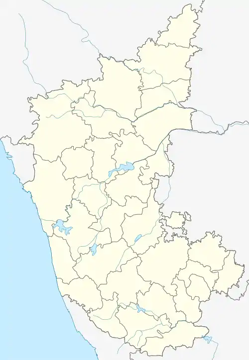
Indi, Karnataka
Indi is a city in the state of Karnataka, India. It is the taluk headquarters of Indi Taluk, in the district of Vijayapura.
Indi, Karnataka | |
|---|---|
City | |
 Indi, Karnataka Location in Karnataka, India | |
| Coordinates: 17.168°N 75.967°E | |
| Country | |
| State | Karnataka |
| District | Bijapur district |
| Area | |
| • Total | 10.5 km2 (4.1 sq mi) |
| Elevation | 464 m (1,522 ft) |
| Population (2001) | |
| • Total | 31,482 |
| • Density | 2,998.29/km2 (7,765.5/sq mi) |
| Languages | |
| • Official | Kannada |
| Time zone | UTC+5:30 (IST) |
| PIN | 586 209 |
| Telephone code | 08359 |
| ISO 3166 code | IN-KA |
| Vehicle registration | KA-28 |
Geography
Indi is located at 17.17°N 75.97°E.[1] It has an average elevation of 465 meters (1525 feet). It is located at the border of Maharashtra, a neighboring state of Karnataka. The soil at Indi is dry and agriculture is dependent on rainfall. But, with the construction of the Upper Krishna project, most of the agricultural land has been brought under irrigation. The Bhima flows through Indi Taluk, originating at the Bhimashankar Hills in Maharashtra.
Demographics
As of 2001 India census,[2] Indi had a population of 31,483. Males constituted 52% of the population and females 48%. Indi had an average literacy rate of 57%, lower than the national average of 59.5%. The male literacy rate was 65% and the female literacy rate was 48%. In Indi, 15% of the population was under 6 years of age. The most widely spoken language is Kannada.
In 2011, Indi had a population of 38,217.[3]
Religion
In 2011, Indi's population was 71.99% Hindu and 25.72% Muslim.[3]
Places of interest
The Graamudevuta (deity) of Indi is Shaanteshwura. A Shaanteshwura temple is located in the center of town with a Shiva linga. Pooja (worship) is done three times a day.
A big celebration is held every year and a special Akki Pooja is done. The linga is decorated with several kilograms of wet rice, the specialty being that not a single grain of rice falls down.
Indi also has an old Venkuteshwura temple which has a beautiful deity. Shree Umbaabhuvaani Temple is located near the Shaanteshwura Temple.
20 kilometers from Indi is the village of Shirashyad, where Shree Murughendra Shivaachaaryuru Hiremuth Sunsthaana, a famous saint, once lived. He performed many miracles and, to this day, has a following of thousands.
10 kilometers from Indi is the village of Lachyan, where Siddulinga Muhaaraajaa, a famous saint, once lived. He performed many miracles and, to this day, has a following of thousands.
3 kilometers from Indi is a place called Hireindi (Hire meaning elder). It is believed to be older than Indi. According to a legend, Hireindi was visited by the plague, so the new town of Indi was formed, to which all migrated. Hireindi has a very old Hanuman temple, alongside a huge farmland maintained by the agriculture department.
Indi also has the Husain Darga. It has graves of Islamic messengers. People of all religions come here for worship and to celebrate the Moharram festival; this is one of the biggest celebrations in Indi.
There is a village called Mannur 23 kilometers from Indi. Mannur has 3 famous temples:
- The Yellamma Devi Temple,
- The Padmavati Jain Mandir and
- The Channa Keshava temple.
Connectivity with other towns
Many buses run from Vijayapura, the district headquarters, to Indi. Vijayapura is 60 kilometers from Indi. The other major town, Solapur, in the neighboring state of Maharashtra, is 70 kilometers from Indi. Indi has a railway station 6 kilometers away, that has the trains, Basava Express and Gol Gumbaz Express, connecting Indi to Bangalore. The Bijapur Fast Passenger connects it to Mumbai.
References
- Falling Rain Genomics, Inc - Indi
- "Census of India 2001: Data from the 2001 Census, including cities, villages and towns (Provisional)". Census Commission of India. Archived from the original on 16 June 2004. Retrieved 1 November 2008.
- census2011.co.in/data/town/803052-indi-karnataka.html