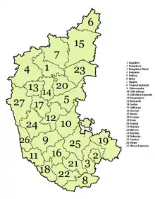
List of districts of Karnataka
The Indian State of Karnataka consists of 31 districts grouped into 4 administrative divisions. The state geographically has 3 principal regions: the coastal region of Karavali, the hilly Malenadu region comprising the Western Ghats, and the Bayaluseeme region, comprising the plains of the Deccan plateau.
History
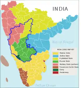
It took its present shape in 1956, when the former states of Mysore and Coorg were merged with the Kannada-speaking districts of the former states of Bombay, Hyderabad, and Madras. Unified Mysore state was made up of ten districts, Bangalore, Kolar, Tumkur, Mandya, Mysore, Hassan, Chikmagalur , Shimoga, Chitradurga, and Bellary had been transferred from Madras state to Mysore in 1953, when the new state of Andhra Pradesh was created out of Madras' northern districts.[1] Coorg State became a district known as Kodagu,[2] Dakshina Kannada was transferred from Madras State, Uttara Kannada, Dharwad, Belgaum, and Bijapur from Bombay State. Bidar, Gulbarga, and Raichuru from Hyderabad State. It received its new name of Karnataka in the year 1973.
In 1986, the Bangalore Rural and the Bangalore Urban districts were formed by splitting the Bangalore district.
Notification RD 42 LRD 87 Part III was part of a notification issued by the Government of Karnataka on 2 August 1997 in Bangalore that resulted in the creation of seven new districts in the Indian state of Karnataka. The new districts created were
- Chamarajanagara from Mysore
- Davanagere from Chitradurga, Bellary and Shimoga
- Bagalkot from Bijapur
- Gadag from Dharwad
- Haveri from Dharwad
- Udupi from Dakshina Kannada
- Koppala from Raichuru
The notification resulted in Karnataka being politically subdivided into 27 official districts with various taluks existing within each district.
On 21 June 2007, the Government announced the cabinet approval for the creation of two more districts, Ramanagara and Chikballapur were formed from the bifurcation of Bangalore Rural and Kolar respectively.[3]
On 30 December 2009, Yadagiri was carved out of Gulbarga and officially declared the 30th district of Karnataka.[4]
On 18th November 2020, the cabinet approved the separation of Vijayanagara district from Bellari.[5]
Currently there is a proposal to carve Chikodi out of Belgaum district, currently the largest district in the state.
Administrative structure

A district of an Indian state is an administrative geographical unit, headed by a District Commissioner, an officer belonging to the Indian Administrative Service. The district commissioner is assisted by a number of officers belonging to the Karnataka Civil Service and other Karnataka state services.
A Superintendent of Police (India), usually an officer belonging to the Indian Police Service is entrusted with the responsibility of maintaining law and order and related issues of the district. He is assisted by the officers of the Karnataka Police Service and other Karnataka Police officials. Cities like Bangalore, Mangalore, Hubli-Dharwad, Mysore and Belgaum are headed by a Commissioner of Police holding the rank of Additional Director General of Police(ADGP) or Inspector General of Police (IGP).
A Deputy Conservator of Forests, an officer belonging to the Indian Forest Service is responsible for managing the forests, the environment and wildlife of the district. He is assisted by the officers of the Karnataka Forest Service and other Karnataka Forest officials and Karnataka wildlife officials.
Sect-oral development is looked after by the district head of each development department such as PWD, Health, Education, Agriculture, Animal husbandry, etc. These officers belong to the various state services.
Administrative divisions
| Belgaum Division | Bangalore Division | Gulbarga Division | Mysore Division |
|---|---|---|---|
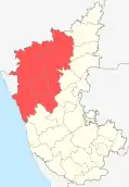 | 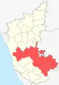 |  |  |
Alphabetical listing of districts
| Code[6] | District | Headquarters[7] | Established[8][9] | Subdivisions(Taluka) | Population[10](As of 2011) | Area[7] | Population density[10](As of 2011) | Map |
|---|---|---|---|---|---|---|---|---|
| BK | Bagalkot | Bagalkot | 15 August 1997[11] | 1,889,752 | 6,575 km2 (2,539 sq mi) | 288/km2 (750/sq mi) |  | |
| BN | Bangalore Urban | Bangalore | 1 November 1956 | 9,621,551 | 2,190 km2 (850 sq mi) | 4,393/km2 (11,380/sq mi) | 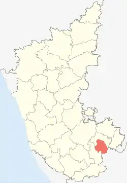 | |
| BR | Bangalore Rural | Bangalore | 15 August 1986[12] | 990,923 | 2,259 km2 (872 sq mi) | 431/km2 (1,120/sq mi) |  | |
| BG | Belgaum | Belgaum | 1 November 1956 | 4,779,661 | 13,415 km2 (5,180 sq mi) | 356/km2 (920/sq mi) |  | |
| BL | Bellary | Bellary | 1 November 1956 | 1,400,970 | 4,252 km2 (1,642 sq mi) | 290/km2 (750/sq mi) | 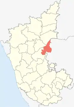 | |
| BD | Bidar | Bidar | 1 November 1956 | 1,703,300 | 5,448 km2 (2,103 sq mi) | 313/km2 (810/sq mi) | 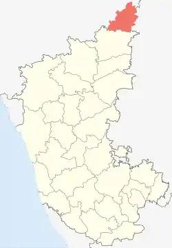 | |
| BJ | Bijapur | Bijapur | 1 November 1956 | 2,177,331 | 10,498 km2 (4,053 sq mi) | 210/km2 (540/sq mi) | 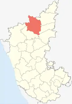 | |
| CJ | Chamarajanagar | Chamarajanagar | 15 August 1997[11] | 1,020,791 | 5,101 km2 (1,970 sq mi) | 181/km2 (470/sq mi) |  | |
| CB | Chikballapur | Chikballapur | 10 September 2007[11] | 1,255,104 | 4,524 km2 (1,747 sq mi)[13] | 296/km2 (770/sq mi) | 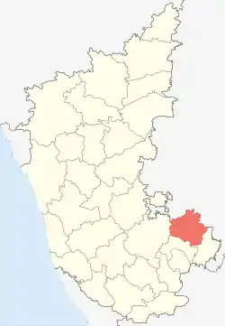 | |
| CK | Chikmagalur | Chikmagalur | 1 November 1956 | 1,137,961 | 7,201 km2 (2,780 sq mi) | 158/km2 (410/sq mi) |  | |
| CT | Chitradurga | Chitradurga | 1 November 1956 | 1,659,456 | 8,440 km2 (3,260 sq mi) | 197/km2 (510/sq mi) | 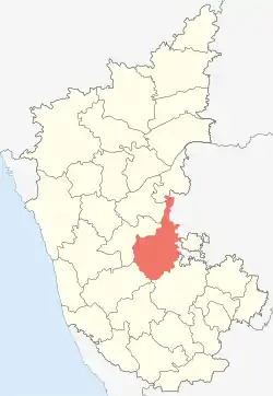 | |
| DK | Dakshina Kannada | Mangalore | 1 November 1956 | 2,089,649 | 4,560 km2 (1,760 sq mi) | 430/km2 (1,100/sq mi) | 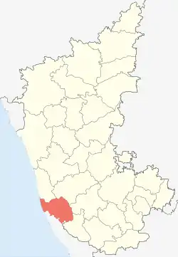 | |
| DA | Davanagere | Davanagere | 15 August 1997[11] | 1,643,494 | 4,460 km2 (1,720 sq mi) | 370/km2 (960/sq mi) | 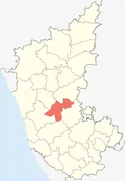 | |
| DH | Dharwad | Dharwad | 1 November 1956 | 1,847,023 | 4,260 km2 (1,640 sq mi) | 434/km2 (1,120/sq mi) |  | |
| GA | Gadag | Gadag | 24 August 1997[11] | 1,064,570 | 4,656 km2 (1,798 sq mi) | 229/km2 (590/sq mi) |  | |
| GU | Gulbarga | Gulbarga | 1 November 1956 | 2,566,326 | 10,951 km2 (4,228 sq mi) | 234/km2 (610/sq mi) |  | |
| HS | Hassan | Hassan | 1 November 1956 |
|
1,776,421 | 6,814 km2 (2,631 sq mi) | 261/km2 (680/sq mi) |  |
| HV | Haveri | Haveri | 24 August 1997[11] | 1,597,668 | 4,823 km2 (1,862 sq mi) | 331/km2 (860/sq mi) |  | |
| KD | Kodagu | Madikeri | 1 November 1956 | 554,519 | 4,102 km2 (1,584 sq mi) | 135/km2 (350/sq mi) | 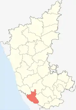 | |
| KL | Kolar | Kolar | 1 November 1956 | 1,536,401 | 3,969 km2 (1,532 sq mi)[14] | 386/km2 (1,000/sq mi) |  | |
| KP | Koppal | Koppal | 24 August 1997[11] | 1,389,920 | 7,189 km2 (2,776 sq mi) | 250/km2 (650/sq mi) |  | |
| MA | Mandya | Mandya | 1 November 1956[15][16] | 1,805,769 | 4,961 km2 (1,915 sq mi) | 364/km2 (940/sq mi) |  | |
| MY | Mysore | Mysore | 1 November 1956 | 3,001,127 | 6,854 km2 (2,646 sq mi) | 476/km2 (1,230/sq mi) | 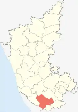 | |
| RA | Raichur | Raichur | 1 November 1956 | 1,928,812 | 6,827 km2 (2,636 sq mi) | 228/km2 (590/sq mi) | 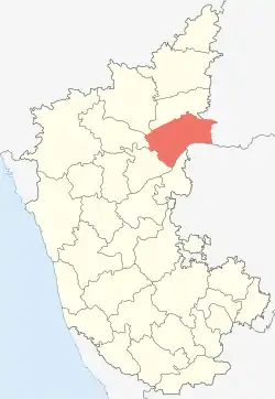 | |
| RM | Ramanagara | Ramanagara | 10 September 2007[11] | 1,082,636 | 3,556 km2 (1,373 sq mi) | 308/km2 (800/sq mi) |  | |
| SH | Shimoga | Shimoga | 1 November 1956 | 1,752,753 | 8,477 km2 (3,273 sq mi) | 207/km2 (540/sq mi) | ||
| TU | Tumkur | Tumkur | 1 November 1956 | 2,678,980 | 10,597 km2 (4,092 sq mi) | 253/km2 (660/sq mi) |  | |
| UD | Udupi | Udupi | 25 August 1997[11] | 1,177,361 | 3,880 km2 (1,500 sq mi) | 329/km2 (850/sq mi) |  | |
| UK | Uttara Kannada | Karwar | 1 November 1956 | 1,437,169 | 10,291 km2 (3,973 sq mi) | 140/km2 (360/sq mi) |  | |
| VN | Vijayanagara | Hospet | 18 November 2020 | 1,353,628 | 5,644 km2 (2,179 sq mi) | 240/km2 (620/sq mi) |  | |
| YD | Yadgir | Yadgir | 30 December 2009 | 1,174,271 | 5,273 km2 (2,036 sq mi) | 223/km2 (580/sq mi) |  |
References
- "Petition against transfer of Bellary dismissed". Indian Express. 30 September 1953. Retrieved 17 December 2010.
- Chinnappa, Jeevan (15 November 2005). "Did reorganisation panel ignore Kodava leaders' plea?". The Hindu. Retrieved 17 December 2010.
- "2 new districts notified in Bangalore". Online Edition of The Times of India, dated 2007-08-06. 6 August 2007. Retrieved 9 August 2007.
- {{cite news|url=http://www.hindu.com/2009/12/30/stories/2009123051050300.htm|title=Creation of Yadgir district|work=Online Edition of The Hindu, dated 2009-12-30 | location=Chennai, India|date=30 December 2009}}
- "Vijayanagar to be Karnataka's 31st district, BSY Cabinet gives in-principle nod". The New Indian Express. 19 November 2020. Retrieved 23 November 2020.
- "NIC Policy on format of e-mail Address: Appendix (2): Districts Abbreviations as per ISO 3166–2" (PDF). Ministry Of Communications and Information Technology, Government of India. 18 August 2004. pp. 5–10. Archived from the original (PDF) on 11 September 2008. Retrieved 24 November 2008.
- "Know India – Districts of Karnataka". Government of India portal. Retrieved 16 November 2010.
- Here 'Established' means year of establishment as a district of Karnataka. If the district was formed earlier to the formation of district in the state of Karnataka, 1 November 1956 will be considered as the day of establishment of the district.
- "STATES REORGANISATION ACT 1956 - Formation of a new Mysore State". Archived from the original on 16 May 2008. Retrieved 17 November 2010.
- "List of districts of Karnataka".
- "A Handbook of Karnataka – Administration" (PDF). Government of Karnataka. pp. 354, 355. Archived from the original (PDF) on 8 October 2011. Retrieved 16 November 2010.
- "District Profile". Archived from the original on 29 November 2010. Retrieved 18 November 2010.
- "District Profile – Area and population". Archived from the original on 25 November 2010. Retrieved 18 November 2010.
- "Kolar district at a glance" (PDF). Archived from the original (PDF) on 12 March 2011. Retrieved 18 November 2010.
- Note: This date means the day when the district was initially formed, even before the formation of the state of Karnataka (Mysore). Hence 1 November 1956 will be considered as the day of formation of district in the state of Karnataka
- "Formation of Mandya district". Archived from the original on 2 August 2010. Retrieved 18 November 2010.
External links
| Wikimedia Commons has media related to Districts of Karnataka. |
| States | ||
|---|---|---|
| Union territories | ||
| Related topics |
| |