Iran–Turkey border
The Iran–Turkey border (Persian: مرز ترکیه و ایران; Turkish: İran–Türkiye sınırı) is 534 km (332 mi) in length and runs from the tripoint with Azerbaijan in the north to the tripoint with Iraq in the south.[2]
| Iran-Turkey border Persian: مرز ترکیه و ایران İran–Türkiye sınırı | |
|---|---|
 | |
| Characteristics | |
| Entities | |
| Length | 560 km (350 mi)[1] |

Description
The border starts in the north at the tripoint with Azerbaijan's Nakhchivan Autonomous Republic on the Aras river. The border then proceeds to the north-west along the Karasu Çayı river, thereby granting Turkey a sliver of territory linking it to Azerbaijan. The border then proceeds south-west and then south via a series of irregular overland lines, down to the Iraqi tripoint. The border region is extremely mountainous and is populated mostly by Kurds on both sides.
History
Ottoman era (1500s–1920)
The Ottoman Empire had conquered much of what is now Iraq from Safavid Persia in the Ottoman–Safavid War of 1532–1555. The war concluded with the Peace of Amasya, by which Ottoman rule over the region was confirmed.[3][4] Ottoman control of Mesopotamia and eastern Turkey was confirmed following the Ottoman–Safavid War (1623–1639), which was ended by the Treaty of Zuhab.[5][6][7][8] The Zuhab treaty stipulated that the boundary between the two empires would run between the Zagros Mountains and the Tigris River, though a precise lines was not drawn at that time.[9]
During the Ottoman–Hotaki War (1722–1727) the Ottomans invaded Iran in league with Russia, gaining large parts of north-west Iran via the Treaty of Hamedan.[9] Another war followed in the 1740s which was ended by the Treaty of Kerden in 1746, which restored Iran's western provinces and re-affirmed the 1639 Zuhab border.[10][9]
The Ottoman–Persian War (1821–1823) ended with the signing of the First Treaty of Erzurum, which re-affirmed the 1639 Zuhab border.[11][12][9] A boundary commission involving Iranian, Ottoman, Russian and British officials assisted with the boundary delimitation, resulting in the Second Treaty of Erzurum of 1847 which affirmed the 1639 border with some small modifications.[13][9] The four-way boundary commission resumed its work in the following years, and after much work and cartographic disputation a detailed map was produced in 1869.[9] Some small modification were made in the vicinity of Qotur as a result of the Treaty of Berlin (1878).[9]
Despite the work of the commission, disputes concerning the precise boundary alignment continued. The Ottomans and Iran agreed to work on a more precise demarcation in 1911 at the urging of Russia and the Britain, both of whom had colonial aspirations in the region.[9][14][15][16] From November 1913-October 1914 a boundary commission established the Constantinople Protocol, providing a detailed delimitation of the entire boundary.[9] The four-nation boundary commission then surveyed the border on the ground and demarcated it with pillars (excluding he Qotur area which remained in dispute), producing a detailed series of map depicting the confirmed frontier.[9]
Post–Ottoman era (1920–present)
During the First World War an Arab Revolt, supported by Britain, succeeded in removing the Ottomans from most of the Middle East. As a result of the secret 1916 Anglo-French Sykes-Picot Agreement Britain gained control of the Ottoman Vilayets of Mosul, Baghdad and Basra, which it organised into the mandate of Iraq in 1920.[9]
By the 1920 Treaty of Sèvres Anatolian Turkey was to be partitioned, with the areas north of the Mosul Vilayet to be included within an autonomous or independent Kurdish state.[9][17] Turkish nationalists were outraged at the treaty, contributing to the outbreak the Turkish War of Independence; the Turkish success in this conflict rendered Sèvres obsolete.[9] By the 1923 Treaty of Lausanne Turkey's independence was recognised and a far more generous territorial settlement was agreed upon, albeit at the cost of Turkey formally renouncing any claim to Arab lands.[18] In the east the former Ottoman-Iran boundary was retained, now forming the borders between Iran and Iraq, and also Iran and the new Republic of Turkey.[9]
On 9 April 1929 a treaty was signed in Ankara between Turkey and Iran to further delimit their border, partly in response to the Kurdish Ararat rebellion; this was then finalised at the 1932 Tehran Convention, resulting in some small exchanges of territory in the vicinity of Little Ararat, Bazhergah and Qotur.[9][19][20][21] The border was then demarcated and a final agreement signed in Tehran on 26 May 1937.[9]
From 2017, Turkey began construction a barrier along the Turkey-Iran border aimed at preventing illegal crossings and smuggling.[22] The wall will cover 144 km[23][24] of the border. As of December 2017, half of the border barrier had been finished.[25] According to the responsible officials, the border barrier should have been completed by spring 2019.[26] The national housing commission TOKİ is building the wall in the provinces Iğdır and Ağrı.[23] Iran has welcomed the construction of the border barrier.[27]
Settlements near the border
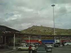
Iran
Crossings
There are three crossings along the entire border, two for vehicular traffic and one for vehicular and rail traffic.[28] The busiest of three, Gürbulak, is among the busiest border checkpoints in the world.
| Province | Province | Opened | Route in Turkey | Route in Iran | Status | ||
|---|---|---|---|---|---|---|---|
| Gürbulak | Ağrı | Bazargan | West Azerbaijan | 4 September 1953 | Open | ||
| Kapıköy | Van | Razi | West Azerbaijan | 16 April 2011 | Open | ||
| Esendere | Hakkâri | Serow | West Azerbaijan | 15 September 1964 | Open | ||
| Borualan | Iğdır | N/A | West Azerbaijan | 1 January 1985 | Closed |
See also
- Iran-Turkey relations
References
- "Türkiyenin Komşuları ve Coğrafi Sınırları". 14 February 2016. Archived from the original on 14 February 2016.
- CIA World Factbook - Iran, retrieved 5 April 2020
- 'The Reign of Suleiman the Magnificent, 1520–1566', V.J. Parry, in A History of the Ottoman Empire to 1730, ed. M.A. Cook (Cambridge University Press, 1976), 94.
- Mikaberidze, Alexander Conflict and Conquest in the Islamic World: A Historical Encyclopedia, Volume 1. ABC-CLIO, 31 jul. 2011 ISBN 1598843362 p 698
- Kia, Mehrdad (2017). The Ottoman Empire: A Historical Encyclopedia. ABC-CLIO. p. 46. ISBN 978-1610693899.
- Somel, Selçuk Akşin, Historical Dictionary of the Ottoman Empire, (Scarecrow Press Inc., 2003), 306
- Meri, Josef W.; Bacharach, Jere L. (2006). Medieval Islamic Civilization: L-Z, index. Taylor & Francis. p. 581. ISBN 978-0415966924.
- "The Origin and Development of Imperialist Contention in Iran; 1884–1921". History of Iran. Iran Chamber Society. Archived from the original on 2018-09-17. Retrieved 2018-09-17.
- International Boundary Study No. 28 – Iran-Turkey Boundary (PDF), 3 February 1964, retrieved 5 April 2020
- Mikaberidze, Alexander (2011). Conflict and Conquest in the Islamic World: A Historical Encyclopedia, Volume 1. ABC-CLIO. p. 169. ISBN 978-1598843361.
- Ateş, Sabri (2013). Ottoman-Iranian Borderlands: Making a Boundary, 1843–1914. New York: Cambridge University Press. p. 49. ISBN 9781107033658.
- Mikaberidze, Alexander (2011). Conflict and Conquest in the Islamic World: A Historical Encyclopedia. Santa Barbara, CA: ABC-CLIO. p. 301. ISBN 9781598843361.
- Victor Prescott and Gillian D. Triggs, International Frontiers and Boundaries: Law, Politics and Geography (Martinus Nijhoff Publishers, 2008: ISBN 90-04-16785-4), p. 6.
- Kazemzadeh, Firuz. Russia and Britain in Persia, 1864–1914: A Study in Imperialism. New Haven, CT: Yale University Press, 1968.
- Siegel, Jennifer. Endgame: Britain, Russia, and the Final Struggle for Central Asia. London and New York: Tauris, 2002.
- White, John Albert. Transition to Global Rivalry: Alliance Diplomacy and the Quadruple Entente, 1895–1907. Cambridge, U.K., and New York: Cambridge University Press, 1995.
- Helmreich, Paul C. (1974). From Paris to Sèvres: The Partition of the Ottoman Empire at the Peace Conference of 1919–1920. Columbus, Ohio: Ohio State University Press.
- Treaty of Peace with Turkey signed at Lausanne, Lausanne, Switzerland, 24 July 1923, retrieved 28 November 2012
- Burdett, Anita L.P., ed. (1998). "Accord relatif à la fixation de la ligne frontière entre la Perse et la Turquie". Armenia: Political and Ethnic Boundaries, 1878-1948. Cambridge: Cambridge Archive Editions. pp. 959–962. ISBN 978-1852079550.
- Tsutsiev, Arthur (2014). Atlas of the Ethno-Political History of the Caucasus. Translated by Nora Seligman Favorov. New Haven: Yale University Press. p. 92. ISBN 978-0300153088.
- Pirouz Mojtahed-Zadeh, Boundary Politics and International Boundaries of Iran: A Study of the Origin, Evolution, and Implications of the Boundaries of Modern Iran with Its 15 Neighbors in the Middle East, the Persian Gulf, the Caucasus, the Caspian Sea, Central Asia, and West Asia by a Number of Renowned Experts in the Field, Universal-Publishers, 2007, ISBN 978-1-58112-933-5, p. 142.
- Hürriyet Daily News: "Turkey builds 700 kilometer long wall on Syrian border" 15 Jun 2017
- Yeni Şafak: "TOKİ’den Türkiye’nin Kuzey-Doğu hattına 144 kilometrelik duvar" 13 May 2017
- Tehran Times: "Erdogan says to build walls on Iran, Iraq borders" 2 Jun 2017
- Yeni Şafak English: "Turkey completes half of security wall along Iranian border" 30 Dec 2017
- The Jerusalem Post "Turkey to complete wall on Iranian border by spring 2019" Jan 10 2018
- PressTV "Iran asks Turkey for explanation over deaths of border guards" May 29, 2017
- Caravanistan - Iran-Turkey border crossings, retrieved 5 April 2020