Ağrı
Ağrı, (Kurdish: Agirî)[3] formerly known as Karaköse (Kurdish: Qerekose)[4] from the early Turkish republican period until 1946, and before that as Karakilise (Ottoman Turkish: قرهکلیسا, romanized: Karakilisa, lit. 'Black Church'), is the capital of Ağrı Province at the eastern end of Turkey, near the border with Iran. Ağrı is named after the Turkish name of Mount Ararat (Turkish: Ağrı Dağı).[5]
- For the place in Azerbaijan, see Ağrı, Azerbaijan; for Mount Ağrı (Ağrı Dağı), see Mount Ararat.
Ağrı | |
|---|---|
 | |
 Ağrı | |
| Coordinates: 39°43′07″N 43°03′03″E | |
| Country | |
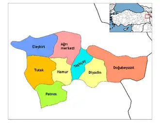
| Province | Ağrı |
| Government | |
| • Mayor | Savcı Sayan (AK Party) |
| Area | |
| • District | 1,497.27 km2 (578.10 sq mi) |
| Elevation | 1,640 m (5,380 ft) |
| Population (2012)[2] | |
| • Urban | 107,839 |
| • District | 145,359 |
| • District density | 97/km2 (250/sq mi) |
| Website | www.agri.bel.tr www.agri.gov.tr |
History
In the Ottoman Empire era the area was called Karakilisa (قرهکلیسا). The current town centre was founded around 1860 by a group of Armenian merchants from Bitlis with the name Karakilise ("the black church") that became known to the local population as Karakise and this version was turned officially to Karaköse at the beginning of the Republican era. This name was changed to Ağrı by 1946.[6]
In the medieval period, the district's administrative centre was located at Alashkert, once an important town. The "kara kilise" that gave the town its name was a medieval Armenian church. In 1895 Lynch stayed in Karakilise and wrote that it had between 1500-2000 inhabitants, was nearly two-thirds Armenian, and that a barracks for a locally recruited Kurdish Hamidiyeh regiment had been recently located in the town.[7]
Economy and infrastructure
Ağrı contains most of the industry in Ağrı Province where the main economic activity is Agriculture and Animal Husbandry. There is Ağrı Meat and Milk Factory and the ELDESAN leather factory is one of the biggest in the region. There is also a Sugar Factory, Shoe Factory Flour Mills, Agricultural Equipment manufacturing sites, brick factory, lime factory, furniture factory, dairy factory and textile mills.[8]
In the south Ağrı counts with access to the Ağrı Ahmed-i Hani Airport in Yolluyazı. National and international flights arrive and depart from here.[9]
North of Ağrı, there is a longwave broadcasting station with 2 250 metres tall guyed masts, broadcasting on 162 kHz with 1000 kW.
It is a very poor region with extremely cold winters. Most people live by grazing animals on the mountainside. Few people manage to attend university; people tend to marry in their teens and families with ten or more children are common. The local MP Fatma Salman Kotan has written of the need to erode the patriarchal nature of society in the region.[10]
Climate
Ağrı has a Mediterranean-influenced warm-summer humid continental climate (Dsb) under Köppen and a warm summer continental climate (Dcb) under Trewartha classification. Summers are generally brief but warm with cool nights. The average high temperature in August is roughly 30 °C (86 °F). Winters are very cold. The average low January temperature is −16 °C (3 °F). It snows a lot in winter, staying for an average of four months in the city. The highest recorded temperature was 39.9 °C (103.8 °F) on 10 August 1961. The lowest recorded temperature in Ağrı was −45.6 °C (−50.1 °F) on 20 January 1972. The highest recorded snow thickness was 225 cm ( 88.6 inches) on 21 February 1985.
| Climate data for Ağrı (1950 - 2015) | |||||||||||||
|---|---|---|---|---|---|---|---|---|---|---|---|---|---|
| Month | Jan | Feb | Mar | Apr | May | Jun | Jul | Aug | Sep | Oct | Nov | Dec | Year |
| Record high °C (°F) | 9.6 (49.3) |
13.0 (55.4) |
21.5 (70.7) |
27.2 (81.0) |
32.7 (90.9) |
39.8 (103.6) |
39.8 (103.6) |
39.9 (103.8) |
35.3 (95.5) |
29.2 (84.6) |
19.8 (67.6) |
16.0 (60.8) |
39.9 (103.8) |
| Average high °C (°F) | −5.6 (21.9) |
−3.7 (25.3) |
2.1 (35.8) |
11.8 (53.2) |
18.5 (65.3) |
24.0 (75.2) |
29.1 (84.4) |
30.0 (86.0) |
25.3 (77.5) |
17.3 (63.1) |
7.7 (45.9) |
−1.8 (28.8) |
12.9 (55.2) |
| Daily mean °C (°F) | −10.8 (12.6) |
−9.4 (15.1) |
−3.0 (26.6) |
6.2 (43.2) |
12.0 (53.6) |
16.6 (61.9) |
21.1 (70.0) |
21.2 (70.2) |
16.2 (61.2) |
9.1 (48.4) |
1.5 (34.7) |
−6.5 (20.3) |
6.2 (43.2) |
| Average low °C (°F) | −15.9 (3.4) |
−14.8 (5.4) |
−7.9 (17.8) |
0.8 (33.4) |
5.3 (41.5) |
8.1 (46.6) |
12.1 (53.8) |
11.8 (53.2) |
6.9 (44.4) |
1.9 (35.4) |
−3.6 (25.5) |
−10.7 (12.7) |
−0.5 (31.1) |
| Record low °C (°F) | −45.6 (−50.1) |
−42.8 (−45.0) |
−39.6 (−39.3) |
−25.6 (−14.1) |
−9.0 (15.8) |
−3.0 (26.6) |
1.7 (35.1) |
1.2 (34.2) |
−4.1 (24.6) |
−11.4 (11.5) |
−31.6 (−24.9) |
−39.8 (−39.6) |
−45.6 (−50.1) |
| Average precipitation mm (inches) | 39.1 (1.54) |
47.5 (1.87) |
49.8 (1.96) |
71.5 (2.81) |
71.1 (2.80) |
45.3 (1.78) |
22.1 (0.87) |
12.0 (0.47) |
18.3 (0.72) |
52.3 (2.06) |
45.6 (1.80) |
40.6 (1.60) |
515.2 (20.28) |
| Average precipitation days | 11.4 | 11.3 | 12.4 | 14.6 | 16.3 | 10.6 | 6.1 | 4.0 | 4.7 | 8.9 | 8.5 | 10.7 | 119.5 |
| Mean monthly sunshine hours | 62.2 | 84.8 | 130.2 | 165.0 | 232.5 | 300.0 | 316.2 | 313.1 | 273.0 | 195.3 | 123.0 | 62.0 | 2,257.3 |
| Percent possible sunshine | 20.8 | 28.2 | 35.2 | 41.5 | 52.1 | 66.7 | 69.3 | 73.5 | 73.1 | 56.5 | 41.1 | 21.4 | 48.3 |
| Source: Turkish State Meteorological Service[11] | |||||||||||||
References
- "Area of regions (including lakes), km²". Regional Statistics Database. Turkish Statistical Institute. 2002. Retrieved 2013-03-05.
- "Population of province/district centers and towns/villages by districts - 2012". Address Based Population Registration System (ABPRS) Database. Turkish Statistical Institute. Retrieved 2013-02-27.
- Adem Avcıkıran (2009). Kürtçe Anamnez Anamneza bi Kurmancî (PDF) (in Turkish and Kurdish). p. 56. Retrieved 17 December 2019.
- ‘Azadiya Demirbaş ji bo aştiyê girîng e' Archived 2013-10-29 at the Wayback Machine, Yeni Özgür Politika, May 06, 2010. (in Kurdish)
- "Ağrı | Turkey". Encyclopedia Britannica. Retrieved 2019-09-09.
- Index Anatolicus
- H. F. B. Lynch, "Armenia, Travels and Studies, volume 2, pages 3 - 9.
- Ağrı sosyal yaşam Archived January 19, 2013, at the Wayback Machine
- aerobilet. "Agri - Ankara Cheap Flight Ticket Fares". aerobilet. Retrieved 2019-09-09.
- "Radikal-çevrimiçi / Politika / Bir vekilin öyküsü doğu kadınının dramı". Archived from the original on 2007-09-30. Retrieved 2007-09-07.
- "Meteoroloji" (in Turkish). Retrieved 8 January 2016.
External links
- Ağrı (in Turkish)
| Authority control |
|
|---|