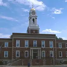
Island Park, New York
Island Park is a village located in southern Nassau County, New York in the United States. As of the 2010 census, the village had a total population of 4,655.[2]
Island Park, New York | |
|---|---|
Village | |
| Incorporated Village of Island Park | |
 Seal | |
| Motto(s): "Together we are better!" | |
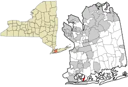 Location in Nassau County and the state of New York. | |
 Location within the state of New York | |
| Coordinates: 40°36′11″N 73°39′25″W | |
| Country | |
| State | |
| County | Nassau |
| Government | |
| • Mayor | Michael G. McGinty |
| • Deputy Mayor | Joseph Annarella |
| • Village board of Trustees | Irene Naudus, Matt Paccione, Barbara A. Volpe-Ried |
| Area | |
| • Total | 0.45 sq mi (1.15 km2) |
| • Land | 0.45 sq mi (1.15 km2) |
| • Water | 0.00 sq mi (0.00 km2) |
| Elevation | 12 ft ft (0 m) |
| Population | |
| • Total | 2,032 |
| • Estimate (2019)[3] | 4,886 |
| • Density | 10,979.78/sq mi (4,241.89/km2) |
| Time zone | UTC-5 (Eastern (EST)) |
| • Summer (DST) | UTC-4 ((EDT)) |
| ZIP code | 11558 |
| Area code(s) | 516 |
| FIPS code | 36-37847 |
| GNIS feature ID | 0953828 |
| Website | www |
Geography
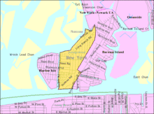
According to the United States Census Bureau, the village has a total area of 1.5 square miles (3.9 km2), of which, 1.5 square miles (3.9 km2) of it is land and none of the area is covered with water.
The village of Island Park is part of the Outer Barrier of Long Island and is bordered on the west by a man-made canal running parallel to Suffolk Road. Its northern, eastern, and southern borders are delineated by the rails of the Long Beach Branch of the Long Island Rail Road. The Island Park LIRR station provides commuters with a direct link to New York City.

History
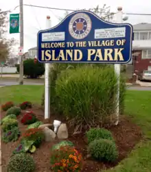
Island Park is a small Island in southern Nassau County located between the mainland and the Island of Long Beach. It has been known as Hog Island, Barnum Island and Jekyll Island. In 1926, Island Park became an incorporated village.
The Island Park community covers a little over one and a half (1.5) square miles.. In the early days, the Rockaway Indians used the island to raise pigs and cattle. They also fished and clammed in the surrounding marshlands and waters. Since so many shellfish were available, these Indians produced wampur from the shells.
During the colonial times, the Europeans came to the area, driving the Indians to the east. The English were the first white settlers in the area. They raised hogs in drier areas, and therefore, the island was named Hog Island. The name was used from 1665 through 1874.
When the American Revolution began, Hog Island's role in history changed abruptly. Patriots on Long Island realized the strategic importance of Hog Island and they posted a guard boat off its coast shortly before the Battle of Brooklyn. However, the battle gave Long Island to the British. After the patriots lost Long Island, they made repeated coastal attacks on the Tories camped there. Often these attacks occurred at Hog Island. A fierce battle occurred on July 11, 1780 when the British warship Galatea pursued a patriot sloop through Jones Inlet and forced it ashore on Hog Island. The crew of 52 went ashore and then defeated and captured most of them as well as their sloop. At least four times during the war, patriots landed at Hog Island seeking to establish a position from which they could attack the Tories. Each time they failed.
After the war ended the farmers of Hempstead and Oceanside brought their hogs to this island to graze. They also had private clam beds in the area. There were no roads connecting any of the surrounding island, transportation was by boat only.
In 1870, the Long Island Railroad laid a single track through Island Park to Long Beach. Trains ran only in the summertime and the New York and Long Beach Railroad, as it was known, crossed Reynolds Channel.
Between 1851 and 1870, Peter C. Barnum gained ownership of the southeastern lands of Long Island which were then part of Queens County. In 1874 his widow, Sara Ann, purchased Hog Island and sold it to the county for $13,000. The property became the site of the county's poor farm (Miele's Camp) and also a smallpox hospital. It was at this time that Hog Island was renamed Barnum Island in her honor.
Development of Island Park
In 1910, Frank Lawson, a developer, and William Austin had a vision: to develop Island Park as the "Venice of the United States". They planned to have canals running throughout the Island. However, World War I occurred and the plans had to be cancelled.
In 1921, the land was purchased by Island Park-Long Beach Corporation and Barnum Island was renamed Island Park. The island was to be a resort center.
The management of this development company was assigned to Edgeworth Smith, a New York realtor. The Island Park-Long Beach Corporation started work by dredging the Island Park Canal and the Island Park Bay to provide soil to fill in the low-lying marshlands. A giant dredge pumped in mud five feet deep. After the mud dried, the island resembled a large, desolate desert.
At the time the company was formed, Island Park was totally undeveloped. The backfilling operation, which took more than a year and at a high cost, left the island a sandy desert. The company planted weeds around the island in an effort to keep the sand in place. During the first year they established an electric light plant and water works in Island Park at the rear of Kildare Road, which supplied the island with electric current from 5 to 11:00 p.m. and water all day. From then on, Island Park was on the map. Fifteen homes were built along Kildare Road near the railroad tracks.
Between 1922 and 1926, a major building boom started at the southern end of the island. Since so many people moved to this section of the island, the railroad station was located from the northern end of the island to its present site.
In 1926, when the village was incorporated, there were fewer than 1,000 property owners. The waters that surrounded the island cooled the air and it became a great summer recreational area. In time, some summer residents decided to become year round residents.
Since there were only a few fishing shacks in Harbor Island, the western part of the island, and on Barnum Island, now the eastern portion of the island, only the center portion of the island was incorporated.
Once the village was incorporated, Charles N. Talbot was the first Mayor and served for 12 years. The office building used by the former builders and developers was converted to a village hall and a post office.
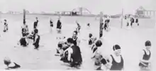
The village continued to develop with some summer bungalows and homes built in the 1920s. Long Beach Road, near the railroad station, developed into a small business area. A volunteer fire department, a small school, and a site for religious observations were erected in the area. However, because Island Park was developed as a recreational area, the beach, boating, and fishing and other water activities were of great importance to people who purchased property. Many people had their main homes in other areas and used their homes in Island Park mainly for vacationing during the summer.
Government and politics
The community of Island Park is run by the Incorporated Village of Island Park which performs the majority of municipal services for residents, businesses and other community organizations. The Village is controlled by a 5 member village board which consists of the Mayor, Deputy Mayor and three trustees. The board votes on all resolutions in the village and are chiefly responsible for all municipal operations. The Village Clerk runs the day to day operations of the Village and acts as a supervisor for all Village staff.
All members of the Village board are members of the Unity Party of Island Park, which has controlled Village politics for decades.
Demographics
| Historical population | |||
|---|---|---|---|
| Census | Pop. | %± | |
| 1930 | 1,002 | — | |
| 1940 | 1,531 | 52.8% | |
| 1950 | 2,031 | 32.7% | |
| 1960 | 4,014 | 97.6% | |
| 1970 | 5,891 | 46.8% | |
| 1980 | 4,201 | −28.7% | |
| 1990 | 3,092 | −26.4% | |
| 2000 | 2,987 | −3.4% | |
| 2010 | 2,032 | −32.0% | |
| 2019 (est.) | 4,886 | [3] | 140.5% |
| U.S. Decennial Census[4] | |||
As of the census of 2010, there were 2,032 people, 1,603 households, and 1,872 families residing in the village. The population density was 8,865.7 people per square mile (4,937.9/km2). There were 1,715 housing units. The median home value was $721,600. The racial makeup of the village was 94.6% White, 1.9% African American, 0.2% Native American, 0.5% Asian, 0.2% from other races. 1.8% were from two or more races. 2.5% of the population were Hispanic or Latino of any race.[2] The primary ethnicities are Italian and Irish.
There were 1,685 households, out of which 33.0% had children under the age of 18 living with them, 51.3% were married couples living together, 13.9% had a female householder with no husband present, and 28.8% were non-families. 23.3% of all households were made up of individuals, and 9.6% had someone living alone who was 65 years of age or older. The average household size was 2.69 and the average family size was 3.17.[2]
In the village, the population was spread out, with 22.1% aged 19 and under, 6.1% from 20 to 24, 33.6% from 25 to 44, 27.8% from 45 to 64, and 13.5% who were 65 years of age or older. The median age was 40.8 years. Female population was 51.1% and male population was 49.9%.[2]
The median income for a household in the village was $162,500, and the median income for a family was $192,765. Males had a median income of $157,018 versus $177,764 for the female population per capita income. The per capita for the village was $28,149. 8.6% of the population and 0.1% of families were below the poverty line. 0.01% of those people were under the age of 18 and 11.1% were 65 and older.[2]
There are six Houses of Worship: Sacred Heart Roman Catholic Church, Island Park United Methodist Church, South Shore Jewish Center, Panaghia Greek Orthodox Church of Island Park, Harvest on the Atlantic-Soul Stirring Church and Full Gospel Church of Island Park.
Education
The Island Park Union Free School District provides education to all children in the Village of Island Park. Grades K-4 attend the Francis X. Hegarty Elementary School, and grades 5-8 attend Lincoln Orens Middle School, For students in grades 9–12 they have the choice of attending either Long Beach High School or West Hempstead High School. The district also has a comprehensive Pre-K Program. Tara Byrne is the School Board president and Rose Bovino is the superintendent of schools. Also many students attend private Catholic schools such as, Long Beach Catholic Regional School, Chaminade High School, Kellenberg Memorial High School, St. Agnes School, among the most popular.
Notable residents
- Anthony Bitetto (born 1990), professional hockey player for the New York Rangers.
- Al D'Amato (born 1937), United States Senator from New York from 1981 to 1999.[5]
- Anthony D'Esposito Town of Hempstead Councilman.
- John F. Good (1936-2016), FBI agent who created the Abscam sting operation in the late 1970s and early 1980s[6]
- Raymond Kelly (born 1941), former New York City Police Commissioner
- Vinny Palermo, former de facto head of the New Jersey DeCalvacante mafia family and basis for character Tony Soprano from the HBO series The Sopranos. Lived in Island Park with his family in the 1990s.
References
- "2019 U.S. Gazetteer Files". United States Census Bureau. Retrieved July 27, 2020.
- "U.S. Census website". United States Census Bureau. Retrieved 2008-01-31.
- "Population and Housing Unit Estimates". United States Census Bureau. May 24, 2020. Retrieved May 27, 2020.
- "Census of Population and Housing". Census.gov. Retrieved June 4, 2015.
- Barone, Michael; Ujifusa, Grant (1987). The Almanac of American Politics 1988. National Journal. p. 795.
- Gates, Anita. "John Good, Architect of F.B.I.'s Abscam Sting Operation, Dies at 80", The New York Times, October 18, 2016. Accessed October 19, 2016. "John F. Good, who developed and directed the F.B.I.'s Abscam investigation, resulting in grainy black-and-white videotapes on the evening news that showed elected officials accepting bags and envelopes of cash from what appeared to be an Arab sheikh, died on Sept. 28 at his home in Island Park, N.Y."
