Jefferson, South Dakota
Jefferson is a city in Union County, South Dakota, United States. The population was 547 at the 2010 census. It is part of the Sioux City, IA-NE-SD Metropolitan Statistical Area. Jefferson was founded in 1859. Every year the citizens of Jefferson and surrounding area celebrate the founding of Jefferson during the "Days of '59", a festival that includes softball, basketball, horseshoes, car show, fireworks and parade.[6]
Jefferson, South Dakota | |
|---|---|
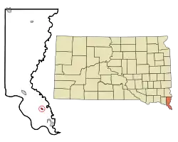 Location in Union County and the state of South Dakota | |
| Coordinates: 42°36′16″N 96°33′46″W | |
| Country | United States |
| State | South Dakota |
| County | Union |
| Incorporated | 1895[1] |
| Area | |
| • Total | 0.51 sq mi (1.32 km2) |
| • Land | 0.51 sq mi (1.32 km2) |
| • Water | 0.00 sq mi (0.00 km2) |
| Elevation | 1,115 ft (340 m) |
| Population | |
| • Total | 547 |
| • Estimate (2019)[4] | 511 |
| • Density | 1,001.96/sq mi (386.50/km2) |
| Time zone | UTC-6 (Central (CST)) |
| • Summer (DST) | UTC-5 (CDT) |
| ZIP code | 57038 |
| Area code(s) | 605 |
| FIPS code | 46-32700 |
| GNIS feature ID | 1255817[5] |
The city has the name of President Thomas Jefferson.[7]
History
Jefferson was primarily settled by French-Canadians. By 1867 the town consisted of 25 or so French-Canadian families.[8] During the winter of 1880–1, the town was ravaged by a smallpox epidemic, reported to have arrived in the area via Russian Mennonite emigrants en route to Yankton, in the Dakota Territory. The town was quarantined for several weeks, without railroad service or mail delivery. At least 150 cases of "black small pox" were reported by February 1881, resulting in more than 82 deaths.[9]
Geography
Jefferson is located at 42°36′16″N 96°33′46″W (42.604514, -96.562823).[10]
According to the United States Census Bureau, the city has a total area of 0.50 square miles (1.29 km2), all land.[11]
Jefferson has been assigned the ZIP code 57038 and the FIPS place code 32700.
The closest bodies of water are Horseshoe Lake, a small oxbow lake formed from the nearby river; McCook Lake, the Big Sioux River and the Missouri River.
Demographics
| Historical population | |||
|---|---|---|---|
| Census | Pop. | %± | |
| 1880 | 90 | — | |
| 1890 | 229 | 154.4% | |
| 1900 | 364 | 59.0% | |
| 1910 | 407 | 11.8% | |
| 1920 | 550 | 35.1% | |
| 1930 | 426 | −22.5% | |
| 1940 | 469 | 10.1% | |
| 1950 | 466 | −0.6% | |
| 1960 | 443 | −4.9% | |
| 1970 | 474 | 7.0% | |
| 1980 | 592 | 24.9% | |
| 1990 | 527 | −11.0% | |
| 2000 | 586 | 11.2% | |
| 2010 | 547 | −6.7% | |
| 2019 (est.) | 511 | [4] | −6.6% |
| U.S. Decennial Census[12] | |||
2010 census
As of the census[3] of 2010, there were 547 people, 233 households, and 146 families residing in the city. The population density was 1,094.0 inhabitants per square mile (422.4/km2). There were 248 housing units at an average density of 496.0 per square mile (191.5/km2). The racial makeup of the city was 97.4% White, 0.5% African American, 0.2% Native American, 0.2% from other races, and 1.6% from two or more races. Hispanic or Latino of any race were 1.5% of the population.
There were 233 households, of which 28.8% had children under the age of 18 living with them, 50.2% were married couples living together, 9.0% had a female householder with no husband present, 3.4% had a male householder with no wife present, and 37.3% were non-families. 29.6% of all households were made up of individuals, and 12.9% had someone living alone who was 65 years of age or older. The average household size was 2.35 and the average family size was 2.94.
The median age in the city was 39.2 years. 23% of residents were under the age of 18; 8.3% were between the ages of 18 and 24; 27.3% were from 25 to 44; 28.4% were from 45 to 64; and 13% were 65 years of age or older. The gender makeup of the city was 49.9% male and 50.1% female.
2000 census
As of the census of 2000, there were 586 people, 228 households, and 160 families residing in the city. The population density was 2,028.2 people per square mile (780.2/km2). There were 240 housing units at an average density of 830.7 per square mile (319.5/km2). The racial makeup of the city was 96.59% White, 0.85% African American, 1.02% Native American, 0.17% Asian, and 1.37% from two or more races. Hispanic or Latino of any race were 1.88% of the population.
There were 228 households, out of which 38.6% had children under the age of 18 living with them, 61.4% were married couples living together, 6.6% had a female householder with no husband present, and 29.8% were non-families. 25.9% of all households were made up of individuals, and 10.1% had someone living alone who was 65 years of age or older. The average household size was 2.57 and the average family size was 3.13.
In the city, the population was spread out, with 29.7% under the age of 18, 6.8% from 18 to 24, 30.2% from 25 to 44, 22.0% from 45 to 64, and 11.3% who were 65 years of age or older. The median age was 33 years. For every 100 females, there were 103.5 males. For every 100 females age 18 and over, there were 99.0 males.
The median income for a household in the city was $47,625, and the median income for a family was $52,813. Males had a median income of $34,750 versus $23,750 for females. The per capita income for the city was $18,467. About 1.3% of families and 3.7% of the population were below the poverty line, including 4.0% of those under age 18 and 3.9% of those age 65 or over.
References
- "SD Towns" (PDF). South Dakota State Historical Society. Archived from the original (PDF) on 2010-02-10. Retrieved 2010-02-13.
- "2019 U.S. Gazetteer Files". United States Census Bureau. Retrieved July 30, 2020.
- "U.S. Census website". United States Census Bureau. Retrieved 2012-06-21.
- "Population and Housing Unit Estimates". United States Census Bureau. May 24, 2020. Retrieved May 27, 2020.
- "US Board on Geographic Names". United States Geological Survey. 2007-10-25. Retrieved 2008-01-31.
- "Archived copy" (PDF). Archived from the original (PDF) on 2012-03-16. Retrieved 2011-01-09.CS1 maint: archived copy as title (link)
- Federal Writers' Project (1940). South Dakota place-names, v.1-3. University of South Dakota. p. 43.
- http://www.waymarking.com/waymarks/WMAQ56_St_Peters_Church_Jefferson_SD
- "Stricken with Small Pox" New York Times, Feb. 3, 1881 https://timesmachine.nytimes.com/timesmachine/1881/02/03/103396017.pdf
- "US Gazetteer files: 2010, 2000, and 1990". United States Census Bureau. 2011-02-12. Retrieved 2011-04-23.
- "US Gazetteer files 2010". United States Census Bureau. Archived from the original on 2012-07-02. Retrieved 2012-06-21.
- United States Census Bureau. "Census of Population and Housing". Retrieved September 23, 2013.
Municipalities and communities of Union County, South Dakota, United States | ||
|---|---|---|
| Cities | 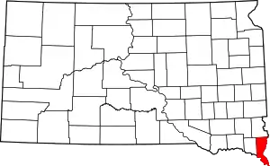 | |
| Townships | ||
| CDPs | ||
| Other unincorporated communities | ||
| Ghost town | ||
| Footnotes | ‡This populated place also has portions in an adjacent county or counties | |
| ||