Jema'a
Jema'a (Ajemaa) is a Local Government Area in southern Kaduna State, Nigeria with headquarters at Kafanchan. It has an area of 1,384 km2 and a population of 278,202 at the 2006 census.[3] The postal code of the area is 801.[4]
Jema'a
Ajemaa Jama'a | |
|---|---|
LGA and Town | |
| Country | |
| State | Kaduna State |
| Headquarters | Kafanchan |
| Government | |
| • Type | Democracy |
| • Executive Chairman | Hon. Peter Danjuma Averik[1][2] |
| Area | |
| • Total | 534 sq mi (1,384 km2) |
| Population (2006) | |
| • Total | 278,202 |
| • Density | 703/sq mi (271.4/km2) |
| 2006 National Census | |
| Time zone | UTC+1 (WAT) |
Boundaries
Jema'a Local Government Area shares boundaries with Zangon Kataf Local Government Area to the north, Jaba Local Government Area to the west, Sanga Local Government Area to the east, Kaura Local Government Area to the northeast, Plateau State to the east and Nasarawa State to the south respectively.[5][6]
Administrative subdivisions
Jema'a Local Government Area consists of 12 subdivisions (second-order administrative divisions) namely:[7]
People
Jema'a Local Government Area consist of a number of related ethnic groups and subgroups as well as a migrant population from other parts of the country, especially in the Local Government Area headquarters of Kafanchan (Fantswam) and the towns of Jema'a, Dangoma and Jagindi where the migrating Fulani population from Kajuru were accepted by the locals and settled in the early 19th century.[8]
The ethnic groups and subgroups in Jema'a LGA include: Atyuku (Atuku), Fantswam, Gwong, Nikyob, Nindem and Nyankpa.[9] Others are: Atyap, Bajju, Berom, Fulani, Hausa, Ham, Igbo and Yoruba.
Population
Jema'a (Ajemaa) Local Government Area according to the March 21, 2006 national population census was put at 278,202. Its population was projected by the National Population Commission of Nigeria and National Bureau of Statistics to be 375,500 by March 21, 2016.
Economy
The people of the local government are predominantly farmers, cultivating cash crops such as cotton, peanuts and ginger; and food crops such as corn, millet and sorghum in subsistent qualities.[10] There is also an old tin mining tunnel site in the town of Godogodo.
Notable people
- Joseph Bagobiri, clergy
- Musa Didam, paramount ruler
- Joe El, singer, songwriter
- Josiah Kantiyok, consultant, paramount ruler
- Victor Moses, footballer
- Patrick Yakowa, former state governor
- Luka Yusuf, military service
References
- Ali, Ahmed (June 17, 2020). "Nigeria: Foundation Constructs 4.2 Million Naira Rural Road in Kafanchan". All Africa. Daily Trust. Retrieved July 5, 2020.
- "APC Wins 12, PDP five local govts". Premium Times. May 15, 2018. Retrieved August 7, 2020.
- "Kaduna State of Nigeria". City Population. Retrieved September 26, 2020.
- "Post Offices- with map of LGA". NIPOST. Archived from the original on 2009-10-07. Retrieved 2009-10-20.
- "Latest violence in Southern Kaduna Longest on record - Report". Premium Times Nigeria. February 12, 2017. Retrieved August 1, 2020.
- "Kaduna-State-Political-Map". VON. Retrieved August 7, 2020.
- "Jema'a, Kaduna State, Nigeria". Retrieved September 25, 2020.
- Afuwai, Yanet. The Place of Kagoro in the History of Nigeria.
- "Districts and Village Units of Kaduna State". Retrieved August 6, 2020.
- "Jemaa, Nigeria". Retrieved August 6, 2020.
External links
- List of Towns and Villages in Jema'a LGA on Nigeria ZIP codes
- Rural Areas in Jema'a L.G.A. on Postcodes.NG
State capital: Kaduna | ||
| Local Government Areas | 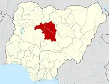 | |