John Day Highway
John Day Highway No. 5 is a highway in eastern Oregon. It comprises Oregon Route 19 (OR 19) and U.S. Route 26 (US 26), as well as short segments of OR 206, OR 207, and US 395.
| John Day Highway No. 5 | ||||
|---|---|---|---|---|
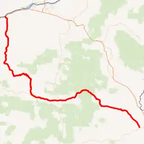
John Day Highway highlighted in red | ||||
| Route information | ||||
| Maintained by ODOT | ||||
| Length | 270.14 mi (434.75 km) | |||
| Existed | 1917–present | |||
| Component highways | ||||
| Major junctions | ||||
| West end | ||||
| ||||
| East end | ||||
| Location | ||||
| Counties | Gilliam, Wheeler, Grant, Baker, Malheur | |||
| Highway system | ||||
| ||||
Route description
The John Day Highway begins at an interchange with Interstate 84, one mile (1.6 km) north of Arlington. It follows OR 19 southward for about 76 miles (122 km), through the cities of Condon and Fossil, where it meets with OR 207 at Service Creek. Here the highway turns eastward and follows OR 207 for 16 miles (26 km) to Spray. At Spray, it splits from OR 207 and goes southward. The highway passes the community of Kimberly, through the John Day Fossil Beds National Monument, and meets up with U.S. 26. The highway then follows US 26 eastward, through the communities of Dayville, Mount Vernon, Prairie City, Unity, Ironside, and Jamieson. The John Day Highway ends at Vale.
The John Day Highway from Fossil to Austin Junction is also a part of the Journey Through Time Scenic Byway,[1] an Oregon state byway.
Major intersections
| County | Location | mi[2] | km | Destinations | Notes |
|---|---|---|---|---|---|
| Gilliam | Arlington | 0.00 | 0.00 | Two separate directional interchanges; western end of OR 19 overlap | |
| 0.31 | 0.50 | Access to opposite directions | |||
| Condon | 38.05 | 61.24 | Western end of OR 206 overlap | ||
| 38.25 | 61.56 | Eastern end of OR 206 overlap | |||
| Wheeler | Fossil | 57.50 | 92.54 | ||
| Service Creek | 76.94 | 123.82 | Western end of OR 207 overlap | ||
| | 89.21 | 143.57 | Eastern end of OR 207 overlap | ||
| Grant | Kimberly | 98.88 | 159.13 | ||
| | 117.37 | 188.89 | Eastern end of OR 19 overlap; western end of US 26 overlap | ||
| Mount Vernon | 147.16 | 236.83 | Western end of US 395 overlap | ||
| John Day | 155.42 | 250.12 | Eastern end of US 395 overlap | ||
| Bates | 183.76 | 295.73 | |||
| Baker | | 203.00 | 326.70 | ||
| Malheur | Vale | 270.08 | 434.65 | One-way couplet; eastern end of US 26 overlap | |
| 270.14 | 434.75 | ||||
1.000 mi = 1.609 km; 1.000 km = 0.621 mi
| |||||
See also
References
- "Oregon Scenic Byways map" (PDF). Oregon Department of Transportation. Retrieved June 16, 2010.
- "JOHN DAY HIGHWAY No. 5" (PDF). Oregon Department of Transportation. Retrieved September 29, 2020.
External links
- "Trip Planning for: Oregon Highway State #19". www.milebymile.com.
- "Trip Planning for: Oregon Highway United States #26". www.milebymile.com.
- "Oregon Route 19 'John Day Highway'". www.roadsnw.com.