Jugsalai
Jugsalai is a township and business center adjacent to Tatanagar Railway Station, Jamshedpur and a municipality in Purbi Singhbhum district in the Indian state of Jharkhand. It is often referred as a wholesale market of Jamshedpur.
Jugsalai | |
|---|---|
Township
and Business Center | |
 The Tata Pigments | |
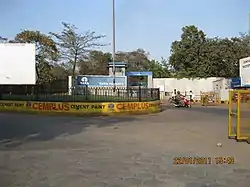
 Jugsalai Location in Jharkhand, India | |
| Coordinates: 22°46′10″N 86°10′49″E | |
| Country | India |
| City | Jamshedpur |
| Deputy Commissioner | Shri Amit Kumar (IAS) |
| Government | |
| • Type | Municipality |
| • City Manager | Rajnish Lal |
| Population (2011) | |
| • Total | 125,374 |
| Time zone | GMT +5:30 |
| Pin Code | 831006 |
| Area code(s) | 0657 |
| Website | http://jamshedpur.nic.in/ |
Geography
Jugsalai has an average elevation of 140 metres (459 feet).[1]
Demographics
As of 2011 India census,[2] Jugsalai had a population of 1,25,374. Males constitute 52% of the population and females 48%. Jugsalai has an average literacy rate of 72%, higher than the national average of 59.5%: male literacy is 77%, and female literacy is 67%. In Jugsalai, 13% of the population is under 6 years of age. Major festivals celebrations in jugsalai areas include in Chath Puja Durga Puja, Makar Sankranti, Deepavali, Kali Puja, Holi, Christmas, Easter, Shab-e-baraat, Ramadan, Eid-al-fitr, Eid al-adha, Mawlid, Muharram. Hindu is the Majority Religion in Jugsalai.
Main areas
- Dispensary Road bhogendra
- Mishra Niwas
- Ghoda Chowk
- Chowk bazaar
- ,Gouri Shankar Road
- Shahid Thakurji Pathak house
- saffi gang muhalla
- Goushala Nala Road
- Bengali Para
- R.P Patel School Road
- Gouri Shankar Road
- Marwari Para
- Panchhi Mohallah
- Gwala Para
- Chaparia Mohallah
- Millatnagar
- Islamnagar
- Chuna Shah Colony
- Rahbar Lane
- Habibnagar
- Gharib Nawaz Colony
- Station Road
- Mahato Para Road
- Kali Asthan Road
- Huma Lane
- Ram Tekri Road
- Nagar Palika Chowk
- M.E. School Road
- Safihganj Mohallah
- Gadhabasa
- Girls School Road
- Rahmat Lane
- Fish Lane
- Ghausia Lane
- Harijan Basti
- Patnaiya Colony
- D.B. Road
- Sachchidanand Mishra coal Industry
- Hussaini Lane
- Chuna Bhatta
- Shiv Ghat Road
- Hill View Area
- Raja Ram Badi
- Dhobi Lane
- Dry fish godwon
- M.e. school road
- River view Colony
- P.b.road
- Pareek bhawan.
References
- Falling Rain Genomics, Inc - Jugsalai
- "Census of India 2001: Data from the 2001 Census, including cities, villages and towns (Provisional)". Census Commission of India. Archived from the original on 16 June 2004. Retrieved 1 November 2008.
- जुगसलाई पिगमेंट पार्क में शहीद ठाकुर जी पाठक सोसाइटी के द्वारा वृक्षारोपण किया गया।. pathaknetwork.com (in Hindi). Retrieved 8 November 2019.