Kandra
Kandra is a census town in Saraikela Kharsawan district in the Indian state of Jharkhand, though it lies in the Seraikela-Kharsawan district of Jharkhand it is considered as an integral part of the Jamshedpur Metropolitan Region.
Kandra | |
|---|---|
city | |
 Kandra Location in Jharkhand, India  Kandra Kandra (India) | |
| Coordinates: 22.85°N 86.05°E | |
| Country | |
| State | Jharkhand |
| District | Saraikela Kharsawan district |
| Elevation | 226 m (741 ft) |
| Population (2011) | |
| • Total | 11,210 |
| Languages | |
| • Official | Hindi, Bengali, Odiya |
| Time zone | UTC+5:30 (IST) |
| PIN | 832402 |
| Vehicle registration | JH 05 |
Geography
Kandra is located at 22.85°N 86.05°E.[1] It has an average elevation of 226 metres (741 feet).
Demographics
As of 2011 India census,[2] Kandra had a population of 11,210. Males constitute 53% of the population and females 47%. Kandra has an average literacy rate of 61%, higher than the national average of 59.5%: male literacy is 72%, and female literacy is 49%. In Kandra, 13% of the population is under 6 years of age.
Culture
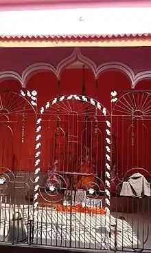
Kandra is famous for Manasa Puja, dedicated to the Goddess of snakes. Durga Puja followed by Dashehra Ravan Dhahan is one of the largest fair held by the local people. Jagganath Rath Yatra, Chat Parv, Tusu Mela, Hari Sankritan, Bhagta Parv, Kandra has a very beautiful cultural heritage.
Economy
- Seraikella Glass Works (P) Ltd. (Closed in 1990s)
- Adhunik Group.
- Nilachal Iron and Power Ltd.
Roadways
Kandra is well connected with all major cities of Jharkhand and other parts of India through national and state highways. The major highways are:
- 6 lane Expressway (Adityapur-Kandra Road) connects Jamshedpur to Kandra
- National Highway 18 passes near Kandra and connects Jamshedpur to Govindpur via Dhanbad, Purulia, Chandil,
- State Highway 5 passes through Kandra and connects to Chaibasa and Seraikela.[3]
Railways
Kandra Railway Station is a railway junction on the Chakradharpur division, of the South Eastern Railway. Kandra station has about 4 platforms and 2 thorough tracks for non stopping trains. Few of the long distance trains heading to Tatanagar Railway Station stop at platform 3 and 2.
Airport
Tata Steel had proposed to set up a 600-acre (2.4 km2) Greenfield airport on the outskirts of Jamshedpur in Kandra, Adityapur-Seraikela region. In June 2011 Tata Steel and TRIL entered formally into a joint venture for building the airport. The new airport will be of international standard with a 10,000 ft runway, it will have the capacity to allow commercial airliners such as the Airbus A320 to land and take off which was not possible from the present airport. As of December 2012, Land acquisition process has started for the Airport. Out of 528 acres (214 ha) of required land 90% is owned by Govt. whereas rest is private land. The company is at present facing opposition in the acquisition process from the local villagers.
Schools

Harish Chandra Vidhya Mandir, Kandra
Bank
Jharkhand Gramin Bank, Kandra.
State Bank of India, Kandra.
Canara Bank, Kandra.
Punjab National Bank, Kandra.
Dena Bank, Kandra.
Bank of India, Kandra.
References
- Falling Rain Genomics, Inc - Kandra
- "Census of India 2001: Data from the 2001 Census, including cities, villages and towns (Provisional)". Census Commission of India. Archived from the original on 16 June 2004. Retrieved 1 November 2008.
- Google maps
