July 2020 Alaska Peninsula earthquake
On July 21, at 10:12 p.m. local time, a magnitude 7.8 undersea earthquake struck ~65 miles south-southeast of the small town of Perryville, Alaska. It caused no severe damage or injuries due to its location relative to the sparsely-populated Alaska Peninsula, but managed to trigger a negligible tsunami that prompted evacuation of coastal residences. It was the strongest earthquake of 2020 by magnitude.[5]
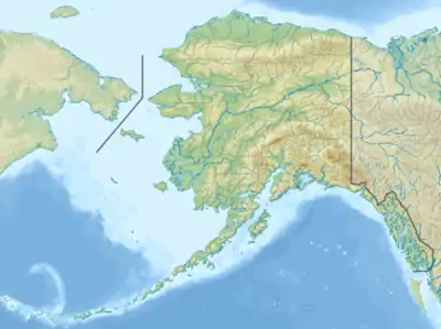 Anchorage Kodiak Perryville | |
| UTC time | 2020-07-22 06:12:44 |
|---|---|
| ISC event | 618259420 |
| USGS-ANSS | ComCat |
| Local date | July 21, 2020 |
| Local time | 10:12:44 p.m. AKDT |
| Magnitude | Mww7.8 |
| Depth | 28 km (17 mi) |
| Epicenter | 38.159°N 117.875°W |
| Fault | Aleutian subduction zone |
| Type | Thrust[1] |
| Areas affected | Alaska |
| Max. intensity | VII (Very Strong)[2] |
| Tsunami | yes |
| Aftershocks | Mww 7.6 three months later, 2,200+ total (As of 07:00 AKDT Oct. 20)[3][4] |
| Casualties | 0 |
Geology
The shallow earthquake was the result of thrust faulting[1] on the Aleutian subduction zone[6] where the Pacific plate subducts underneath the North American plate, forming the Aleutian Trench and Arc. This convergent boundary is one of the most active in the world, and was the location of the Mw9.2 1964 Alaska earthquake; the largest recorded in North America, and the second largest in the world.[7] On average, the rate at which these plates converge is about 64 mm/year.[8] The earthquake struck east of the Shumagin Gap, a 125 mile-wide (200 km) seismic gap in the subduction zone which hasn't ruptured with a large quake for at least 100 years.[9] Previously, it was thought that the subducting plate in the Shumagin Gap was poorly coupled to the overriding crust, quietly slipping and preventing large quakes. However, research suggests that the seismic gap, contrary to speculation that it might be a relatively “safe” seismic zone in the arc, may pose a threat similar to that of the rest of the Aleutian subduction zone.[10]
Earthquake
The earthquake ruptured an area of about 120 mi × 60 mi (193 km × 97 km), equal to about 7,200 sq mi (19,000 km2). The estimated maximum slip along this fault surface was about 3 to 4 m (9.8 to 13.1 ft).[11] It was reportedly felt as far as Vancouver and Victoria, more than 1,500 miles (2,400 km) away.[12][13]
Impact
There have been no reports of severe damage or injuries.[14][15] Mild damage occurred in Sand Point with reports of damaged docks, cracked roads and cement.[16]
Tsunami
A tsunami warning was issued by the NOAA for cities and towns within 200 miles (320 km) from the epicenter, evacuating coastal residents to higher ground. The warning was rescinded about four hours later, as the maximum measured run-up height of 9.4 inches (0.24 m) was negligible.[17][18][19][20] The aftershock sequence of the earthquake suggests that its rupture didn't reach the ocean floor, possibly explaining why the tsunami was disproportionately small.[21]
Aftershocks
Within the first 5 hours proceeding the mainshock, there were 6 aftershocks at or above M 4.5, including a mb 6.1 occurring less than 4 minutes later.[22][23] One week later on July 28, another Mww6.1 aftershock occurred west of the mainshock.[24][4]
On October 19, an Mww 7.6 aftershock affected the same area, prompting tsunami warnings and advisories.[25] It is the largest aftershock of the sequence.
References
- "USGS M7.8 focal mechanism". earthquake.usgs.gov. Retrieved August 14, 2020.
- "USGS Impact summary".
- "USGS aftershocks from 7.8 Alaska". earthquake.usgs.gov. Retrieved July 22, 2020.
- "Event Page | Alaska Earthquake Center". earthquake.alaska.edu. Retrieved August 11, 2020.
- "USGS worldwide earthquakes above M 7.5 from 1/1/2020 - 12/31/2020, largest to smallest". earthquake.usgs.gov. Retrieved July 22, 2020.
- "Event Page | Alaska Earthquake Center". earthquake.alaska.edu. Retrieved August 14, 2020.
- Carver, Gary; Plafker, George (2008). "Paleoseismicity and neotectonics of the Aleutian Subduction Zone—An overview". Washington DC American Geophysical Union Geophysical Monograph Series. 179: 43–63. doi:10.1029/179GM03.
- "Tectonic summary". earthquake.usgs.gov. Retrieved July 22, 2020.
- Temblor (August 1, 2020). "Does Alaska's magnitude-7.8 Simeonof earthquake finally close a seismic gap?". Temblor.net. Retrieved December 9, 2020.
- "A New Perspective on Seismic Hazards in the Shumagin Gap | Alaska Earthquake Center". earthquake.alaska.edu. Retrieved December 9, 2020.
- "Event Page | Alaska Earthquake Center". earthquake.alaska.edu. Retrieved August 14, 2020.
- "DYFI felt reports, USGS". earthquake.usgs.gov. Retrieved July 22, 2020.
- "Impacts | Alaska Earthquake Center". earthquake.alaska.edu. Retrieved September 26, 2020.
- AP (July 22, 2020). "7.8-magnitude quake rocks Alaska, tsunami warning canceled". ABC7 Los Angeles. Retrieved July 22, 2020.
- "Powerful 7.8 quake hits Alaska isles; tsunami threat over". WYFF. July 22, 2020. Retrieved July 22, 2020.
- McKenney, Hope. "Sand Point's Docks, Road To Harbor Damaged In Magnitude-7.8 Earthquake". www.kucb.org. Retrieved August 11, 2020.
- "Tsunami Event". www.ngdc.noaa.gov. Retrieved August 11, 2020.
- "Tsunami warning canceled hours after strong earthquake hit off Alaska". www.cbsnews.com. Retrieved July 22, 2020.
- U.S. National Tsunami Warning Center (July 22, 2020). "Public Tsunami Message Number 5 (final) - NWS National Tsunami Warning Center Palmer AK". Retrieved July 22, 2020.
- "Tsunami | Alaska Earthquake Center". earthquake.alaska.edu. Retrieved September 26, 2020.
- Temblor (August 1, 2020). "Does Alaska's magnitude-7.8 Simeonof earthquake finally close a seismic gap?". Temblor.net. Retrieved January 28, 2021.
- "USGS 6.1 Alaska (aftershock)". earthquake.usgs.gov. Retrieved July 22, 2020.
- "USGS aftershocks above M 4.5". earthquake.usgs.gov. Retrieved July 22, 2020.
- "USGS 6.1 aftershock #2". earthquake.usgs.gov. Retrieved August 11, 2020.
- "M 7.6 - 97 km SSE of Sand Point, Alaska". earthquake.usgs.gov. Retrieved October 21, 2020.