Jurangmangu railway station
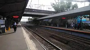
Jurangmangu Station (JMG) is a class III railway station located in Sawah Lama, Ciputat, South Tangerang. The station is located at the elevation of +25 metres above sea level, is included in the Operation Area I Jakarta. Even though it is called Jurangmangu, this station is not located in Jurangmangu Village, Pondok Aren District, but is located in the south of Jurangmangu village itself.
Jurangmangu Station Stasiun Jurangmangu | |||||||||||||||||||||||
|---|---|---|---|---|---|---|---|---|---|---|---|---|---|---|---|---|---|---|---|---|---|---|---|
 Jurangmangu Station, Photo was taken on 12 March 2019 | |||||||||||||||||||||||
| Location | Jl. Cenderawasih, Sawah Lama, Ciputat, South Tangerang Banten Indonesia | ||||||||||||||||||||||
| Coordinates | 6.288612°S 106.729154°E | ||||||||||||||||||||||
| Elevation | +25 m (82 ft) | ||||||||||||||||||||||
| Owned by | Kereta Api Indonesia | ||||||||||||||||||||||
| Operated by | Kereta Commuter Indonesia | ||||||||||||||||||||||
| Line(s) |
| ||||||||||||||||||||||
| Platforms | 2 side platforms | ||||||||||||||||||||||
| Tracks | 2 | ||||||||||||||||||||||
| Construction | |||||||||||||||||||||||
| Structure type | Ground | ||||||||||||||||||||||
| Parking | Available | ||||||||||||||||||||||
| Disabled access | Available | ||||||||||||||||||||||
| Other information | |||||||||||||||||||||||
| Station code | JMG | ||||||||||||||||||||||
| Classification | Class III[1] | ||||||||||||||||||||||
| History | |||||||||||||||||||||||
| Opened | 1 October 1889[2] Reopened 16 September 2009[3][4] | ||||||||||||||||||||||
| Rebuilt | 2002[3] | ||||||||||||||||||||||
| Services | |||||||||||||||||||||||
| |||||||||||||||||||||||
| Location | |||||||||||||||||||||||
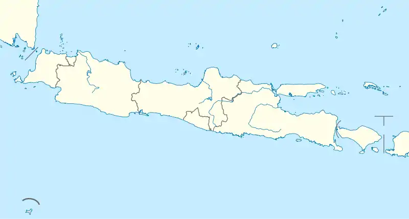
 Jurangmangu Station Location in Java | |||||||||||||||||||||||
Jurangmangu is one of two stations serving the Bintaro housing area, along with Pondok Ranji, located about 2 kilometers northeast. It is also located near the Bintaro XChange mall.
Services
The following is a list of train services at the Jurangmangu Station.
- KRL Commuterline
 Green Line, towards Tanah Abang and Serpong (Serpong branch)
 Green Line, towards Tanah Abang and Parung Panjang (Parung Panjang branch)
 Green Line, towards Tanah Abang and Maja (Maja branch)
 Green Line, towards Tanah Abang and Rangkasbitung (Rangkasbitung branch)
Intermodal support
| Public transport type | Line | Destination |
|---|---|---|
| TransJakarta | S31 (RoyalTrans) | Bintaro XChange Mall-Fatmawati Station |
| JR Connexion | Trans Bintaro Jaya | Bintaro XChange Mall-FX Sudirman (via Pondok Indah Mall) |
| Shuttle bus[5] | Intrans Bintaro Jaya | Jurangmangu–Kebayoran, Jurangmangu–Discovery/Emerald, Jurangmangu–CBD Bintaro |
| Angkot[6] | D10 | Ciputat–Pasar Ceger |
References
- Buku Informasi Direktorat Jenderal Perkeretaapian 2014 (PDF) (in Indonesian).
- Staatsspoorwegen (1921–1932). Verslag der Staatsspoor-en-Tramwegen in Nederlandsch-Indië 1921-1932 (in Dutch). Batavia: Burgerlijke Openbare Werken.
- "Stasiun Jurangmangu, Stasiun Anyar di Kota Tangerang Selatan" (in Indonesian). Retrieved 8 December 2009.
- "Stasiun Jurangmangu Resmi Dioperasikan" (in Indonesian). Retrieved 16 December 2009.
- "Shuttle Bus Intrans Bintaro Mulai Beroperasi". Bintarojaya.id. Retrieved 19 October 2017.
- "Trayek Angkot". About Tangerang. Retrieved 18 October 2017.
External links
| Preceding station | Kereta Api Indonesia | Following station | ||
|---|---|---|---|---|
| Sudimara towards Merak |
Merak–Tanah Abang | Pondok Ranji towards Tanah Abang |
This article is issued from Wikipedia. The text is licensed under Creative Commons - Attribution - Sharealike. Additional terms may apply for the media files.
