K-12 (Kansas highway)
K-12 was a state highway in the U.S. state of Kansas, created in the mid-1980s. Its alignment was changed during its existence.
| ||||
|---|---|---|---|---|
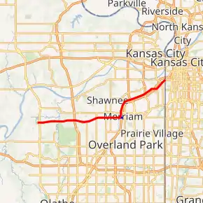
Former K-12 in red, former K-12 Spur in blue | ||||
| Route information | ||||
| Maintained by KDOT | ||||
| Existed | 1985–1987 | |||
| Major junctions | ||||
| West end | ||||
| East end | Missouri state line at Kansas City | |||
| Highway system | ||||
| ||||

History
K-12 was commissioned when the first section of the K-10 freeway was completed from K-7 in Olathe, Kansas to I-435 in Lenexa, Kansas. K-10, at the time, overlapped K-7 from K-12's western terminus in Olathe north to Shawnee Mission Parkway.[1]
When the K-10 freeway segment from Lawrence to Olathe was completed, K-10 was signed for the entire length (both sections) of the expressway. At this time, K-12 was realigned north to replace the former K-10 alignment along the Shawnee Mission Parkway. It followed the parkway from K-7 in Shawnee, then turned north on Merriam Drive in Merriam, which follows into Kansas City, Kansas. Merriam Lane turns into Southwest Boulevard near US-169, and K-12 ended not far east at the Missouri state line.[2]
Since K-12 existed entirely within the city limits of the cities it traverses, it was turned back to the cities in 1987 according to KDOT policy.[3]
Junction list
Major junctions as listed shortly before K-12 was decommissioned in 1987.[4]
| County | Location | mi | km | Destinations | Notes |
|---|---|---|---|---|---|
| Johnson | Shawnee | 0.000 | 0.000 | Interchange; western terminus | |
| I-435 exits 6A-B | |||||
| Lackman Road | Interchange | ||||
| Overland Park | I-635 exit 1B | ||||
| Wyandotte | Kansas City | ||||
| Western terminus of K-12 Spur; to I-35 exit 233A | |||||
| Southwest Boulevard northeast | Continuation into Missouri | ||||
| 1.000 mi = 1.609 km; 1.000 km = 0.621 mi | |||||
K-12 Spur
| |
|---|---|
| Length | 0.376 mi (0.605 km) |
K-12 Spur was a .376-mile-long (0.605 km) spur route that ran from K-12 east to Interstate 35 (I-35).
References
- State Highway Commission of Kansas (October 27, 1965). "Resolution for Location and Designation of Road in Johnson County". Topeka: State Highway Commission of Kansas. Retrieved June 4, 2020.
- State Highway Commission of Kansas (December 16, 1983). "Resolution for redesignation of a portion of two highways, city connecting links and withdrawal of the designation of a portion of highway in Johnson and Wyandotte Counties". Topeka: State Highway Commission of Kansas. Retrieved June 4, 2020.
- Resolution Designating City Connecting Links in State Highway System (City of Merriam) (PDF), Kansas Department of Transportation, August 1, 1987, retrieved November 28, 2009
- "1987 Official Kansas Transportation Map" (PDF). KDOT. Kansas Department of Transportation. 1987. p. Inset side. Retrieved February 16, 2019.
External links
- Kansas Department of Transportation State Map
- KDOT: Historic State Maps
- Kansas Highways Routelog (Highway 12) (accessed November 28, 2009)