Interstate 435
Interstate 435 (I-435) is an Interstate Highway beltway that encircles much of the Kansas City metropolitan area within the states of Kansas and Missouri in the United States.
| |||||||||
|---|---|---|---|---|---|---|---|---|---|

I-435 highlighted in red | |||||||||
| Route information | |||||||||
| Auxiliary route of I-35 | |||||||||
| Length | 83.02 mi[1] (133.61 km) | ||||||||
| Existed | 1965–present | ||||||||
| Major junctions | |||||||||
| Beltway around Kansas City | |||||||||
| |||||||||
| Location | |||||||||
| States | Kansas, Missouri | ||||||||
| Counties | KS: Johnson, Wyandotte MO: Platte, Clay, Jackson | ||||||||
| Highway system | |||||||||
| |||||||||

Route description
I-435, a loop route of I-35, is 80.81 miles (130.1 km) long and intersects with nearly every other interstate highway in the Kansas City area (except for I-635 and I-670). An additional 2.8 miles (4.5 km) near Kansas City International Airport is signed along with I-29 and U.S. Route 71 (US 71), making I-435 the second-longest complete beltway numbered as a single Interstate Highway in the U.S., and seventh longest in the world after Cincinnati, Ohio's I-275 at 83.71 miles (134.7 km), Houston, Texas's Beltway 8 at 88 miles (140 km), Berlin's Bundesautobahn 10 at 122 miles (196 km), and London's M25 motorway at 117 miles (188 km) as well as Beijing’s 7th and 8th ring roads. The majority—52.8 miles (85.0 km)—of I-435 is within the state of Missouri, and most of that roadway lies within the city limits of Kansas City. The first/last exit is at I-435's parent route, I-35, in Lenexa, Kansas. Going clockwise around Kansas City, the next interchange is exit 1A for Lackman Road. The milepost numbers do not start over when I-435 crosses the state line, but where it shares the same roadway as I-29, the latter's milepost (and therefore exit) numbering takes precedence.
History
I-435 in Kansas City was built piece by piece starting in the mid-1960s and not finished until 1987.
In 1965, the first segment of I-435 was built and opened between I-35 and US-69 (which at that time was signed with Metcalf Avenue) near Overland Park, Kansas. A second segment was opened the same year between I-70 and US-50 in eastern Kansas City, Missouri, but the two were not connected. The eastern segment of I-435 was extended south to Gregory Boulevard and north past 23rd Street/Route 78 by 1968. By 1969, I-435 was fully built between these two segments, through southern and eastern Kansas City. The freeway was extended from 23rd Street/Route 78 to US-24 two years later. In 1973, I-435 was extended north from the former terminus of US-24 across the Missouri River to I-35 in Claycomo. It now extended halfway around the city. In 1983, a small segment was opened on the outskirts of Kansas City north between US-169 and Route 291 near Kansas City International Airport (KCI). Later, this small segment was connected with the rest of the freeway. A segment was built heading almost due north from I-35 in Claycomo to Route 291/Cookingham Drive at North Reinking Road, curving due west from there to US-169. In this year, the southwest end was also extended to K-10. In 1987, the freeway was opened all the way around the city. The northwest end was signed on I-29 for eight miles (13 km) northwest, then exited, near Platte City and bore south on the west side of KCI. It crossed several small highways before crossing the Missouri River into Wyandotte County, Kansas. It continued generally south or southwest, crossed several state highways and I-70, then the Kaw River, before connecting with the former southwest end at K-10.
Exit list
| State | County | Location | mi | km | Exit | Destinations | Notes |
|---|---|---|---|---|---|---|---|
| Kansas | Johnson | Lenexa | 0.97 | 1.56 | 1A | Lackman Road | Proposed diverging diamond interchange; eastbound exit via exit 83 on I-35 |
| 1.35 | 2.17 | 1B | Eastern terminus of K-10; westbound becomes northbound and southbound becomes eastbound[lower-alpha 1] | ||||
| 2.11 | 3.40 | 2 | 95th Street | ||||
| 2.97 | 4.78 | 3 | 87th Street | ||||
| Shawnee | 5.02 | 8.08 | 5 | Midland Avenue | |||
| 5.99 | 9.64 | 6 | Shawnee Mission Parkway | Northbound signed as exits 6A (east) and 6B (west) | |||
| 6.44 | 10.36 | 6C | Johnson Drive | ||||
| 7.87 | 12.67 | 8A | Holiday Drive | ||||
| Wyandotte | Edwardsville | 8.29 | 13.34 | 8B | Woodend Road | ||
| 8.99 | 14.47 | 9 | |||||
| 10.99 | 17.69 | 11 | Kansas Avenue | ||||
| 11.98 | 19.28 | 12 | Northbound signed as exits 12A (east) and 12B (west); I-70 exit 411 | ||||
| Kansas City | 12.59 | 20.26 | 13 | State Avenue | Signed as exits 13A (east) and 13B (west) northbound | ||
| 13.91 | 22.39 | 14 | Parallel Parkway | Signed as exits 14A (east) and 14B (west) | |||
| 15.02 | 24.17 | 15 | Southern end of K-5 concurrency; signed as exits 15A (south/east) and 15B (west) | ||||
| 16.02 | 25.78 | 16 | Donahoo Road | ||||
| 17.98 | 28.94 | 18 | Northern end of K-5 concurrency | ||||
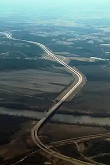
| Kansas–Missouri line | Wyandotte–Platte county line | | 20.98– 21.35 | 33.76– 34.36 | Missouri River crossing | ||
| Missouri | Platte | Parkville | 22.02 | 35.44 | 22 | ||
| 23.98 | 38.59 | 24 | Western terminus of Route 152; southern terminus of Route N | ||||
| | 29.02 | 46.70 | 29 | ||||
| Platte City | 31.00 | 49.89 | 31 | Northbound becomes eastbound and westbound becomes southbound[lower-alpha 2]; western end of I-29 / US 71 concurrency; signed as exit 17 on northbound I-29/US 71 and westbound I-435 | |||
| Kansas City | 32.49 | 52.29 | 15 | Mexico City Avenue | Exit number follows I-29 | ||
| 34.02 | 54.75 | 14 | Eastern end of I-29 / US 71 concurrency; eastbound exit and westbound entrance; exit 14 on I-29 | ||||
| 36.03 | 57.98 | 36 | NW Cookingham Drive / To | Eastbound signed as Cookingham Dr. only; westbound signed to I-29 south / KCI Airport only; no access to eastbound Cookingham from westbound I-435; no access to eastbound I-435 from westbound Cookingham | |||
| 36.95 | 59.47 | 37 | |||||
| 39.91 | 64.23 | 40 | NW Cookingham Drive | ||||
| Clay | 41.11 | 66.16 | 41 | Signed as exits 41A (south) and 41B (north) | |||
| 41.99 | 67.58 | 42 | N Woodland Avenue | ||||
| 45.02 | 72.45 | 45 | Northern terminus of Route 291; eastbound becomes southbound and northbound becomes westbound[lower-alpha 2] | ||||
| 45.89 | 73.85 | 46 | NE 108th Street | ||||
| 47.02 | 75.67 | 47 | NE 96th Street | ||||
| 48.99 | 78.84 | 49 | Signed as exits 49A (west) and 49B (east) | ||||
| 50.89 | 81.90 | 51 | Shoal Creek Parkway | ||||
| 52.11 | 83.86 | 52A | |||||
| Claycomo | 52.13 | 83.90 | 52B | No southbound exit to I-35 north/Route 110 (CKC) east; no northbound entrance from I-35 south; I-35 exit 12 | |||
| Kansas City | 54.10 | 87.07 | 54 | 48th Street, Parvin Road - Worlds of Fun | |||
| Randolph | 54.89 | 88.34 | 55 | Diverging diamond interchange completed in October 2018[3] | |||
| Clay–Jackson county line | Randolph–Kansas City line | 55.34 | 89.06 | Missouri River crossing | |||
| Jackson | Kansas City | 56.99 | 91.72 | 57 | Front Street | Diverging diamond interchange, existing interchange converted November 2011[4] | |
| 59.03 | 95.00 | 59 | Eastern end of I-435 and US-24 concurrency | ||||
| 60.09 | 96.71 | 60 | 12th Street signed southbound only | ||||
| 61.19 | 98.48 | 61 | |||||
| 63.02 | 101.42 | 63A | Southbound exit and northbound entrance | ||||
| 63.02 | 101.42 | 63A–B | Western end of I-435 and US 24 concurrency; I-70 exits 8A-B; signed as exits 63A (west) and 63B (east). | ||||
| 63.19 | 101.69 | 63C | Raytown Road, Stadium Drive - Truman Sports Complex | Northbound exit and southbound entrance | |||
| 65.10 | 104.77 | 65 | Eastwood Trafficway | ||||
| 66.10 | 106.38 | 66 | Southbound left exit and northbound entrance | ||||
| 66.10 | 106.38 | 66A | Blue Parkway | Northbound exit and southbound entrance | |||
| 66.08 | 106.35 | 66B | 63rd Street / To | Northbound exit and southbound entrance; access to Route 350 east via 63rd Street | |||
| 67.02 | 107.86 | 67 | Gregory Road | ||||
| 69.07 | 111.16 | 69 | 87th Street | ||||
| 69.99 | 112.64 | 70 | Westbound signed Route W only | ||||
| 71.02 | 114.30 | 71A | Northern end of US 50 concurrency; I-49 exits 183-184; I-470 exit 1; northern terminus of I-49; southbound becomes westbound and eastbound becomes northbound[lower-alpha 3]; left exit westbound | ||||
| 72.01 | 115.89 | 71B | Eastbound left exit and westbound entrance; I-49 exit 184A–B northbound; I-470 exit 1B westbound | ||||
| 72.97 | 117.43 | 73 | 103rd Street | Westbound exit and eastbound entrance | |||
| 74.04 | 119.16 | 74 | Holmes Road | ||||
| 74.97 | 120.65 | 75A | Wornall Road | ||||
| Missouri–Kansas line | Jackson–Johnson county line | Kansas City–Leawood line | 75.51 | 121.52 | 75B | State Line Road to 103rd Street | |
| Kansas | Johnson | Overland Park | 77.11 | 124.10 | 77A | Roe Avenue | Diverging diamond interchange converted from existing diamond interchange |
| 77.39 | 124.55 | 77B | Nall Ave | ||||
| 78.97 | 127.09 | 79 | Metcalf Avenue | ||||
| 80.08 | 128.88 | 80 | Antioch Road | ||||
| 81.06 | 130.45 | 81 | Ramp to southbound US-69 also provides access to College Boulevard and 119th Street | ||||
| 81.99 | 131.95 | 82 | Quivira Road | ||||
| Lenexa | 83.02 | 133.61 | 83 | Western end of US-50 concurrency; I-35 exit 222; access to Lackman Road via eastbound exit | |||
1.000 mi = 1.609 km; 1.000 km = 0.621 mi
| |||||||
See also
Notes
References
- Price, Jeff (May 6, 2019). "Table 2: Auxiliary Routes of the Dwight D. Eisenhower National System of Interstate and Defense Highways as of December 31, 2018". Route Log and Finder List. Federal Highway Administration. Retrieved September 20, 2020.
- Google (September 20, 2020). "Interstate 435" (Map). Google Maps. Google. Retrieved September 20, 2020.
- Kansas City District (October 29, 2018). "Construction/Traffic Alert: Over the weekend, crews opened the new DDI (Diverging Diamond Interchange) at Route 210 and I-435 in Clay County..." Missouri Department of Transportation. Retrieved September 20, 2020 – via Facebook.
- Kansas City District. "Front Street DDI". Missouri Department of Transportation. Retrieved March 30, 2014.
External links
| ||
Crossings of the Missouri River | ||||
|---|---|---|---|---|
| ||||
Crossings of the Missouri River | ||||
|---|---|---|---|---|
| ||||