K-51 (Kansas highway)
K-51 is a 79-mile-long (127 km) west–east state highway in the southwestern part of the U.S. state of Kansas. K-51 begins at the Colorado state line as a continuation of County Road M and travels eastward through portions of Morton, Stevens, and Seward counties before ending at U.S. Route 83 (US-83) near Liberal. Along the way, it overlaps US-56 from Rolla to Hugoton. K-51 travels through mostly rural farmlands, however does pass through the cities of Richfield, Rolla and Hugoton. The highway is also a two-lane road most of its length with the exception of short sections within Rolla and Hugoton.
| ||||
|---|---|---|---|---|
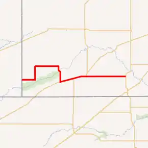
K-51 highlighted in red | ||||
| Route information | ||||
| Maintained by KDOT | ||||
| Length | 79.095 mi[1] (127.291 km) | |||
| History | Established in 1926;[2] became K-12 c. 1930; re-established as K-51 on January 7, 1937 | |||
| Major junctions | ||||
| West end | ||||
| East end | ||||
| Location | ||||
| Counties | Morton, Stevens, Seward | |||
| Highway system | ||||
| ||||

Before state highways were numbered in Kansas there were auto trails. The eastern terminus (US-83) was part of the Atlantic and Pacific Highway. K-51 was first designated as a state highway in 1926, and at that time started as a continuation of Colorado Highway 51 and went east to K-25 (current K-27). Then by 1927, it ran from K-12 north of Rolla to K-27 in Richfield.[3] Between 1930 and 1931, K-51 was replaced with an extension of K-12. Then on January 1, 1937, K-51 was re-established from the Colorado border east to K-27. Then by 1937, K-51 was extended further east to US-83, its modern day routing. K-51 originally overlapped US-270, then in a May 18, 1981 resolution, the US-270 designation was removed.
Route description
K-51 begins at the Colorado state line, acting as a continuation of County Road M. The highway travels due east through flat rural farmlands for 7.9 miles (12.7 km) then intersects K-27. At this point K-51 turns north and begins to overlap K-27. The two highways continues north for 3.5 miles (5.6 km) then crosses an unnamed creek. The highway continues north through more farmlands for another two miles (3.2 km) then crosses North Fork Cimarron River. K-51 and K-27 continue north for roughly 2.6 miles (4.2 km) then curves east at Road 9 and U Road. They continue east through flat farmlands for about six miles (9.7 km) and enters Richfield as South Boulevard. About 0.5 miles (800 m) into the city K-27 turns north onto Main Street, as K-51 continues east. K-51 then crosses North Fork Cimarron River again as it exits the city.[4] The highway continues east through rural farmlands for 7.1 miles (11.4 km) then curves south at Road 23 and U Road. It continues south for about 2.5 miles (4.0 km), where it curves southeast and crosses Cimarron River. The highway then curves back south and after 1.8 miles (2.9 km) intersects Road. From here it continues south for another 4.3 miles (6.9 km) then enters Rolla.[5][6]
Inside the city, K-51 crosses a Cimarron Valley Railroad track then intersects US-56. K-51 turns east onto US-56 and then the two routes exit the city.[7] K-51 and US-56 continue for about four miles (6.4 km), parallel to the railroad, then cross into Stevens County.[5] The two highways continue into the county for 4.1 miles (6.6 km) through farmlands then intersect K-25, which travels south into Oklahoma. From here all three routes continue northeast for 4.6 miles (7.4 km) then curve east. The highway then passes a group of houses then enters Hugoton as 11th Street and transitions from two lanes to four lanes. The three routes continue through the city for 0.5 miles (800 m) then US-56 and K-25 turn north onto Main Street. K-51 continues east and exits the city after about 0.5 miles (800 m), becoming a two-lane road again.[8] The highway continues through rural farmlands for 6.9 miles (11.1 km) then intersects Road 20, which travels north to Moscow. From here, K-51 continues for about six miles (9.7 km) and passes through Woods. The highway continues another two miles (3.2 km) then enters into Seward County.[9] About one mile (1.6 km) into the county, K-51 intersects Marteney Road and Ww Road. From here, the highway continues for seven miles (11 km) through more flat rural farmlands then intersects US-83 north of Liberal.[6][10]
The Kansas Department of Transportation (KDOT) tracks the traffic levels on its highways, and in 2018, they determined that on average the traffic varied from 110 vehicles per day near the western terminus to 2320 vehicles per day just west of the city of Hugoton.[11][12] K-51 is not included in the National Highway System,[13] a system of highways important to the nation's defense, economy, and mobility.[14] K-51 does connect to the National Highway System at its junction with US-83.[13]
History
Early roads
Before state highways were numbered in Kansas there were auto trails, which were an informal network of marked routes that existed in the United States and Canada in the early part of the 20th century. The eastern terminus of K-51 (US-83) was part of the Atlantic and Pacific Highway. It connected Los Angeles on the Pacific Ocean with New York City on the Atlantic Ocean.[15]
Establishment and realignments
| |
|---|---|
| Existed | 1927[3]–c. 1937[16][17] |
K-51 was first designated as a state highway in 1926, and at that time started as a continuation of Colorado Highway 51 and went east to K-25 (current K-27).[2] Then by 1927, K-25 was renumbered as K-27 and K-51 was extended along K-27 to Richfield then south to K-12 north of Rolla.[3][18] Between 1930 and 1931, K-51 was replaced with an extension of K-12.[19][20] In a January 1, 1937 resolution, K-51 was re-established from the Colorado border east to K-27.[21] Then between 1936 and February 1937, K-51 was extended east and replaced the former K-12, from K-27 in Richfield to US-83 by Liberal.[16][17] Between February 1937 and January 1938, US-270 was extended into Kansas, and overlapped K-51 from the eastern end of the overlap with K-25 to US-83.[17][22] This lasted until 1981, when in a May 18, 1981 resolution, the US-270 designation was removed and was truncated to Liberal.[23] In a January 4, 1939 resolution, K-51 was to be realigned where it crosses the Cimarron River to eliminate two sharp curves.[24]
The section of K-51 from Rolla northeast to Hugoton, originally overlapped K-45. In the early 1950s, towns along the K-45 corridor, connecting Ellsworth, Kansas to the Oklahoma state line at Elkhart, formed the Mid-Continent Diagonal Highway Association[25] to push for a new highway from Springer, New Mexico (on US-85) northeast across the Oklahoma Panhandle, along K-45, and continuing to Manitowoc, Wisconsin on Lake Michigan.[26] By mid-1954, it was being promoted as US-55 between the Great Lakes and the Southwestern United States.[27] The first submissions to the American Association of State Highway Officials (AASHO) to establish the route were made in 1954. The first route considered in northeast Kansas was via US-40 from Ellsworth to Topeka and K-4 and US-59 via Atchison to St. Joseph, Missouri.[28] A revised route adopted in March 1955, due to AASHO objections to the original route, which traveled concurrently with other U.S. highways for over half of its length, followed K-14, K-18, US-24, K-63, K-16, and US-59 via Lincoln and Manhattan.[29] In July, the US-50N Association proposed a plan that would have eliminated US-50N by routing US-55 along most of its length, from Larned east to Baldwin Junction, and then along US 59 to Lawrence and K-10 to Kansas City; towns on US-50N west of Larned, which would have been bypassed, led a successful fight against this.[30][31] However, in September of that year, the Kansas Highway Commission accepted that plan, taking US-55 east to Kansas City.[32] On June 27, 1956, the AASHO Route Numbering Committee considered this refined plan for US-55, between Springer, New Mexico and Kansas City, Missouri, with a short US-155 along the remaining portion of US-50N from Larned west to Garden City. The committee approved the request, but since the proposed route was more east–west than north–south, it changed it to an even number – US-56 – and the spur to US-156. At this time, K-45 became known as US-56.[33]
Major intersections
| County | Location | mi[1] | km | Destinations | Notes |
|---|---|---|---|---|---|
| Morton | Westola Township | 0.000 | 0.000 | Continuation into Colorado | |
| 7.871 | 12.667 | Western end of K-27 concurrency | |||
| Richfield | 22.265 | 35.832 | Eastern end of K-27 concurrency | ||
| Rolla | 39.746 | 63.965 | Western end of US-56 concurrency | ||
| Stevens | West Center Township | 47.994 | 77.239 | Western end of K-25 concurrency | |
| Hugoton | 56.211 | 90.463 | Eastern end of US-56 and K-25 concurrencies | ||
| Seward | Liberal Township | 79.095 | 127.291 | Eastern terminus; road continues as Road 13 (unpaved) | |
1.000 mi = 1.609 km; 1.000 km = 0.621 mi
| |||||
References
- Staff (2016). "Pavement Management Information System". Kansas Department of Transportation. Retrieved April 22, 2017.
- Rand McNally and Company (1926). "Kansas" (Map). Rand McNally Auto Road Atlas of the United States, including a Brief Description of the National Parks and Monuments. Chicago: Rand McNally and Company. pp. 56–57.
- Rand McNally and Company (1927). "Kansas" (Map). Rand McNally Auto Road Atlas of the United States and Ontario, Quebec, and the Maritime Provinces of Canada, with a Brief Description of the National Parks and Monuments. 1:1,600,000. Chicago: Rand McNally and Company. pp. 54–55. OCLC 2078375 – via Rumsey Collection.
- Bureau of Transportation Planning (October 2006). City of Richfield (PDF) (Map). Scale not given. KDOT City Maps. Topeka: Kansas Department of Transportation. Retrieved October 19, 2020.
- Bureau of Transportation Planning (June 2009). Morton County (PDF) (Map). [c. 1: 211,200]. General Highway Map. Topeka: Kansas Department of Transportation. Retrieved October 19, 2020.
- "Overview of K-51". Google Maps. Google, Inc. Retrieved January 10, 2021.
- Bureau of Transportation Planning (October 2006). City of Rolla (PDF) (Map). Scale not given. KDOT City Maps. Topeka: Kansas Department of Transportation. Retrieved October 19, 2020.
- Bureau of Transportation Planning (October 2004). City of Hugoton (PDF) (Map). Scale not given. KDOT City Maps. Topeka: Kansas Department of Transportation. Retrieved October 19, 2020.
- Bureau of Transportation Planning (April 2009). Stevens County (PDF) (Map). [c. 1: 211,200]. General Highway Map. Topeka: Kansas Department of Transportation. Retrieved October 19, 2020.
- Bureau of Transportation Planning (January 2009). Seward County (PDF) (Map). [c. 1: 211,200]. General Highway Map. Topeka: Kansas Department of Transportation. Retrieved October 19, 2020.
- Bureau of Transportation Planning (2018). Traffic Flow Map Kansas State Highway System (PDF) (Map). [c. 1:1,584,000]. Topeka: Kansas Department of Transportation. Retrieved April 17, 2020.
- Bureau of Transportation Planning (2018). Traffic Flow Inset Map Kansas State Highway System (PDF) (Map). [c. 1:1,584,000]. Topeka: Kansas Department of Transportation. Retrieved April 18, 2020.
- Federal Highway Administration (May 8, 2019). National Highway System: Kansas (PDF) (Map). Scale not given. Washington, DC: Federal Highway Administration. Retrieved April 18, 2020.
- Natzke, Stefan; Neathery, Mike; Adderly, Kevin (September 26, 2012). "What is the National Highway System?". National Highway System. Washington, DC: Federal Highway Administration. Retrieved April 18, 2020.
- Rand McNally and Company (1924). "Kansas" (Map). AutoTrails Map, Southern Nebraska, Eastern Colorado, Kansas, Northeastern New Mexico, Northern Oklahoma. 1:1,600,000. Chicago: Rand McNally and Company. OCLC 2078375. Retrieved June 15, 2020 – via Rumsey Collection.
- State Highway Commission of Kansas (1936). Kansas State Highway System (PDF) (Map). Scale not given. Topeka: State Highway Commission of Kansas. Retrieved April 18, 2020.
- State Highway Commission of Kansas (1937). Kansas State Highway System (PDF) (Map). Scale not given. Topeka: State Highway Commission of Kansas. Retrieved April 18, 2020.
- National Map Company (1927). "Kansas" (Map). Sectional paved road map. 1:1,600,000. Indianapolis: National Map Company. pp. 18–19. OCLC 4048012 – via Rumsey Collection.
- Rand McNally and Company (1930). "Kansas" (Map). Rand McNally Auto Road Atlas of the United States, A Map of Every State in the United States and Every Province of Eastern Canada. Chicago: Rand McNally and Company. pp. 32–33.
- Rand McNally and Company (1931). "Kansas" (Map). Clason's Road Map of Kansas. 1:2,000,000. Denver: Clason Map Company. p. 87 – via Rumsey Collection.
- State Highway Commission of Kansas (July 1, 1937). "Resolution for designation of K-51". Topeka: State Highway Commission of Kansas. Retrieved April 18, 2020.
- State Highway Commission of Kansas (1938). Kansas State Highway System (PDF) (Map). Scale not given. Topeka: State Highway Commission of Kansas. Retrieved April 18, 2020.
- Kansas Department of Transportation (May 18, 1981). "Resolution to withdraw a US Numbered Route from the State Highway System in several counties in Kansas". Topeka: Kansas Department of Transportation. Retrieved October 19, 2020.
- State Highway Commission of Kansas (January 4, 1939). "Resolution for relocation and redesignation of road in Morton County". Topeka: State Highway Commission of Kansas. Retrieved April 18, 2020.
- "Highway Assured". Atchison Daily Globe. December 17, 1953. p. 20. Retrieved October 7, 2020 – via Newspapers.com.
- "Vernon Tip Traylor..." Great Bend Daily Tribune. October 1, 1953. p. 1. Retrieved October 7, 2020 – via Newspapers.com.
- "New Mexico Okays US-55 Road Proposal". Great Bend Daily Tribune. June 2, 1954. p. 7. Retrieved October 7, 2020 – via Newspapers.com.
- "Another Effort to Reroute Proposed Federal Highway". Great Bend Daily Tribune. January 6, 1955. Retrieved October 7, 2020 – via NewspaperArchive.
- "New US-55 Route Approved Here". Great Bend Daily Tribune. March 20, 1955. p. 3. Retrieved October 7, 2020 – via Newspapers.com.
- "Call Meeting On Road Proposals". Great Bend Daily Tribune. July 26, 1955. p. 1. Retrieved October 7, 2020 – via Newspapers.com.
- "US 50N Boosters Turn Down New Route, Name". Great Bend Daily Tribune. July 29, 1955. Retrieved October 7, 2020 – via Newspapers.com.
- "Highway Boosters Here Oppose New US-55 Plan". Great Bend Daily Tribune. September 16, 1955. Retrieved October 7, 2020 – via NewspaperArchive.
- "Chronological History Documentation: US 56 (correspondence between ODOT, AASHO, and other DOTs)" (PDF). Oklahoma Department of Transportation. Retrieved January 10, 2021.