K-14 (Kansas highway)
K-14 is a 219.3-mile-long (352.9 km) north–south state highway which runs most of the length of the U.S. state of Kansas. The highway runs through the central part of the state. K-14's southern terminus is at U.S. Highway 160 (US-160) and K-2 in the city of Harper, and the northern terminus is a continuation as Nebraska Highway 14 (N-14) at the Nebraska border north of the City of Mankato.
| ||||
|---|---|---|---|---|
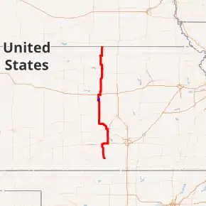
K-14 highlighted in red, K-14 Truck highlighted in blue | ||||
| Route information | ||||
| Maintained by KDOT and the city of Ellsworth | ||||
| Length | 219.276 mi[1] (352.891 km) | |||
| Major junctions | ||||
| South end | ||||
| ||||
| North end | ||||
| Location | ||||
| Counties | Jewell, Mitchell, Lincoln, Ellsworth, Rice, Reno, Kingman, Harper | |||
| Highway system | ||||
| ||||

Route description

K-14 begins on its southern end at US-160 in the town of Harper in Harper County. From there, it travels north into Kingman County, crossing the Chikaskia River near the community of Rago. K-14 continues north to Kingman, where it crosses the South Fork of the Ninnescah River and meets US-54/US-400. K-14 travels east with US-54/US-400 for approximately 10 miles (16 km) before turning north again near Waterloo and continuing into Reno County, where it crosses the North Fork of the Ninnescah River. K-14 meets K-96 just south of South Hutchinson, and the two highways run concurrently for three miles (4.8 km), until they meet US-50 and K-61, where all four routes run concurrently for two miles (3.2 km) to the west, when K-14 and K-96 turn north and pass through Nickerson, and US-50 and K-61 continue west.
The two highways enter Rice County just south of Sterling before passing through the town. The highway then crosses the Arkansas River before encountering Lyons, and US-56, at which point K-96 splits from K-14 and continues west along US-56 toward Great Bend, while K-14 continues north into Ellsworth County. In the historic town of Ellsworth, the highway crosses the Smoky Hill River and continues north to Interstate 70 (I-70). K-14 travels east along I-70 for approximately two miles (3.2 km) before exiting and resuming north into Lincoln County, where K-14 passes through the Smoky Hills Wind Farm.
K-14 passes north through Lincoln and Mitchell counties, crossing the Saline River in the town of Lincoln and the Solomon River in Beloit (the largest town along the highway). The highway jogs to the west for close to two miles (3.2 km) at the Mitchell–Jewell county line before continuing north into Jewell County. K-14 passes through the town of Jewell and meets US-36 just east of Mankato. K-14 overlaps US-36 for three miles (4.8 km) as it heads east, before splitting off again to the north. K-14 passes over White Rock Creek at the far western end of Lovewell Reservoir and continues north into Nebraska near the town of Superior, Nebraska, where the highway continues as N-14.
The northern and southern halves of the highway differ fairly significantly in terms of terrain and landscape. The southern half of K-14 travels over fairly flat terrain in the valley of the Arkansas River. Just north of the intersection with K-4 in southern Ellsworth County, K-14 passes into the Smoky Hills region, traveling over a series of broad, rolling hills, providing several scenic vistas of the surrounding countryside. The portion of the highway between Lincoln and Beloit is particularly hilly.
History
In a September 9, 2009, resolution, K-14 was rerouted along K-61 from Arlington to Hutchinson then along K-96 from Hutchinson to the former end of the K-14/K-96 overlap.[2]
K-28 originally overlapped K-14 from K-28's current western terminus north to the southern end of the overlap with US-36, then continued west along US-36. Then on February 8, 1996, K-28 was truncated to K-14 in Jewell.[3][4][5]
Until 2013, K-14 followed US-54/US-400 west out of Kingman for four miles (6.4 km). From there it went north to K-61 and through Arlington and continued north, then met K-96 south of Sterling. In 2013, K-14 was realigned to the now defunct K-17, and K-11 took over a section of original K-14 alignment from US-54/US-400 north to K-61.[6]
Junction list
All exits are unnumbered.
| County | Location | mi[1] | km | Destinations | Notes |
|---|---|---|---|---|---|
| Harper | Harper | 0.000 | 0.000 | Southern terminus; highway continues as US-160 west/K-2 south (former K-14 south) | |
| Kingman | Rago | 12.506 | 20.126 | ||
| Kingman | 26.162 | 42.104 | Southern end of US-54/US-400 overlap; former K-14 north | ||
| | 29.909 | 48.134 | 40th Avenue | Interchange; southern end of freeway | |
| | 30.617 | 49.273 | 70th Avenue | ||
| | 36.321 | 58.453 | Northern end of US-54/US-400 overlap ; orthern end of overlap with freeway | ||
| Reno | | 57.459 | 92.471 | Southern end of K-96 overlap | |
| South Hutchinson | 60.184 | 96.857 | eastern end of US-50/K-61 overlap Interchange; east end of expressway section;; access to Hutchinson Regional Medical Center | ||
| | 61.696 | 99.290 | Western end of US-50/K-61 overlap; partial cloverleaf interchange; west end of expressway section, south end of super two; former K-14 south | ||
| | 63.402 | 102.036 | 6th Avenue | ||
| | 65.084 | 104.743 | 4th Avenue | ||
| | 67.606 | 108.801 | Wilson Road / Nickerson Boulevard | ||
| | 50th Avenue | Dirt road; north end of super two | |||
| Rice | Lyons | 94.319 | 151.792 | Northern end of K-96 overlap | |
| | 105.895 | 170.421 | |||
| Ellsworth | | 120.214 | 193.466 | Southern end of K-14 Truck | |
| Ellsworth | 122.347 | 196.898 | Western end of K-140; northern end of K-14 Truck; serves Ellsworth County Medical Center | ||
| | 129.800 | 208.893 | Southern end of I-70/US-40 overlap; exit 219 on I-70 | ||
| | 132.713 | 213.581 | Northern end of I-70/US-40 overlap ; exit 221 on I-70 | ||
| Lincoln | Lincoln | 147.514 | 237.401 | ||
| | 157.111 | 252.846 | Western terminus of K-284 | ||
| Mitchell | Beloit | 178.516 | 287.294 | ||
| Jewell | Jewell | 193.566 | 311.514 | Western terminus of K-28 | |
| | 201.600 | 324.444 | Southern end of US-36 overlap | ||
| | 204.053 | 328.391 | Northern end of US-36 overlap | ||
| | 219.276 | 352.891 | Contunuation into Nebraska | ||
1.000 mi = 1.609 km; 1.000 km = 0.621 mi
| |||||
K-14 Truck
| |
|---|---|
| Location | Ellsworth |
| Length | 2.790 mi[1] (4.490 km) |
K-14 Truck is a truck route in Ellsworth. From K-14, K-14 Truck follows K-156 east to K-140, then follows the latter west to end back at K-14.
Major junctions
The entire route is in Ellsworth County.
| Location | mi[1] | km | Destinations | Notes | |
|---|---|---|---|---|---|
| | 0.000 | 0.000 | Southern terminus; southern end of K-156 overlap; highway continues west as K-156 | ||
| Ellsworth | 1.076 | 1.732 | Kanopolis | Partial interchange; access via southbound exit ramp and connector road | |
| 2.295 | 3.693 | Northern end of K-156 overlap; southern end of K-140 overlap | |||
| 2.790 | 4.490 | Northern terminus; northern end of K-140 overlap; western terminus of K-140; road continues west as 15th Street | |||
1.000 mi = 1.609 km; 1.000 km = 0.621 mi
| |||||
References
- Kansas Department of Transportation (2016). "Pavement Management Information System". Kansas Department of Transportation. Retrieved April 21, 2017.
- State Highway Commission of Kansas (September 9, 2009). "Resolution for Relocation and Redesignation of Roads in McPherson County". Vermillion: State Highway Commission of Kansas. Retrieved August 6, 2019.
- Kansas Department of Transportation (February 8, 1996). "Resolution to Redesignate Highway K-28 and K-128 in Jewell County". Topeka: Kansas Department of Transportation. Retrieved October 1, 2019.
- Bureau of Transportation Planning (1989). Jewell County (PDF) (Map). Scale not given. General Highway Map. Topeka: Kansas Department of Transportation. Retrieved July 29, 2019.
- Bureau of Transportation Planning (2000). Jewell County (PDF) (Map). Scale not given. General Highway Map. Topeka: Kansas Department of Transportation. Retrieved July 29, 2019.
- State Highway Commission of Kansas (December 2011). 2011-12 Kansas Highway Map (PDF) (Map). Kansas: State Highway Commission of Kansas. Retrieved August 6, 2019.
