Kamal Rural Municipality
Kamal (Nepali: कमल गाउँपालिका) is a rural municipality (gaunpalika) out of seven rural municipality located in Jhapa District of Province No. 1 of Nepal. There are a total of 15 municipalities in Jhapa in which 8 are urban and 7 are rural.
Kamal
कमल गाउँपालिका | |
|---|---|
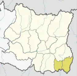
 Kamal Location in Province No. 1 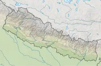 Kamal Kamal (Nepal) | |
| Coordinates: 26.60°N 87.75°E | |
| Province | Province No. 1 |
| District | Jhapa |
| Wards | 7 |
| Established | 10 March 2017 |
| Seat | Topgachchi |
| Government | |
| • Type | Village Council |
| • Chairperson | Mrs. Menuka Kafle (NCP) |
| • Vice-chairperson | Mr. Benu Prasad Siwakoti (NCP) |
| Area | |
| • Total | 104.57 km2 (40.37 sq mi) |
| Population (2011) | |
| • Total | 44,365 |
| • Density | 420/km2 (1,100/sq mi) |
| Time zone | UTC+5:45 (Nepal Standard Time) |
| Website | official website |
According to Ministry of Federal Affairs and Local Development Kamal has an area of 104.57 square kilometres (40.37 sq mi) and the total population of the municipality is 44365 as of Census of Nepal 2011.[1][2]
Topgachchi and Lakhanpur which previously were all separate Village development committee merged to form this new local level body. Fulfilling the requirement of the new Constitution of Nepal 2015, Ministry of Federal Affairs and Local Development replaced all old VDCs and Municipalities into 753 new local level body (Municipality).[1][3]
The rural municipality is divided into total 7 wards and the headquarter of this newly formed rural municipality is situated in Topgachchi.
References
- "स्थानीय तहहरुको विवरण". www.mofald.gov.np/en. MoFALD. Archived from the original on 31 August 2018. Retrieved 16 April 2018.
- "CITY POPULATION – statistics, maps & charts". www.citypopulation.de. 8 October 2017. Retrieved 16 April 2018.
- "कमल गाउँपालिका" [Kamal rural municipality]. www.kamalmun.gov.np (in Nepali). Kamal Rural Municipality. Retrieved 15 April 2018.