Jhapa District
Jhapa (Nepali: झापा जिल्ला![]() Listen ) is a district of Province No. 1 in eastern Nepal named after a Rajbanshi word "Jhapa" meaning "cover" (verb). The latest official data, the 2011 Nepal Census, puts the total population of the district at 812,650. Jhapa is one of the most ethnically diverse districts of the country, and is home to 110 ethnic groups.[3] The total area of the district is 1606 square kilometres.
Listen ) is a district of Province No. 1 in eastern Nepal named after a Rajbanshi word "Jhapa" meaning "cover" (verb). The latest official data, the 2011 Nepal Census, puts the total population of the district at 812,650. Jhapa is one of the most ethnically diverse districts of the country, and is home to 110 ethnic groups.[3] The total area of the district is 1606 square kilometres.
Jhapa District
झापा जिल्ला | |
|---|---|
District | |
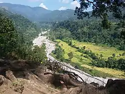 Beautiful hill and river view,Jhapa | |
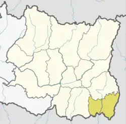 | |
.png.webp) Administrative divisions of Jhapa | |
| Country | |
| Province | Province No. 1 |
| Admin HQ. | Bhadrapur |
| Government | |
| • Type | Coordination committee |
| • Body | DCC, Jhapa |
| • Head | Mr. Somnath Bishwakarma |
| • Deputy-Head | Mrs. Mina Parajuli |
| • Parliamentary constituencies | 5 |
| • Provincial constituencies | 10 |
| Area | |
| • Total | 1,606 km2 (620 sq mi) |
| Elevation (maximum) | 506 m (1,660 ft) |
| Population (2011[1]) | |
| • Total | 812,650 |
| • Density | 510/km2 (1,300/sq mi) |
| • Households | 39,393 |
| Demographics | |
| • Ethnic groups | Bahun, Chhetri, Rajbanshi, Limbu, Rai |
| • Female ♀ | 53% |
| • Male ♂/100 female | 90.07 |
| Human Development Index | |
| • Per Capita Income | 1,226 USD |
| • Poverty rate | 21.82 |
| • Literacy | 75 % |
| • Life Expectancy | 67.29 |
| Time zone | UTC+05:45 (NPT) |
| Main Language(s) | Nepali, Rajbanshi, Limbu, Maithili |
| Major highways | Mahendra Highway, Postal Highway |
| Website | ddcjhapa |
Location
Jhapa is the easternmost district of Nepal and lies in the fertile Terai plains. It is part of the Outer Terai. Jhapa borders with Ilam in the north, Morang in the west, the Indian state of Bihar in the south and the Indian state of West Bengal to the southeast and east. Geographically, it covers an area of 1,606 km2 (620 sq mi) and lies on 87º39’ east to 88º12’ east longitude and 26º20’ north to 26º50’ north latitude.[4]
Climate and Geography
Jhapa receives 250 to 300 cm of rainfall a year, and mostly during the monsoon season in the summer, and its hilly northern area receives more rainfall than the south.[5] The maximum temperature is recorded 42 °C in summer and 10 °C in winter. The lowest elevation point is 58 meter which is the lowest land of Nepal and highest elevation point is 500 meter from mean sea level of the district.[6]
| Climate Zone[7] | Elevation Range | % of Area |
|---|---|---|
| Lower Tropical | below 300 meters (1,000 ft) | 98.8% |
| Upper Tropical | 300 to 1,000 meters 1,000 to 3,300 ft. |
1.2% |
Administrative Division
Jhapa consists of 15 administrative divisions including 8 municipalities and 7 rural municipalities. Each divisions have wards according to the demographic and geographic size. These are:
Municipalities
Demographics
Jhapa district has average population density of around 428.4 per square kilometer. The district population growth rate is 1.84%. However, the growth is balanced and in-migration is rapidly increasing day to day into the district. At the time of the 2011 Nepal census, Jhapa District had a population of 812,650 making it the 4th largest district in Nepal after Kathmandu, Morang and Rupandehi.
| Rank | Language | percentage |
|---|---|---|
| 1 | Nepali(lingua franca) | 56% |
| 2 | Rajbanshi/Tajpuria | 11% |
| 3 | Limbu | 5.6% |
| 4 | Maithili | 5.5% |
| 5 | Santali | 3.6% |
| 6 | Rai | 2.5% |
| 7 | Urdu | 2.3% |
| 8 | Tamang | 2.1% |
| 9 | Newari | 1.5% |
| 10 | Other | 11% |
International Borders
Jhapa borders to India in east and south. Jhapa is an eastern entry point of Nepal from India. Famous Kakarbhitta border lies here and is an important trade point of Nepal.
Education
Among 77 districts, Jhapa has a literacy rate of 75.2%, higher than the national average.[9] There are enough primary schools, secondary schools, high schools and colleges available both from private sector and the government.
References
- Household and population by districts, Central Bureau of Statistics (CBS) Nepal Archived 2013-07-31 at the Wayback Machine
- http://www.npc.gov.np/human_development_indicators_by_district
- "Seven places to visit while you're in Jhapa". kathmandupost.com. Retrieved 2019-12-14.
Jhapa might just be the most diverse of Nepal’s districts. Out of the total 126 castes/ethnic groups across the country, Jhapa is home to 110 ethnic groups, including the endangered Santhal and Ganesh (Gangai) tribes.
- District Transport Masterplan-Jhapa (PDF), retrieved May 5, 2020
- Climate in Jhapa, retrieved May 5, 2020
- District Transport Masterplan-Jhapa (PDF), retrieved May 5, 2020
- The Map of Potential Vegetation of Nepal - a forestry/agroecological/biodiversity classification system (PDF), Forest & Landscape Development and Environment Series 2-2005 and CFC-TIS Document Series No.110., 2005, ISBN 87-7903-210-9, retrieved Nov 22, 2013
- "National Data Portal-Nepal". nationaldata.gov.np. Retrieved 2020-06-29.
- "Census 2001". Census. central bureau of statistics, Nepal. 2001. Archived from the original on 2008-09-24. Retrieved 2008-08-24.
External links
| Wikimedia Commons has media related to Jhapa District. |
- "Districts of Nepal". Statoids.
Places adjacent to Jhapa District | ||||||||||
|---|---|---|---|---|---|---|---|---|---|---|
| ||||||||||