Kangean Islands
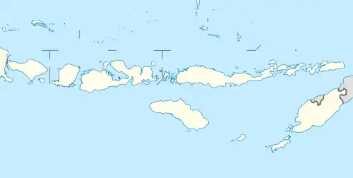
The Kangean Islands or simply Kangean (Indonesian: Kepulauan Kangean) is a collective name referred to the area of Kangean (the main island) and its surrounding islands lie in the north of Bali in northern Bali Sea, northwest of the Lesser Sunda Islands (Nusa Tenggara),[3] administratively part of Sumenep Regency, East Java Province. It comprises a total of 91 islands altogether with 27 inhabited islands, Kangean located approximately 120 km (75 mi) in the north of Bali,[4] the northwest of Lombok, and 120 km east of Madura.[5] Apart from the regencial administrative, the capital of Kangean is Arjasa, it is the biggest district which located in the western hemisphere of the island. The Kangean Islands has a relatively large potential of natural resources, such as natural gas, teak, coconut, and salt production.[3]
Kangean Islands | |
|---|---|
| Kangean | |
 | |
 Kangean Islands | |
| Coordinates: 6°59′S 115°39′E | |
| Capital | Arjasa |
| Largest city | Arjasa |
| Divisions | 3 districts, 37 subdistrics[1] |
| Government | |
| • Body | Sumenep Regencial Government |
| Area | |
| • Total | 648.56 km2 (250.41 sq mi) |
| Elevation | 364 m (1,194 ft) |
| Population | |
| • Total | 125,840[2] |
| • Density | 173.41/km2 (449.1/sq mi) |
| Demographics | |
| • Ethnic groups | |
| • Religion |
|
| • Languages | Indonesian (official) Kangeanese (regional) Other languages: Bajo/Bajau, Mandarese, Buginese, Madurese |
| Time zone | UTC+7 (Indonesia Western Time) |
Layout
The largest island, at about 490 km², is Kangean Island. Other islands include Paliat, Sepanjang, and several smaller islands. The towns of Arjasa and Kalikatak, both on Kangean Island, are the area's largest population centres. The Kangean islands have strong historic and ethnic ties with Madura, Bali, West Nusa Tenggara, Sumbawa, South Borneo, and also South Sulawesi. The majority religion at Kangean is Islam.
The highest elevation point on the islands is in the northeast at 1,192 feet (364 m.), while overall the islands are low in elevation.[3] The weather tends to rain regularly.
.jpg.webp)
Saltwater crocodiles are reported to be present within the island's coastal mangroves.
They are administered as three districts (kecamatan) of Sumenep Regency - Arjasa, Kangayan, and Sapêken. Together, their population was 108,264 in the 2000 census, increasing to 123,367 in the 2010 count[6]
Ethnic group
The Kangeanese (Kangeanese: Oréng Kangéan, Indonesian: Orang Kangean or Suku Kangean) are an Austronesian ethnic group native to the Indonesian island of Kangean and its surrounding islands.[7] The Kangeanese population of c.125,840[8] live mostly on the island of Kangean, making up c.90% of the island's population.
Languages
The Kangean language is mainly spoken in Kangean areas.
Exports and reserves
Since 1993 the islands have been the site of substantial natural gas mining. The natural gas fields were first discovered and developed by the United States corporation ARCO, which became a subsidiary of BP in 2000. In mid-2004, BP sold its Kangean holdings to an Indonesian corporation, PT Energi Mega Persada. The islands are connected to East Java via a 430 km pipeline,[9] most of which runs underwater.
Other economic activities on the islands include teak, coconut, and salt production.[3]
Airstrip
In 2014, the local government agreed to reactivate an old airstrip on Kangean Island. The airstrip is 1,000 meters long and 30 meters wide.[10]
References
- "Area by District in Sumenep Regency". sumenepkab.bps.go.id. The Official Statistics of Sumenep Regency. 2013. Retrieved 31 December 2020.
Kangean's districts of Sapeken, Arjasa, Kangayan
- "The Total Population by District in Sumenep Regency". sumenepkab.bps.go.id. The Official Statistics of Sumenep Regency. 2013. Retrieved 31 December 2020.
Kangean's districts of Sapeken, Arjasa, Kangayan
- "Kangean Islands". britannica. Retrieved 5 November 2012.
- "Y E 3 K". www.mdxc.org. Archived from the original on 2 August 2015. Retrieved 5 November 2012.
- "KANGEAN ISLANDS". en.voi.co.id. Retrieved 5 November 2012.
- Biro Pusat Statistik, Jakarta, 2011.
- "Kangean in Indonesia". joshuaproject.net. Joshua Project. 2011. Retrieved 19 January 2021.
- "The Total Population by District in Sumenep Regency". sumenepkab.bps.go.id. The Official Statistics of Sumenep Regency. 2013. Retrieved 31 December 2020.
Kangean's districts of Sapeken, Arjasa, Kangayan
- "Kangean People Group". www.frontiersusa.org. Retrieved 5 November 2012.
- "Pemkab Buka Lapter Eks Belanda di Pulau Kangean". 7 May 2014.
External links
| Authority control |
|---|