Karaikal
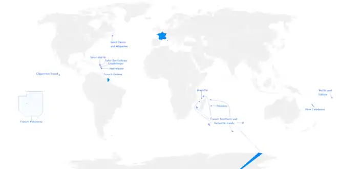
Karaikal (/kʌdɛkʌl/, French: Karikal /kaʁikal/) is a town of the Indian Union Territory of Puducherry. Karaikal became a French Colony in 1674 and held control, with occasional interruption from the British and Dutch, until 1954 (de jure in 1956), when it was incorporated into the Republic of India, along with Chandernagore, Mahé, Yanaon, and Pondichéry.
Karaikal
Karikal | |
|---|---|
Town | |
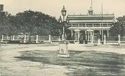 Government House (Maison du gouvernement) in Karaikal | |
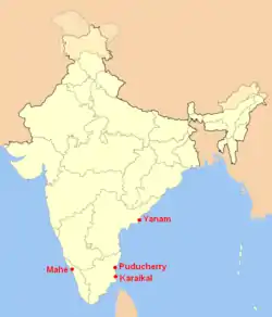 Location of Karaikal District in India along with the other districts of Pondicherry | |
 Karaikal Location of Karaikal in Tamil Nadu, India | |
| Coordinates: 10.932701°N 79.831853°E | |
| Country | India |
| Union territory | Puducherry |
| District | Karaikal |
| Region | Chola Nadu |
| Government | |
| • Type | Municipality |
| • Body | Karaikal Municipality (Conseil Municipal de Karaikal) |
| Languages | |
| • Official | Tamil, French |
| • Additional | English |
| Time zone | UTC+5:30 (IST) |
| PIN | 609602 |
| Telephone code | +91-4368 |
| Vehicle registration | PY 02 |
| Website | www |
Etymology
The origin of the word Karaikal is uncertain. The Imperial Gazetteer of British India gives its meaning as 'fish pass'. Both the words ‘Karai and 'Kal' have several meanings, of which the more acceptable ones are 'lime mix' and 'canal' respectively. Hence it has been suggested that the name may mean a canal built of lime mix, however, no trace of such a canal is evident.
History
Kingdom of Tanjore
Before 1739, Karaikal was under the regime and control of Raja Pratap Singh of Tanjore. In 1738, Pierre Benoît Dumas was anxious to extend the French territory in India by smooth means and negotiated with Sahuji of Thanjavur for possession of Karaikal, the fortress of Karakalcheri and five village for 40,000 chakras. On 14 February 1739 the French took possession of Karaikal town, the fort of Karakalcheri and eight dependent villages. At this point, the King of Thanjavur raised the price for the town of Karaikal and the fort of Karakalcheri to 50,000 chakras. He also demanded a loan of 150,000 chakras without interest repayable in three years against the hypothecation of Mayavaram lands, and an annual rent of 4,000 pagodas for five villages. The French agreed to all the terms except for the payment of 150,000 chakras, which was then reduced to 10,000 chakras, while the annual rental was reduced to two or three thousand chakras. The villages received were Kilaiyur, Melaiyur, Puduthurai, Kovilpathu and Tirumalairayanpattinam. Subsequently, two villages were ceded to the French. Pratap Singh, who succeeded the throne, renewed the demand for a loan of 100,000 chakras, and on receipt of the first instalment of 4,000 chakras he assigned eight more villages to the French viz., Codague (Kondagai), Vanjiyur, Arimullimangalam, Niravi, Dharmapuram, Uzhiapathu, Mattakudi (probably Mathalangudi) and Polagam. On 12 February 1740, he sold these villages for 60,000 chakras, which he had assigned only the previous year for 40,000 chakras.
French colony
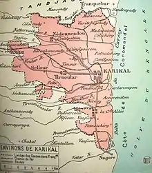
The same year, Dumas pledged Thirunallar Mahanam for 55,350 chakras and also pledged 33 villages for 60,000 chakras. By a treaty signed on 12 January 1750 Pratap Singh ceded to the French 81 villages around Karaikal and cancelled the annual rent of 2,000 pagodas payable for the villages. This was all the territory the French possessed around Thanjavur when they surrendered to the British in 1761. The territory then passed twice to British control before it was finally handed over to the French in 1816/1817 under the Treaty of Paris, 1814.
Independence struggle
The formation of the Karaikal National Congress on 13 June 1947 and the Karaikal Students' Congress on 31 January 1947 symbolised the first concrete expression of popular desire in Karaikal for independence from French India. The French ruled this district until 31 October 1954, on which date the French flag flying atop the government house at Karaikal was lowered with due military honors before a large gathering of officials and non-officials. Thus the de facto transfer of power took place on 1 November 1954 followed by de jure transfer on 16 August 1962.
Part of India
Even though the territory was handed over to the Republic of India on 1 November 1954, Karaikal's municipal administration was continued pursuant to the Arrêté dated 8 March 1880. This was replaced by the promulgation of the Pondicherry Municipality Act, 1973, with effect from 26 January 1974. Mr. Gaudart was the first Mayor of Karaikal in 1884.
Geography
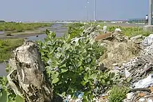
Karaikal is a small coastal enclave which was formerly part of French India. Together with the other former French territories of Pondicherry, Yanam, and Mahé, it forms the Union Territory of Puducherry. Karaikal is bounded on the North and South by Nagapattinam district of Tamil Nadu state, on the west by Tiruvarur district (also belonging to Tamil Nadu), and on the East by the Bay of Bengal. The enclave is located 140 kilometres (87 miles) south of the city of Pondicherry, 158 kilometres (98 miles) east of Trichy and is known for its rich cultural heritage. Karaikal town, about 20 kilometres (12 miles) north of Nagappattinam and 12 kilometres (7.5 miles) south of Tarangambadi, is the regional headquarters.
The main branches of Kaveri below Grand Anicut are the Kodamurutti, Arasalar, Virasolanar and the Vikramanar. Although Arasalar and its branches spread through Karaikal, the waters of Kodamurutti and Virasolanar also meet the irrigation needs of the region.
Forming a part of the fertile Cauvery delta, the region is completely covered by the distributaries of Cauveri. Covered completely by a thick mantle of alluvium of variable thickness, the lie of the region is flat having a gentle slope towards the Bay of Bengal in the east. It is limited on the north by the Nandalar and on the south-east by the Vettar. The group of rocks known as Cuddalore formations is met with in the area contiguous to Karaikal region in Nagappattinam District.
Climate
Köppen-Geiger climate classification system classifies its climate as tropical wet and dry (As).
| Climate data for Karaikal (1981–2010, extremes 1973–2012) | |||||||||||||
|---|---|---|---|---|---|---|---|---|---|---|---|---|---|
| Month | Jan | Feb | Mar | Apr | May | Jun | Jul | Aug | Sep | Oct | Nov | Dec | Year |
| Record high °C (°F) | 32.2 (90.0) |
34.2 (93.6) |
37.2 (99.0) |
40.7 (105.3) |
42.0 (107.6) |
41.6 (106.9) |
39.5 (103.1) |
39.2 (102.6) |
38.0 (100.4) |
36.9 (98.4) |
34.3 (93.7) |
32.7 (90.9) |
42.0 (107.6) |
| Average high °C (°F) | 28.6 (83.5) |
30.1 (86.2) |
31.8 (89.2) |
33.6 (92.5) |
36.1 (97.0) |
36.5 (97.7) |
35.6 (96.1) |
35.0 (95.0) |
33.9 (93.0) |
31.8 (89.2) |
29.4 (84.9) |
28.5 (83.3) |
32.6 (90.7) |
| Average low °C (°F) | 22.3 (72.1) |
22.9 (73.2) |
24.4 (75.9) |
26.5 (79.7) |
27.2 (81.0) |
26.9 (80.4) |
26.3 (79.3) |
25.8 (78.4) |
25.4 (77.7) |
24.9 (76.8) |
23.7 (74.7) |
22.8 (73.0) |
24.9 (76.8) |
| Record low °C (°F) | 18.0 (64.4) |
17.8 (64.0) |
18.4 (65.1) |
20.8 (69.4) |
21.0 (69.8) |
20.8 (69.4) |
21.1 (70.0) |
21.0 (69.8) |
20.8 (69.4) |
20.6 (69.1) |
19.5 (67.1) |
17.8 (64.0) |
17.8 (64.0) |
| Average rainfall mm (inches) | 47.8 (1.88) |
36.5 (1.44) |
24.4 (0.96) |
24.9 (0.98) |
51.2 (2.02) |
51.1 (2.01) |
45.5 (1.79) |
87.6 (3.45) |
104.0 (4.09) |
269.7 (10.62) |
487.5 (19.19) |
233.9 (9.21) |
1,464.3 (57.65) |
| Average rainy days | 2.6 | 1.3 | 0.9 | 1.3 | 2.1 | 2.3 | 2.9 | 5.1 | 5.3 | 10.5 | 13.2 | 8.4 | 55.9 |
| Average relative humidity (%) (at 17:30 IST) | 75 | 72 | 72 | 73 | 72 | 66 | 67 | 70 | 76 | 78 | 81 | 79 | 73 |
| Source: India Meteorological Department[1][2] | |||||||||||||
Governance
The District Collector is the official representative to the Lieutenant Governor and Chief Co-ordinator and Liaison Officer to all Government departments of Karaikal district. District Collectorate, Karaikal is the functional headquarters of Karaikal District.
Karaikal region is made up of Karaikal municipality and the Communes of
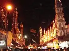
Culture
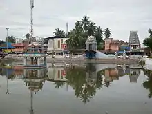
Located 140 kilometres (87 miles) south of the city of Pondicherry, 300 kilometres (190 miles) south of Chennai and 180 kilometres (110 miles) east of Thiruchi, Karaikal is known for its rich religious heritage, and is a destination for those seeking leisure and serenity.
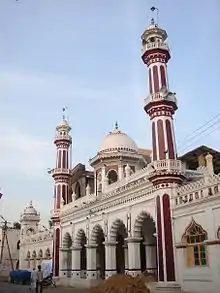
The town is made up of Hindus, Muslims, Christians and people of other religious persuasions. The French flavor still persists in the peaceful land of Karaikal, sometimes called Fremil (a combination of French culture and Tamil culture).
Tamil is the predominant native language of the people. As the area was formerly a French possession, the French language is also found, especially among the elder generation.
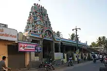
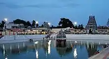
Karaikal is known for the only temple devoted to the Lord Saneeswara at Thirunallar.[3]
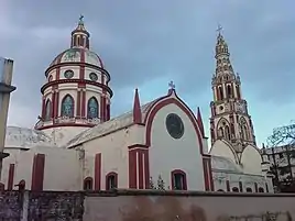
Our Lady of Angels Church is the most prominent church in the town.
In Tirumalairayanpattinam, there is a famous temple called Ayirankaliamman temple, ayiram means 1000. We can see this god once in 5 years, because whatever offerings are given to this god, it should be 1008. So they will open for 3 days once in 5 years, and many devotees from all over Tamil Nadu and Puducherry will come and worship.
Karaikal is the Gateway to various places of worship in the eastern coast of Tamil Nadu. Two famous shrines, Velankanni for Christians and Nagore for Muslims are nearby Karaikal.
Karaikal Ammaiyar
Karaikal Ammaiyar is one of the 63 nayanmar that lived in Karaikal. She is one of the renowned saints, who devoted their life for lord shiva. She was called "ammaiye" means mother by lord shiva. She married Paramathathan, a rich merchant of Nagapattinam in 6th century. Paramathathan sent 2 mangoes to his house for eating in lunch time. A Shaiva devotee came there.Ammaiyaar gave the devotee, curd rice and one of the two mangoes which her husband gave earlier. Later, when Ammaiyar's husband came home, Ammaiyar served him the other mango. The mango was very delicious, and her husband requested that the other mango be served. Ammaiyaar went inside kitchen, and Ammaiyar didn't know what to do since the Mango is already served to the adiyaar[siva's devotee]. With Lord Siva's grace a Divine Mango appeared in her palm. Ammaiyaar was very happy and Ammaiyar served the Mango to her husband.As this fruit was divinely sweet and was infinitely delicious compared to the previous one, her husband inquired as to how Ammaiyar obtained this mango. Since her husband was not a proper devotee, Ammaiyaar was afraid of revealing the God's grace. The rule is that God's grace should not be revealed to non-devotees. But there is one more rule that when a husband is asking something, the wife has to truthfully answer his questions. Subsequently, Ammaiyar worshiped Lord's feet and revealed the truth to her husband. Her husband didn't believe it. He asked her to produce another mango with divine help. Ammaiyar prayed to Lord Shiva for another mango and said to her Lord that if He didn't give her another Mango, his name will get affected. Immediately Lord gave her a similar mango, which she gave it to her husband. The mango then disappeared, and Paramathathan realised the divine nature of his wife. Paramathathan understood that Ammaiyar was worthy of worship and Ammaiyar cannot be treated as his wife. He then deserted Ammaiyar, becoming a trader and married the daughter of a merchant who then gave birth to their child. After knowing this she went to kailash mountain by her head, since she don't want her feet to touch the sacred mountain and by getting a ghost body as a boon from shiva.
Economy
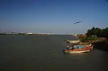
Most of the people in town are office goers and industrial workers. There are a number of iron and steel rolling mills, spinning mills, tiles, polythene, rubber and chemical industries in Karaikal. Other common sources of the people's income come from business. The prominent source of income of this district is agriculture and fishing. Karaikal is a coastal town with a total coastline of 26 kilometres (16 miles). There are 12 big fishing hamlets and around more than 25000 fishermen (6000 families) are living in these coastal villages. Their main employment is fishing, exporting and fishing related activities. The other main source is the liquor business, the tax being less and the cost almost half when compared to the neighbouring state of Tamil Nadu. Karaikal is one of the towns in South India with high cost of living due to French NRI's presence. Thousands of families of origin of Karaikal live in France. The ONGC's office Kaveri rig is at Karaikal.[4]
Transport
Airways
Karaikal Airport is being constructed as a greenfield project. It is the first airport in the country built entirely with private capital. The project received in-principle clearance from the Ministry of Civil Aviation in February 2011. Karaikal Airport's Air Traffic Control, however, will be operated by the Airports Authority of India (AAI). The Airport, spread across 562 acres (227 ha), is being developed by Karaikal Airport Private Limited, a subsidiary of Super Airport Private Limited. The first phase of construction includes construction of a 1200-metre runway and a terminal building capable of handling 120 passengers during peak hours. The airport is expected to handle regional turboprop airliners like the ATR-42. The company plans to expand the airport after five years, extending the runway to 2,600 metres (8,500 feet) and increasing terminal building capacity to 500 passengers per hour. A further expansion is planned ten years down the line with a 3500-metre runway and a passenger capacity of 1,000 per hour.
Seaways
Karaikal port is a new deep sea water port being constructed in Karaikal. More than 600 acres (2.4 km2) of land was leased out to MARG corporation in year 2005 for 30 years and can be renewed for every 10 years thereafter. The port will have a total of nine berths and is constructed for primary transport of coal, textile and cement. The Karaikal port is intended to primarily handle cement and coal to serve the hinterland in Ariyalur, Perambalur and Tiruchi districts. The port is also expected to provide an alternative to the Chennai and Tuticorin ports, which are the major ports in the coastline but are separated by long distance. Further, Karaikal is in the middle of the Tamil Nadu coast, midway between the two deepwater ports of Chennai and Tuticorin.
Roadways
The National Highway NH 32 connects Chennai and Thoothukudi, passes through Karaikal. It is located at the distance 297 km from Chennai, 132 km from Puducherry, 154 km from Tiruchirapalli, 57 km from Kumbakonam and 20 km from Nagapattinam. Karaikal is connected with both National Highways and State Highways. Both Govt. and Private buses available from Karaikal to Bangalore, Chennai, Coimbatore, Tiruchirapalli, Kumbakonam, Mayiladuthurai, Puducherry, Chidambaram.
Railways
Karaikal having rail line connected from Tiruchirapalli via Thanjavur, Tiruvarur, Nagapattinam, and Nagore. Presently Rails are available from Karaikal to Bangalore, Mumbai, Chennai, Ernakulam, Tiruchirapalli, Tanjore, Tiruvarur, Nagapattinam, Nagore, Velanganni and currently Karaikal to Peralam Railway line work is under progress
Education
According to the 2001 Census, Karaikal has literacy rate of 83%. There is a wide network of Educational Institutions right from the Elementary level to Collegiate level in Karaikal region.
Jawaharlal Institute of Postgraduate Medical Education and Research (JIPMER) was established in Karaikal in 2016 with an initial intake of 50 students. The students are selected through entrance exams conducted nationwide.
National Institute of Technology Puducherry was established in Karaikal in 2010. The students are admitted based on Joint Entrance Examination – Main entrance exam score.
Famous Personalities
See also
References
- "Station: Karaikal Climatological Table 1981–2010" (PDF). Climatological Normals 1981–2010. India Meteorological Department. January 2015. pp. 391–392. Archived from the original (PDF) on 5 February 2020. Retrieved 19 March 2020.
- "Extremes of Temperature & Rainfall for Indian Stations (Up to 2012)" (PDF). India Meteorological Department. December 2016. p. M196. Archived from the original (PDF) on 5 February 2020. Retrieved 19 March 2020.
- "Thirunallar Temple Website -". www.thirunallar.org.
- "Archived copy". Archived from the original on 30 September 2011. Retrieved 9 October 2011.CS1 maint: archived copy as title (link)
External links
| Wikimedia Commons has media related to Karaikal. |
- Official website
- www.KaraikalPort.com
| Former |
| ||||||||||||||||||||||||||||||||||||||||
|---|---|---|---|---|---|---|---|---|---|---|---|---|---|---|---|---|---|---|---|---|---|---|---|---|---|---|---|---|---|---|---|---|---|---|---|---|---|---|---|---|---|
| Present |
| ||||||||||||||||||||||||||||||||||||||||