Karawara, Western Australia
Karawara is a suburb of Perth, Western Australia. In 2016 census, the total population was at 2,061.[2]
| Karawara Perth, Western Australia | |||||||||||||||
|---|---|---|---|---|---|---|---|---|---|---|---|---|---|---|---|
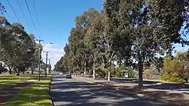 Manning Road, Karawara | |||||||||||||||
 Karawara | |||||||||||||||
| Coordinates | 32.008°S 115.879°E | ||||||||||||||
| Population | 2,061 (2016 census)[1] | ||||||||||||||
| Established | 1973 | ||||||||||||||
| Postcode(s) | 6152 | ||||||||||||||
| LGA(s) | City of South Perth | ||||||||||||||
| State electorate(s) | South Perth | ||||||||||||||
| Federal Division(s) | Swan | ||||||||||||||
| |||||||||||||||
History
Formerly the southern portion of the Collier Pine Plantation, Karawara is an Aboriginal word meaning green. The suburb name was approved in 1973.[3]
Geography
Karawara is located 7 km (4.3 M) south of Perth. The suburb is bounded by the Collier Park Golf Course to the north, Kent Street and Curtin University to the east, Manning Road to the south and the Curtin Primary School (formerly known as Koonawarra Primary School) to the west.
References
- Australian Bureau of Statistics (27 June 2017). "Karawara (State Suburb)". 2016 Census QuickStats. Retrieved 19 April 2018.

- "Population Census".
- Western Australian Land Information Authority. "History of metropolitan suburb names – K". Retrieved 10 October 2008.
This article is issued from Wikipedia. The text is licensed under Creative Commons - Attribution - Sharealike. Additional terms may apply for the media files.
