Kelling
Kelling (also known as Low Kelling and as Lower Kelling)[2] is a village and a civil parish in the English county of Norfolk. The village is 10.1 miles (16.3 km) west of Cromer, 26 miles (42 km) north of Norwich, and 130 miles (210 km) northeast of London. The village straddles the A149 Coast road between Kings Lynn and Great Yarmouth.
| Kelling | |
|---|---|
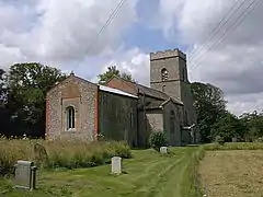 St Marys Kelling Parish Church. | |
 Kelling Location within Norfolk | |
| Area | 8.06 km2 (3.11 sq mi) |
| Population | 177 (parish, 2011 census)[1] |
| • Density | 22/km2 (57/sq mi) |
| OS grid reference | TG094429 |
| • London | 130 miles (210 km) |
| Civil parish |
|
| District | |
| Shire county | |
| Region | |
| Country | England |
| Sovereign state | United Kingdom |
| Post town | HOLT |
| Postcode district | NR25 |
| Dialling code | 01263 |
| Police | Norfolk |
| Fire | Norfolk |
| Ambulance | East of England |
| UK Parliament | |
The nearest railway station is at Sheringham for the Bittern Line which runs between Sheringham, Cromer, and Norwich. The nearest airport is Norwich International Airport. The village lies within the Norfolk Coast AONB (Area of Outstanding Natural Beauty) and the North Norfolk Heritage Coast.
Changes in government policy have discontinued management of coastal erosion in North Norfolk.[3]
Village amenities
Kelling is a small village (pop 177 in 2011), which had a reputation for smuggling.[4] The village has a reading room, which is now a book shop, gallery and tea-room. There is a small Victorian school house built in 1876 and opened October 1877,[5] still in use as a primary school today on the coastal side of the A149 just opposite the reading room. Today it is attended by 90[6] children from the surrounding area. The postal addresses for Kelling are unusual as only 10 of the 37 properties have a number; the rest are known only by the house name[7] the postcode for the village is NR25 7EL.
Around Kelling are Kelling Heath and Muckleburgh Hill, two raised areas of outstanding natural beauty. The heaths contain a network of paths, nature trail and views of the surrounding area. Kelling village is 1 km from the coast which is accessed via a road used as a public path (RUPP). The coastline at Kelling along with Weybourne and Salthouse was of part the strategic defence during the Second World War.
Images
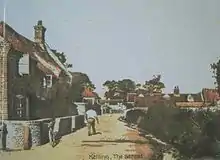
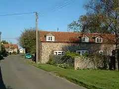 The Street
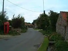 The Street
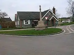 The Old Reading Room
.JPG.webp) The Old Reading Room
The Old Reading Room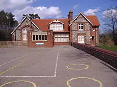 Kelling Village School
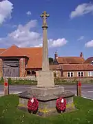 Kelling War Memorial
 Poppies in field near Kelling June 2002
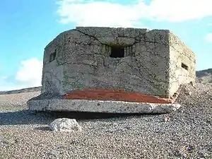 World War II Type 22 Pillbox on the shingle beach at Kelling
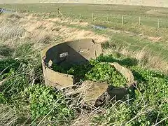 World War II Norcon pillbox on Kelling Hard
| Wikimedia Commons has media related to Kelling. |
See also
References
- "Civil Parish population 2011". Retrieved 1 September 2015.
- GENUKI: Norfolk: Genealogy: Towns and Parishes: Kelling
- Archived October 30, 2007, at the Wayback Machine
- Weybourne, Peaceful mirror of a turbulent past: by Peter Brooks, Published by Poppyland Publishing: Page 16, Smugglers and Volunteers: ISBN 0-946148-05-8
- kelling school 1900
- Kelling Primary School
- "Archived copy". Archived from the original on 30 June 2007. Retrieved 24 November 2007.CS1 maint: archived copy as title (link)
Neighbouring villages
External links
- "WW2 Coastal Defences". Archived from the original on 10 January 2010.
| Authority control |
|
|---|