Broadland
Broadland is a local government district in Norfolk, England, named after the Norfolk Broads. The population of the Local Authority District taken at the 2011 Census was 124,646.[1] Its council is based in Thorpe St Andrew, which is a suburb of the City of Norwich.
Broadland District | |
|---|---|
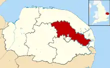 Broadland shown within Norfolk | |
| Sovereign state | United Kingdom |
| Constituent country | England |
| Region | East of England |
| Non-metropolitan county | Norfolk |
| Status | Non-metropolitan district |
| Admin HQ | Thorpe St Andrew |
| Incorporated | 1 April 1974 |
| Government | |
| • Type | Non-metropolitan district council |
| • Body | Broadland District Council |
| • Leadership | Leader & Cabinet (Conservative) |
| • MPs | Jerome Mayhew Chloe Smith |
| Area | |
| • Total | 213.3 sq mi (552.4 km2) |
| Area rank | 82nd (of 317) |
| Population (mid-2019 est.) | |
| • Total | 130,783 |
| • Rank | 172nd (of 317) |
| • Density | 610/sq mi (240/km2) |
| • Ethnicity | 98.8% White |
| Time zone | UTC0 (GMT) |
| • Summer (DST) | UTC+1 (BST) |
| ONS code | 33UC (ONS) E07000144 (GSS) |
| OS grid reference | TG2682109307 |
| Website | www |
In 2013, Broadland was announced as the most peaceful locality within the United Kingdom, having the lowest level of violent crime in the country.[2]
History
The district was formed on 1 April 1974 by the merger of St. Faiths and Aylsham Rural District and part of Blofield and Flegg Rural District.
Politics
The council is currently under Conservative control, as it has been for the majority of its existence, with the exception of two periods of no overall control. The council consists of 47 councillors, elected from 27 wards. After the most recent full council elections held on 2 May 2019, the composition of the council is as follows:
| Broadland District Council Composition as of 2 May 2019 | |||||||||
|---|---|---|---|---|---|---|---|---|---|
| Party | Seats | Swing | |||||||
| Conservatives || 35 | -8 | ||||||||
| Liberal Democrats || 12 | +8 | ||||||||
- UK Youth Parliament
Although the UK Youth Parliament is an apolitical organisation, the elections are run in a way similar to that of the Local Elections. The votes come from 11-18 year olds and are combined to make the decision of the next, 2 year Member of Youth Parliament. The elections are run at different times across the country with Broadland's typically being in early Spring and bi-annually.
Due to the large scale nature of Broadland’s and its bordering with all other districts, the district is represented by all four MYPs for Norfolk for ease and true representation.[3][4][5]
Composition
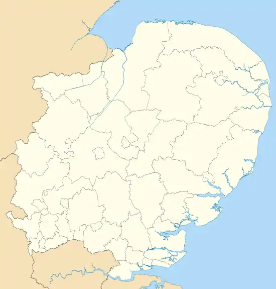
The district is entirely parished, and is made up of 65 civil parishes. At the time of the 2001 census, the district had an area of 546 square kilometres (211 sq mi), with a population of 118,513 in 50,009 households.[6]
The district contains the following civil parishes:
- Acle, Alderford, Attlebridge, Aylsham
- Beeston St. Andrew, Beighton, Belaugh, Blickling, Blofield, Booton, Brampton, Brandiston, Brundall, Burgh and Tuttington, Buxton Lammas, Buxton
- Cantley, Cawston, Coltishall, Crostwick
- Drayton
- Felthorpe, Foulsham, Freethorpe, Frettenham
- Great Plumstead, Great Witchingham, Guestwick
- Hainford, Halvergate, Haveringland, Hellesdon, Hemblington, Hevingham, Heydon, Honingham, Horsford, Horsham St Faith, Horsham St Faith and Newton St Faith, Horstead with Stanninghall
- Lingwood and Burlingham, Little Plumstead, Little Witchingham
- Marsham, Morton on the Hill
- Old Catton, Oulton
- Postwick with Witton
- Rackheath, Reedham, Reepham, Ringland
- Salhouse, Salle, South Walsham, Spixworth, Sprowston, Stratton Strawless, Strumpshaw, Swannington
- Taverham, Themelthorpe, Thorpe St. Andrew
- Upton with Fishley
- Weston Longville, Woodbastwick, Wood Dalling, Wroxham
Climate
Climate in this area has mild differences between highs and lows, and there is adequate rainfall year-round. The Köppen Climate Classification subtype for this climate is "Cfb". (Marine West Coast Climate/Oceanic climate).[7]
| Climate data for Broadland, UK | |||||||||||||
|---|---|---|---|---|---|---|---|---|---|---|---|---|---|
| Month | Jan | Feb | Mar | Apr | May | Jun | Jul | Aug | Sep | Oct | Nov | Dec | Year |
| Average high °C (°F) | 7 (45) |
8 (46) |
10 (50) |
13 (55) |
16 (61) |
19 (66) |
21 (70) |
22 (72) |
19 (66) |
15 (59) |
10 (50) |
7 (44) |
14 (57) |
| Average low °C (°F) | 1 (34) |
1 (34) |
2 (36) |
3 (37) |
6 (43) |
9 (48) |
11 (52) |
11 (52) |
9 (48) |
5 (41) |
2 (36) |
1 (34) |
5 (41) |
| Average precipitation mm (inches) | 48 (1.9) |
43 (1.7) |
43 (1.7) |
43 (1.7) |
41 (1.6) |
61 (2.4) |
53 (2.1) |
61 (2.4) |
64 (2.5) |
69 (2.7) |
74 (2.9) |
66 (2.6) |
670 (26.2) |
| Source: Weatherbase [8] | |||||||||||||
Controversies
A total of £357,000 was paid to two managers leaving Broadland council as a result of the merger of two management teams at Broadland and South Norfolk councils, reported Private Eye in October 2020. (A further £594,000 in termination payments was to be shared between three managers leaving South Norfolk council due to the merger.) The councils reportedly claimed these so-called "golden goodbyes" would actually save money, as they would have fewer highly paid senior officials after they departed.[9]
References
- "Local Authority District population 2011". Neighbourhood Statistics. Office for National Statisticxs. Retrieved 26 July 2016.
- "Archived copy". Archived from the original on 27 April 2013. Retrieved 24 April 2013.CS1 maint: archived copy as title (link)
- "Members of Youth Parliament - Norfolk County Council". www.norfolk.gov.uk.
- "Your Norfolk -". yournorfolk.norfolkpublications.org.uk.
- Cope, Lauren. "Norfolk's four new Members of Youth Parliament are announced". Eastern Daily Press.
- Office for National Statistics & Norfolk County Council (2001). Census population and household counts for unparished urban areas and all parishes. Retrieved 2 December 2005. Archived 11 February 2017 at the Wayback Machine
- Climate Summary
- "Weatherbase.com". Weatherbase. 2013. Archived from the original on 30 June 2013. Retrieved 5 June 2013.
- Private Eye, Issue 1532, p.21
| Boroughs or districts | |
|---|---|
| Major settlements |
|
| Topics | |