Kenli District
Kenli District (simplified Chinese: 垦利区; traditional Chinese: 墾利區; pinyin: Kěnlì Qū) is a district of the city of Dongying, in northern Shandong province. It includes the mouth of the Yellow River.
Kenli
垦利区 | |
|---|---|
 Yellow River mouth | |
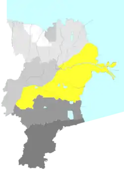 Location in Dongying | |
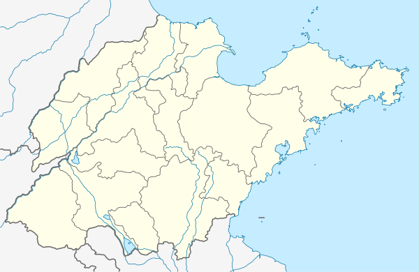 Kenli Location in Shandong | |
| Coordinates: 37°34′19″N 118°34′30″E | |
| Country | People's Republic of China |
| Province | Shandong |
| Prefecture-level city | Dongying |
| Area | |
| • Total | 2,331 km2 (900 sq mi) |
| Elevation | 7.6 m (25 ft) |
| Population (2019) | |
| • Total | 238,900[1] |
| Time zone | UTC+8 (China Standard) |
| Postal code | 257500 |
| Website | www |
The population in 1999 was 211,444.[2]
Administrative divisions
As 2017, this district is divided to 2 subdistricts and 5 towns.[3]
- Subdistricts
- Kenli Subdistrict (垦利街道)
- Xinglong Subdistrict (兴隆街道)
- Towns
|
|
References
- "China : Population - ceicdata.com". ceicdata. Retrieved 2021-01-05.
- National Population Statistics Materials by County and City - 1999 Period, in China County & City Population 1999, Harvard China Historical GIS
- 2017年统计用区划代码和城乡划分代码:垦利区 (in Chinese). National Bureau of Statistics of the People's Republic of China. 2017. Retrieved 2018-11-16.
统计用区划代码 名称 370505001000 垦利街道办事处 370505002000 兴隆街道办事处 370505101000 胜坨镇 370505102000 郝家镇 370505104000 永安镇 370505105000 黄河口镇 370505106000 董集镇 370505400000 开发区类似乡级单位 370505402000 红光类似乡级单位 370505403000 垦东类似乡级单位 370505404000 东营市现代畜牧业示范区类似乡级单位
| Authority control |
|---|
This article is issued from Wikipedia. The text is licensed under Creative Commons - Attribution - Sharealike. Additional terms may apply for the media files.