Kentucky Route 130
Kentucky Route 130 (KY 130) is a 17.013-mile (27.380 km) state highway in Union County, Kentucky, United States, that travels from KY 109 and KY 1257 northwest of Sturgis to the Uniontown Ferry on the Ohio River in Uniontown via Morganfield.
| ||||
|---|---|---|---|---|
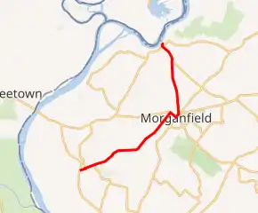
KY 130 highlighted in red | ||||
| Route information | ||||
| Maintained by KYTC | ||||
| Length | 20.986 mi[1] (33.774 km) | |||
| Major junctions | ||||
| South end | ||||
| North end | Uniontown Ferry in Uniontown | |||
| Location | ||||
| Counties | Union | |||
| Highway system | ||||
| ||||

Major intersections
The entire route is in Union County.
| Location | mi[1] | km | Destinations | Notes | |
|---|---|---|---|---|---|
| | 0.000 | 0.000 | Southern terminus; continues as KY 1257 | ||
| | 0.550 | 0.885 | Southern terminus of KY 2834 | ||
| | 1.308 | 2.105 | Western terminus of KY 270 | ||
| | 3.218 | 5.179 | Northern terminus of KY 2101 | ||
| | 8.743 | 14.070 | |||
| Morganfield | 9.584 | 15.424 | South end of KY 56 overlap | ||
| 10.244 | 16.486 | North end of KY 56 overlap; south end of US 60 overlap | |||
| 10.581 | 17.028 | North end of US 60 overlap | |||
| | 13.522 | 21.762 | Northern terminus of KY 948 | ||
| | 13.670 | 22.000 | Eastern terminus of KY 666 | ||
| | 15.077 | 24.264 | Northern terminus of KY 141 | ||
| Uniontown | 16.654 | 26.802 | |||
| 17.013 | 27.380 | Uniontown Ferry | Northern terminus | ||
1.000 mi = 1.609 km; 1.000 km = 0.621 mi
| |||||
See also
- List of state highways in Kentucky
References
- "Official DMI Route Log". Kentucky Transportation Cabinet. Retrieved April 5, 2015.
This article is issued from Wikipedia. The text is licensed under Creative Commons - Attribution - Sharealike. Additional terms may apply for the media files.