Kentucky Route 56
Kentucky Route 56 (KY 56) is a 61.503-mile-long (98.979 km) state highway in Kentucky that runs from Illinois Route 13 (IL 13) near Old Shawneetown, Illinois, on the Shawneetown Bridge at the Kentucky-Illinois state line to KY 81 near Owensboro via Morgantown and Sebree.
| ||||
|---|---|---|---|---|
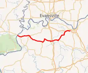
KY 56 highlighted in red | ||||
| Route information | ||||
| Maintained by KYTC | ||||
| Length | 61.503 mi[1] (98.979 km) | |||
| Major junctions | ||||
| West end | ||||
| ||||
| East end | ||||
| Location | ||||
| Counties | Union, Webster, McLean, Daviess | |||
| Highway system | ||||
| ||||

Major intersections
| County | Location | mi | km | Destinations | Notes |
|---|---|---|---|---|---|
| Ohio River | 0.000 | 0.000 | Continuation into Illinois | ||
| 0.020– 0.630 | 0.032– 1.014 | Shawneetown Bridge | |||
| Union | | 0.870 | 1.400 | ||
| | 2.723 | 4.382 | Northern terminus of KY 109 | ||
| | 5.396 | 8.684 | Northern terminus of KY 2834 | ||
| Spring Grove | 6.608 | 10.635 | Southern terminus of KY 1598 | ||
| | 7.812 | 12.572 | Western terminus of KY 360 | ||
| | 11.119 | 17.894 | Southern terminus of KY 1594 | ||
| | 11.500 | 18.507 | Morganfield bypass; western terminus of KY 56 truck route | ||
| Morganfield | 12.308 | 19.808 | Eastern terminus of KY 947 | ||
| 12.415 | 19.980 | Western end of KY 130 overlap | |||
| 13.075 | 21.042 | Eastern end of KY 130 overlap; 130 turns north to follow 60 East | |||
| | 14.011 | 22.549 | Eastern terminus of KY 56 truck route; bridge to the west | ||
| | 15.810 | 25.444 | Southern terminus of KY 2091 | ||
| | 15.974 | 25.708 | Northern terminus of KY 758 | ||
| Boxville | 19.637 | 31.603 | |||
| | 20.326 | 32.712 | Northern terminus of KY 983 | ||
| Webster | | 28.506 | 45.876 | Southern end of US 41 Alt. concurrency | |
| | 30.010 | 48.296 | Northern terminus of KY 2839 | ||
| Poole | 32.435 | 52.199 | Northern end of US 41 Alt. concurrency; southern terminus of KY 145 | ||
| | 36.354 | 58.506 | |||
| Sebree | 39.373 | 63.365 | Eastern terminus of KY 139 | ||
| 39.583 | 63.703 | Southern end of US 41 concurrency; northern terminus of KY 359 | |||
| 39.798 | 64.049 | Northern end of US 41 concurrency | |||
| | 41.360– 41.644 | 66.562– 67.020 | I-69 exit 134 | ||
| | 41.933– 41.999 | 67.485– 67.591 | Corporal James B. Grisham Commemorative bridge over Green River | ||
| McLean | Beech Grove | 47.328 | 76.167 | Western terminus of KY 256 | |
| 47.515 | 76.468 | Western terminus of KY 136 | |||
| | 48.164 | 77.512 | Southern terminus of KY 1233 | ||
| | 49.021 | 78.892 | Western terminus of KY 258 | ||
| Elba | 50.872 | 81.871 | |||
| Daviess | | 54.204 | 87.233 | Eastern terminus of KY 258 | |
| Saint Joseph | 54.565 | 87.814 | Southern terminus of KY 500 | ||
| | 56.619 | 91.119 | Western terminus of KY 815 | ||
| | 59.612 | 95.936 | Eastern terminus of KY 456 | ||
| Sorgho | 61.586 | 99.113 | Southern terminus of KY 1554 | ||
| | 62.415 | 100.447 | Western end of KY 259 overlap | ||
| | 63.422 | 102.068 | Eastern end of KY 259 overlap | ||
| | 65.647 | 105.649 | Eastern terminus of KY 56; roundabout | ||
1.000 mi = 1.609 km; 1.000 km = 0.621 mi
| |||||
References
- Staff. "Official DMI Route Log". Kentucky Transportation Cabinet. Retrieved June 23, 2014.
This article is issued from Wikipedia. The text is licensed under Creative Commons - Attribution - Sharealike. Additional terms may apply for the media files.