Khatlon Region
Khatlon Region (Tajik: Вилояти Хатлон, Viloyati Xatlon), one of the four provinces of Tajikistan (Tajik: вилоят, Viloyat) is the most populous of the four first level administrative regions. It is situated in the southwest of the country, between the Hisor (Gissar) Range in the north and the river Panj in the south and borders on Afghanistan in the southeast and on Uzbekistan in the west. During Soviet times, Khatlon was divided into Kurgan-Tyube (Qurghonteppa) Oblast (Western Khatlon) – with the Kofarnihon and Vakhsh river valleys – and Kulob Oblast (Eastern Khatlon) – with the Kyzylsu and Yakhsu river valleys. Both regions were merged in November 1992 into today's Khatlon Region (or viloyat). The capital city is Qurghonteppa, formerly known as Kurgan-Tyube.[2]
Khatlon
Вилояти Хатлон | |
|---|---|
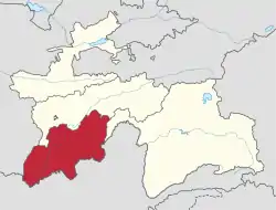 Khatlon in Tajikistan | |
| Coordinates: 37°50′N 69°00′E | |
| Country | |
| Capital | Qurghonteppa (Bokhtar) |
| Area | |
| • Total | 24,700 km2 (9,500 sq mi) |
| Population (2020) | |
| • Total | 3,348,300 |
| • Density | 140/km2 (350/sq mi) |
| ISO 3166 code | TJ-KT |
| HDI (2017) | 0.622[1] medium |
Khatlon has an area of 24,700 square kilometres and consists of 21 districts and 4 district-level cities. The total population of Khatlon in 2020 was 3,348,300,[3] up from 2,677,251 in the 2010 population census. The population in Khatlon is mainly engaged in agriculture.
History
During the Soviet era, Khatlon became one of the two main cotton regions in Tajikistan, along with Sughd (Leninabad). Collectivisation of agriculture was implemented aggressively in the early 1930s, to expand cotton cultivation in Tajikistan as a whole, with particular emphasis on the southern part of the republic. The process included violations against peasants, substantial expansion of the irrigation network, and forcible resettlement of mountain peoples and people from Uzbekistan to the lowlands.[4]
The results of this policy are to be seen in the ethnic composition of Salua oblast as well as in the fact that the Tajik population identifies themselves either as Gharmis (resettled from the mountains) or Kulobis. These groups never melted, and fought against each other during the Civil War in Tajikistan. Khatlon oblast suffered the heaviest damage in Tajikistan.
Since the conflicts leading to the civil war were never really resolved, tensions in the region still exist. The eastern part – Kulob – is home to the president and his clan and has thus gained a lot of political influence. During Soviet times, the region cooperated with the then ruling elite from Leninabad, and was responsible for the militia, the army and the security forces. Kulob is regarded as a very conservative region. In the capital Qurghonteppa and parts of Kulob, the Islamic opposition has a lot of support among the Garmis.[5]
The Kulyab clan is based in Khatlon.[6] In February 1996 Colonel Mahmud Khudoiberdiyev launched a rebellion, insisting that three officials from the Kulyab clan resign before he ended the rebellion. The government complied. Additionally, Prime Minister Dzhamshed Karimov and Abudzhalil Khamidov, the Chairman of the Leninabad Oblast executive committee, resigned.[7]
Administrative divisions
The Khatlon Region is subdivided into 21 districts and 4 district-level cities: Kulob, Levakant, Norak and Qurghonteppa. The districts are:[3]
- Baljuvon District
- Danghara District
- Dusti District (Jilikul District)
- Farkhor District
- Hamadoni District (Moskovskiy District)
- Jaloliddin Balkhi District (Kolkhozobod District, Rumi District)
- Jayhun District (Qumsangir District)
- Jomi District
- Khovaling District
- Khuroson District (Ghozimalik District)
- Kulob District
- Kushoniyon District (Bokhtar District)
- Mu'minobod District
- Norak District
- Nosiri Khusrav District (Beshkent District)
- Panj District
- Qabodiyon District
- Sarband District
- Shahrtuz District
- Shamsiddin Shohin District (Shuro-obod District)
- Temurmalik District (Qizil-Mazor District, Sovetskiy District)
- Vakhsh District
- Vose' District
- Yovon District
Demography
In 2010, the ethnic composition of the Khatlon region was 81.8% Tajik, 12.9% Uzbek, 0.5% Turkmen and 4.6% other.[8] The ethnic composition of Kulob region is: 85% Tajiks, 13% Uzbeks, 2% others. In Qurghonteppa the breakdown is 59% Tajiks, 32% Uzbeks and three percent Russian.
Terrorist attack
On 29 July 2018, four cyclists, two Americans, one Dutch national and one Swiss national, were killed by a hit and run driver while three others were injured. Officials said the terrorists rammed into the group before getting out and attacking them with knives. 4 suspects were killed by security forces and 1 suspect was arrested.[9][10][11]
References
- "Sub-national HDI - Area Database - Global Data Lab". hdi.globaldatalab.org. Retrieved 2018-09-13.
- Borjian, H., “Khatlon”, Encyclopaedia Iranica. Volume 16, Issue 4, 2018, pp. 437-439.
- "Population of the Republic of Tajikistan as of 1 January 2020" (PDF) (in Russian). Statistics office of Tajikistan. Retrieved 12 October 2020.
- Muriel Atkin. Tajikistan in: Glenn E. Curtis (ed.): Kazakhstan, Kyrgyzstan, Tajikistan, Turkmenistan, and Uzbekistan, Country Studies, Washington: 1997. pp. 197–290.
- Borjian, Habib, Kurgan Tepe, Encyclopaedia Iranica Online
- Ethnic groups at risk: The status of Tajiks Heritage Society
- Tajikistan: Central Asian Powderkeg Archived 2007-09-30 at the Wayback Machine The Jamestown Foundation
- "CensusInfo - Data". www.censusinfo.tj. Retrieved 2019-09-09.
- US cyclists killed in ISIS-claimed attack in Tajikistan identified
Places adjacent to Khatlon Region | |
|---|---|
