Khenchela Province
Khenchela Province (Arabic: ولاية خنشلة) is a province (wilaya) in the Aures region in Algeria.
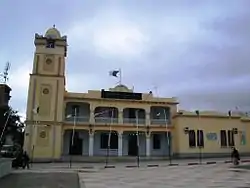
Khenchela Province
ولاية خنشلة | |
|---|---|
 | |
| Nickname(s): Hansala | |
.svg.png.webp) | |
| Coordinates: 35.434°N 7.147°E | |
| Country | |
| Capital | Khenchela |
| Area | |
| • Total | 9,811 km2 (3,788 sq mi) |
| Population (2008)[1] | |
| • Total | 384,268 |
| • Density | 39/km2 (100/sq mi) |
| Time zone | UTC+01 (CET) |
| Area Code | +213 (0) 032 |
| ISO 3166 code | DZ-40 |
| Districts | 8 |
| Municipalities | 21 |
History
The province was created from parts of Oum el Bouaghi Province and Tébessa Province in 1984.
Administrative division
The province is divided into 8 districts, which are further divided into 21 communes or municipalities.
Districts
- Khenchela, as a district and capital Khenchela
- Aïn Touila, located 20 kilometres (12 mi) northeast of the capital
- Babar, located 30 kilometres (19 mi) south of the capital
- Bouhmama, located 35 kilometres (22 mi) west of the capital
- Chechar, located 50 kilometres (31 mi) south of the capital
- El Hamma, located 7 kilometres (4.3 mi) west of the capital
- Kaïs, located 22 kilometres (14 mi) west of the capital
- Ouled Rechache, located 22 kilometres (14 mi) east of the capital
References
| Wikimedia Commons has media related to Khenchela Province. |
- Office National des Statistiques, Recensement General de la Population et de l’Habitat 2008 Archived 2008-07-24 at the Wayback Machine Preliminary results of the 2008 population census. Accessed on 2008-07-02.
Capital: Khenchela | ||
| Khenchela District | | |
| Kaïs District | ||
| Aïn Touila District | ||
| El Hamma District | ||
| Bouhmama District | ||
| Chechar District | ||
| Ouled Rechache District | ||
| Babar District | ||
| Flag of Algeria | |
This article is issued from Wikipedia. The text is licensed under Creative Commons - Attribution - Sharealike. Additional terms may apply for the media files.
