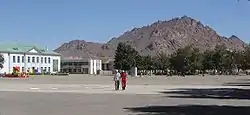
Khovd (city)
Khovd or Hovd (Mongolian: Ховд), formerly known as Kobdo[1] or Khobdo, is the capital of the Khovd Province of Mongolia. It is officially known as Jargalant sum.
Khovd
Ховд ᠬᠣᠪᠳᠤ | |
|---|---|
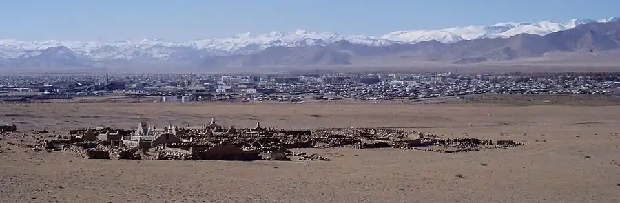
 The city of Khovd | |
 Khovd | |
| Coordinates: 48°00′15″N 91°38′26″E | |
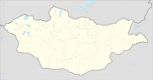
| Country | Mongolia |
| Province | Khovd Province |
| Founded | 1731 |
| Area | |
| • Total | 70.0 km2 (27.0 sq mi) |
| Elevation | 1,395 m (4,577 ft) |
| Population (2017) | |
| • Total | 29,800 |
| • Density | 430/km2 (1,100/sq mi) |
| Time zone | UTC+7 |
| Area code(s) | +976 (0)143 |
| Climate | BWk |
| Website | http://khovd.gov.mn/ |
Geography and climate
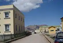
It is situated at the foot of the Mongol Altay Mountains, on the Buyant River. The Khar-Us Lake is located approximately 25 km east of Khovd and is the location of a Strictly Protected Area (Mongolian Government designation), called the Mankhan Nature Preserve.
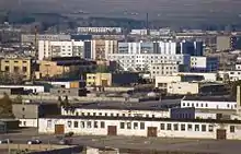
As a result of administrative reforms in 1992, Khovd was accorded the status of Jargalant sum. City area is 80 km2.
Khovd has a cold desert climate (Köppen climate classification BWk) with long, dry, frigid winters and short warm summers. Precipitation is minimal and very heavily concentrated in summer.
| Climate data for Khovd | |||||||||||||
|---|---|---|---|---|---|---|---|---|---|---|---|---|---|
| Month | Jan | Feb | Mar | Apr | May | Jun | Jul | Aug | Sep | Oct | Nov | Dec | Year |
| Record high °C (°F) | 8.7 (47.7) |
13.6 (56.5) |
21.7 (71.1) |
30.7 (87.3) |
32.0 (89.6) |
34.2 (93.6) |
33.4 (92.1) |
35.6 (96.1) |
30.0 (86.0) |
24.7 (76.5) |
14.4 (57.9) |
13.3 (55.9) |
35.6 (96.1) |
| Average high °C (°F) | −16.3 (2.7) |
−12 (10) |
0.3 (32.5) |
11.1 (52.0) |
19.1 (66.4) |
23.8 (74.8) |
24.7 (76.5) |
23.4 (74.1) |
17.7 (63.9) |
9.0 (48.2) |
−2.3 (27.9) |
−12.9 (8.8) |
7.1 (44.8) |
| Daily mean °C (°F) | −24.3 (−11.7) |
−20.2 (−4.4) |
−7.4 (18.7) |
3.9 (39.0) |
11.9 (53.4) |
17.1 (62.8) |
18.6 (65.5) |
16.7 (62.1) |
10.6 (51.1) |
1.5 (34.7) |
−9.7 (14.5) |
−20 (−4) |
−0.1 (31.8) |
| Average low °C (°F) | −29.9 (−21.8) |
−27.1 (−16.8) |
−14.7 (5.5) |
−3.5 (25.7) |
4.6 (40.3) |
10.3 (50.5) |
12.3 (54.1) |
10.0 (50.0) |
3.9 (39.0) |
−4.7 (23.5) |
−15.7 (3.7) |
−25.6 (−14.1) |
−6.7 (19.9) |
| Record low °C (°F) | −46.6 (−51.9) |
−44.6 (−48.3) |
−31.7 (−25.1) |
−19.7 (−3.5) |
−8.6 (16.5) |
−6.4 (20.5) |
1.5 (34.7) |
−0.9 (30.4) |
−13.9 (7.0) |
−25.3 (−13.5) |
−35.2 (−31.4) |
−40.4 (−40.7) |
−46.6 (−51.9) |
| Average precipitation mm (inches) | 1.4 (0.06) |
0.9 (0.04) |
2.3 (0.09) |
5.9 (0.23) |
9.5 (0.37) |
26.5 (1.04) |
35.0 (1.38) |
22.7 (0.89) |
10.6 (0.42) |
4.6 (0.18) |
1.8 (0.07) |
1.6 (0.06) |
122.8 (4.83) |
| Average precipitation days (≥ 1.0 mm) | 0.3 | 0.2 | 0.6 | 1.4 | 2.4 | 3.9 | 6.2 | 4.0 | 1.9 | 0.8 | 0.4 | 0.5 | 22.6 |
| Mean monthly sunshine hours | 171.6 | 196.3 | 255.2 | 266.8 | 300.4 | 300.1 | 302.1 | 298.0 | 269.7 | 230.9 | 180.3 | 151.0 | 2,922.4 |
| Source: NOAA (1961-1990) [2] | |||||||||||||
History
The city was established by Galdan Boshogtu Khan of Dzungaria in the 17th century on the bank of the river Khovd in what is now Erdenebüren sum. Horticulture was developed around city Khovd using the land cultivating experience from Taranchi and Central Asian captives. The city was 'moved' by the Qing administration after destruction of the Dzungar Khanate after 1757 on to the bank of the river Buyant. On 7 August 1912, the Mongol troops under leadership of Manlai Baatur Damdinsuren, Khatanbaatar Magsarjav and Ja Lama Dambiijantsan captured the city of Khovd, destroyed all the Manchu-Chinese garrisons and abolished the governance of the Qing-appointed amban.
Population
The city had a population of 26,023 in 2000 (2000 census), 30,479 in 2003 (2003, est.) and 28,601 in 2007 (2007).[3]
In 2005, Jargalant sum (the centre of Khovd Aimag) had 32,351 inhabitants (6,675 households), belonging to more than ten ethnic groups and nationalities such as Uuld, Khalkh, Zakhchin, Torguud, Uriankhai, Myangad, Dörbet, Bayads, Kazak, Chantuu and Üzemchin.[4]
See also
References
- Chisholm, Hugh, ed. (1911). . Encyclopædia Britannica. 15 (11th ed.). Cambridge University Press. p. 884.
- "Khovd Climate Normals 1973-1990". National Oceanic and Atmospheric Administration. Retrieved January 13, 2013.
- Khovd Aimag Statistical Office 2007 Annual Report
- Dr Jörg Janzen (2006). "Feasibility Assessment of Sustainable Use of Land and Water in the Buyant River Delta, Khovd Aimag" (PDF). National University of Mongolia. p. 138. Archived from the original (PDF) on 22 August 2007.
| Wikivoyage has a travel guide for Hovd. |