Kilmacanogue
Kilmacanogue (Irish: Cill Mocheanóg, meaning "Mocheanóg's church")[2] is a small village in north County Wicklow, Ireland.
Kilmacanogue
Cill Mocheanóg | |
|---|---|
Village | |
 Kilmacanogue | |
 Kilmacanogue Location in Ireland | |
| Coordinates: 53°10′05″N 6°08′17″W | |
| Country | Ireland |
| Province | Leinster |
| County | County Wicklow |
| Elevation | 80 m (260 ft) |
| Population (2011)[1] | |
| • Urban | 1,028 |
| Irish Grid Reference | O243148 |
| Kilmacanoge is the official spelling.[2] | |
Location and transport
The village lies on the junction of the R755 to Roundwood and the N11, 5 km (3.1 mi) southeast of Bray town centre. It lies between the Little Sugar Loaf to the east and the Big Sugar Loaf to the west in the northeastern foothills of the Wicklow Mountains, near the Glen of the Downs.
Two small streams join in Kilmacanogue, behind the old Post Office (Donnelly's), to form the Kilmacanogue River,[3] which flows into the River Dargle near the old "Silver Bridge" at Kilbride approximately two miles to the north, just downstream of the confluence with the Cookstown River. These watercourses once held a good population of trout but increasing urbanisation led to a deterioration in water quality.
Kilmacanogue is served by the half-hourly 45A/B to Dún Laoghaire and Bray bus route operated by Go-Ahead Ireland. Until 2014 it was served by high-frequency Dublin Bus route 145 to Heuston Station; however, this was cut short to terminate in Ballywaltrim and the 45A was extended to serve Kilmacanogue. Only a handful of 145 journeys still continue to Kilmacanogue. It is also served by Bus Éireann route 133.
History
The village is named after Saint Mocheanog, a companion of Saint Patrick, who, according to Irish legend, baptised the children of Lir just before their death.
On the morning of 1 January 1942 the Luftwaffe dropped two magnetic mines near Kilmacanogue but they did not explode.[4]
Amenities
The village has two petrol stations, a primary school, a restaurant, a small shop, a post office, a church and a pub. The "Pub" (Public House), variously called "Connolly's", "Sweeney's", The Glencormac Inn and most lately "Plucks" is a very old coaching house dating back to the 19th century. It was a place where teams of horses were changed and stabled on the old road to Wicklow and further south. Charles Stewart Parnell was a frequent passenger on his way down to his family house in Avondale – hence his moniker "The Blackbird of Avondale" – a ballad sung in his memory. It was not until 1861 that the railway was opened as far as Rathdrum hence the need to travel by coach up to that time.
Business
Avoca Handweavers have one of their earliest outlets at the northern end of the village. This outlet is situated on the site of Glencormac House, which was completed in 1860 by the Jameson Whiskey family, who were originally from Scotland. The house became a hotel (Grade A, a precursor to five-star rated hotels) in the 1950s but was razed to the ground in a fire that occurred in 1967; no lives were lost in the fire.
Clubs and organisations
Kilmacanogue is home to the Kilmacanogue GAA Club, a branch of the Cubs and the Scouts, Kilmac Drama, karate, Kilmacanogue History Society and Glencormac United.
References
- "Kilacanogue Legal Town Results". Central Statistics Office. 2011.
- Placenames Database of Ireland
- "Kilmacanogue Settlement Plan, 2010-2016" (PDF). Wicklow County Council. Retrieved 27 May 2019.
- O'Reilly, Michael (December 2001). "Luftwaffe magnetic mines land near Kilmacanogue". Ireland's Eye.
Places in County Wicklow | ||
|---|---|---|
| Towns | 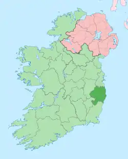 | |
| Villages |
| |
| ||