Shillelagh, County Wicklow
Shillelagh (Irish: Síol Éalaigh) is a village in County Wicklow, Ireland. It is located in the south of the county, on the R725 regional road from Carlow to Gorey. The River Derry, a tributary of the River Slaney, flows through the village, while the Wicklow Way passes to the north and west.
Shillelagh
Síol Éalaigh | |
|---|---|
Village | |
 Shillelagh Courthouse | |
 Shillelagh Location in Ireland | |
| Coordinates: 52.755°N 6.536°W | |
| Country | Ireland |
| Province | Leinster |
| County | County Wicklow |
| Elevation | 65 m (213 ft) |
| Population (2016)[1] | |
| • Total | 337 |
| Irish Grid Reference | S986681 |
The village was planned as part of the FitzWilliam estate in the 17th century. In 2016, it had a population of 337.[1]
Sport
Shillelagh has a Gaelic Athletic Association team and a soccer team. The team colours are sky blue and navy. Coollattin Golf Club, an 18-hole parkland course, is located just east of the village.
Transport
Shillelagh railway station opened on 22 May 1865, at the end of a branch from Woodenbridge via Aughrim and Tinahely. It closed to passengers and goods traffic on 24 April 1944, and altogether on 20 April 1945.[2] The station building was subsequently converted to a private residence.[3]
References
- "Census 2016 Sapmap Area: Settlements Coolboy". Central Statistics Office. Retrieved 29 March 2018.
- Ayres, Bob (2003). "Irish Railway Stations" (PDF). Railscot. Retrieved 24 November 2007.
- "Shillelagh Railway Station, Shillelagh, County Wicklow". National Inventory of Architectural Heritage. Retrieved 3 October 2016.
External links
- A Wee Look at the History of County Wicklow Information about the FitzWilliam Estate.
- Shillelagh at Wicklow Tourism
- Shillelagh GAA information at Wicklow GAA
Places in County Wicklow | ||
|---|---|---|
| Towns | 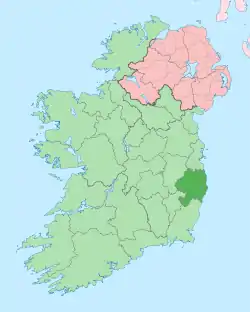 | |
| Villages |
| |
| ||