Rathdangan
Rathdangan (Irish: Ráth an Daingin[2], meaning "Ringfort of the Stronghold") is a village in County Wicklow, Ireland. It is in the Electoral Division of Rathdangan, in Civil Parish of Kiltegan, in the Barony of Upper Talbotstown.[3]
Rathdangan
Ráth Daingin | |
|---|---|
Village | |
 Rathdangan village | |
 Rathdangan Location in Ireland | |
| Coordinates: 52°55′N 6°33′W | |
| Country | Ireland |
| Province | Leinster |
| County | County Wicklow |
| Area | |
| • Total | 52 km2 (20 sq mi) |
| Population (2006) | |
| • Total | 543[1] |
| Time zone | UTC+0 (WET) |
| • Summer (DST) | UTC-1 (IST (WEST)) |
Toponymy
In Liam Price's extensive survey of place names County Wicklow he recorded that in the Down Survey, dated 1655-9, the name is first noted as Radangin, but the 1660 the Books of Survey and Distribution now uses the spelling Radanginge. A few years later, in 1668, Rathdangin is stated in the Hearth Money Roll of County Wicklow, followed by Radangin in the 1685 Hiberniæ Delineatio. Finally the current village name is shown in A.R. Neville's Map of County Wicklow from circa 1810.[4]
Geography
Rathdangan is at an elevation of 207m.[5] and is located on the road from Aughrim to Baltinglass joining the east and west of County Wicklow. To the north the terrain rises up to the summit of Lugnaquilla, the highest mountain in Leinster. The village has experienced severe weather with heavy snowfall, cutting off the village for days, during the winters of 1947, 1963 and 1982.[6]
Places of interest
Rathdangan once had two pubs, two shops and a post office. Only one pub now remains, and while known by locals as Junior's[7] the name over the door is Byrne's, per the family name. A community shop operates most mornings, in the parish hall "The Village Pantry".[8] An amenity park and playground was opened in July 2018.[9]
Tober Owen Well
A holy well, Tober Owen, or St. John's Well, is a short distance from the village on the left side of the road leading to the Glen of Imaal. A festival used to take place on the saint's day, June 24. An ancient tree used to grow over the well and a man called Moore was eventually hanged on the tree, having been on the run for quite some time, for murdering Hume of Humewood who hunted rebels of the 1798 rebellion. The tale goes that nothing grew upon the limb on which Moore was hanged and when the tree was blown down in a storm, it was used as firewood by some locals but those pieces of the branch used to hang Moore exploded and scattered all around the place.[10] A memorial to Moore was erected beside the well.[6]
Kilamote Church

The local church in Kilamote is about 1 km from the village and houses several windows by the stained-glass artist Harry Clarke.[11]
References
- "Rathdangan Community Council, Co. Wicklow". Muintir na Tire. 2020. Retrieved 8 December 2020.
- Gasaitéar na hÉireann/Gazetteer of Ireland. Dublin: Ordnance Survey of Ireland. 1989. p. 149. ISBN 0-7076-0076-6.
- "Rathdangan Townland, Co. Wicklow". Townlands.ie. 7 September 2020. Retrieved 26 November 2020.
- Price, Liam (1949). The Place-names of Co. Wicklow: The Barony of Ballinacor South, Volume 3. Dublin: Dublin Institute for Advanced Studies. p. 113. ISBN 0901282359.
- "Elevation of Rathdangan, Kiltegan, Co. Wicklow, Ireland". Worldwide Elevation Map Finder. 2020. Retrieved 6 December 2020.
- "Points of Interest in Rathdangan". Wicklow Uplands Council. 2020. Retrieved 6 December 2020.
- "Junior's Bar Rathdangan". www.facebook.com. Retrieved 17 December 2017.
- Buchanan, Myles (28 April 2015). "Tearoom brings community together". Bray People. Retrieved 26 November 2020.
- "Excitement as new Rathdangan play park opened". Wicklow People. 21 July 2018. Retrieved 8 December 2020.
- O'Toole, Edward (1933). "The Holy Wells of County Carlow". Béaloideas. Dublin: An Cumann Le Béaloideas Éireann/Folklore of Ireland Society. 4 (2): 122–124. ISSN 0332-270X. JSTOR 20521779=. Retrieved 5 December 2020.
- "Saint Mary's Catholic Church, Killamoat Lower, Rathdangan, County Wicklow". National Inventory of Architectural Heritage. Department of Housing, Local Government and Heritage. 12 August 2003. Retrieved 26 November 2020.
- Frank, Harald; Stange, Klaus (29 September 1990). Irish Post Offices and their postmarks 1600-1990. Munich: Forchumgs- und Arbeitsgemeinschaft Irland e.V. p. 298.
External links
- dúchas.ie 1938 Schools report about St. John Well
- PURE Mile 2011 Heritage updates related to Rathdangan
- The Murder of Mr Hume of Humewood (details of Moore hanging pg 30–38)
- A Village with Vision YouTube video
- Historical Videos - YouTube video
Places in County Wicklow | ||
|---|---|---|
| Towns | 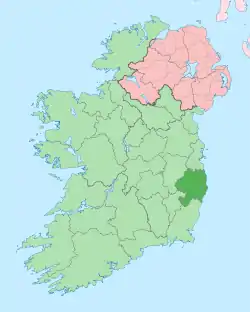 | |
| Villages |
| |
| ||