Kimbolton, Cambridgeshire
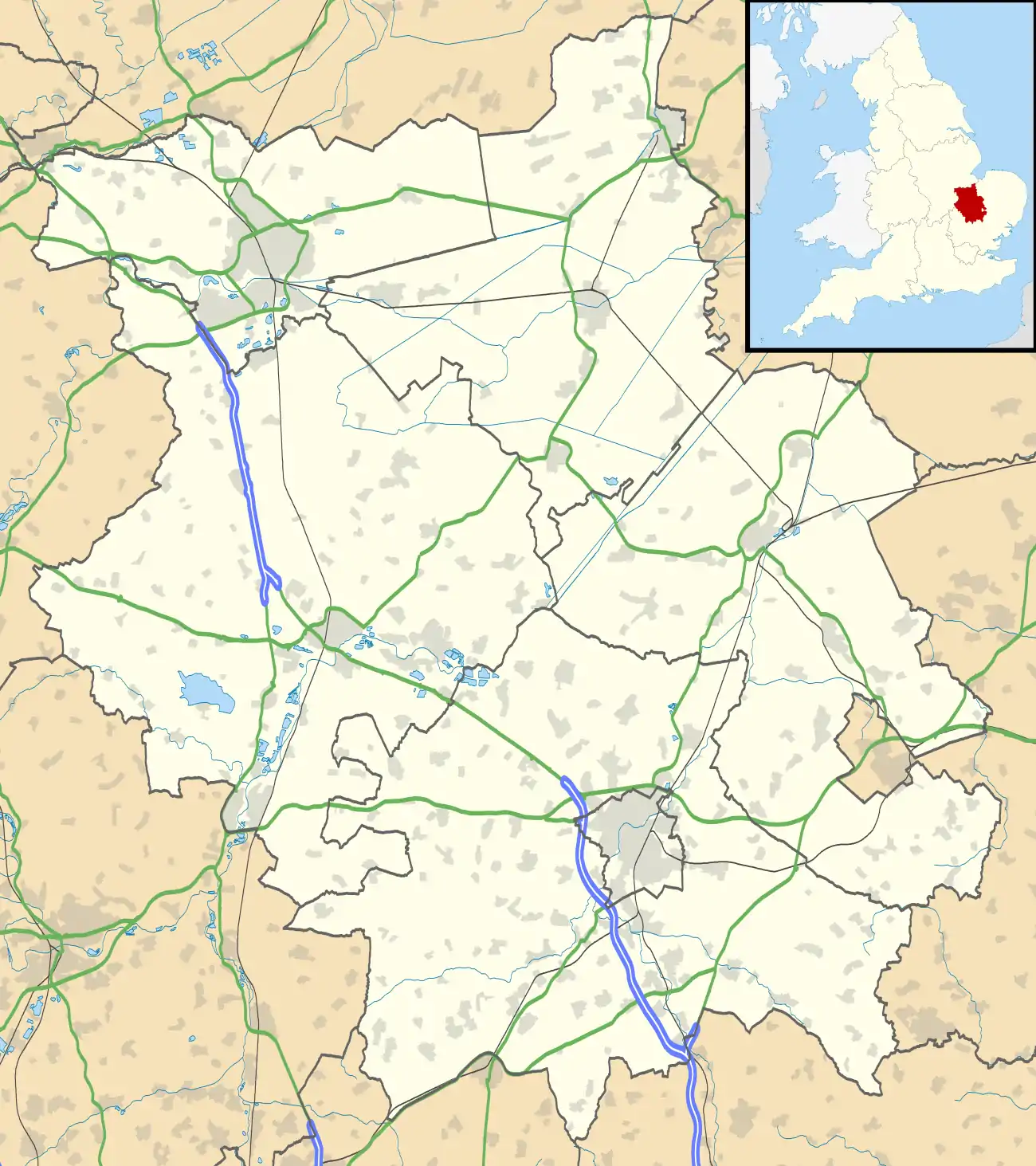
Kimbolton is a village and civil parish in England.[1] Kimbolton is about 9 miles (14 km) west of Huntingdon and 14 miles (23 km) north of Bedford. Kimbolton is administered as part of Cambridgeshire; however it is geographically situated within Huntingdonshire, which is an historic county of England and is now a non-metropolitan district of Cambridgeshire. The parish includes the hamlet of Stonely.
| Kimbolton | |
|---|---|
 High Street | |
 Kimbolton Location within Cambridgeshire | |
| Population | 1,477 (Including Stonely2011 Census) |
| OS grid reference | TL102681 |
| Civil parish |
|
| District | |
| Shire county | |
| Region | |
| Country | England |
| Sovereign state | United Kingdom |
| Post town | Huntingdon |
| Postcode district | PE28 |
| Police | Cambridgeshire |
| Fire | Cambridgeshire |
| Ambulance | East of England |
| UK Parliament | |
Catherine of Aragon, after her divorce from Henry VIII, died at Kimbolton Castle in 1536.
History
Limited archaeological finds in the vicinity of the airfield suggest that there may have been a small Roman settlement. The name Kimbolton, however, is Anglo-Saxon meaning "Cenebald's Ton" (or estate).[2]
Kimbolton, and the lands of its soke, comprised the only estate of King Harold in Huntingdonshire. It is believed that Harold had a hunting lodge nearby. The town was listed as Chenebaltone and Kenebaltone in the Domesday Book of 1086 in the Hundred of Leightonstone in Huntingdonshire.[3] The survey records that there were 20 ploughlands at Kimbolton in 1086 and, in addition to the arable land, there were 70 acres (28 hectares) of meadows, 3,784 acres (1,531 hectares) of woodland and a water mill.[4] By 1086 there were already a church and a priest at Kimbolton.
Many members of the Montagu family (Earls and Dukes of Manchester of Kimbolton) are buried at St Andrew's Church. Several Montagu monuments still exist in the South Chapel, while the Montagu vault (extended in 1853) is located beneath the North Chapel.[5]
The main road through Kimbolton bends through four tight right angles in quick succession. Originally, the road travelled directly through the outskirts of the village, nearer to the River Kym to the north.
The parish also includes the hamlet of Stonely, the site of a former Augustinian priory.[6]
Castle

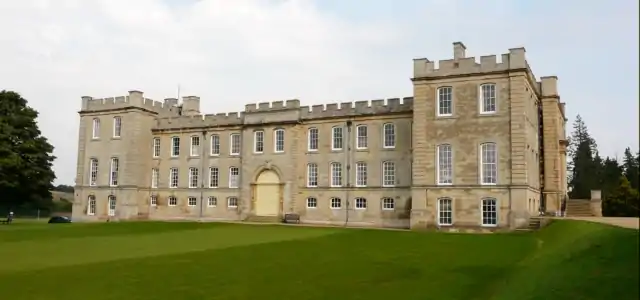
The centre of the village is Kimbolton Castle which now forms the main building of Kimbolton School (an independent day and boarding secondary school), but its predecessor on the same site was once home and prison to Catherine of Aragon after her divorce from Henry VIII. Catherine died at Kimbolton Castle in 1536 and was transported from there to Peterborough Cathedral to be buried.[7]
Governance
Kimbolton was in the historic and administrative county of Huntingdonshire until 1965. From 1965, the village was part of the new administrative county of Huntingdon and Peterborough. Then in 1974, following the Local Government Act 1972, Kimbolton became a part of the administrative county of Cambridgeshire.
For Kimbolton the highest tier of local government is Cambridgeshire County Council. Kimbolton is part of the electoral division of Brampton and Kimbolton[8] and is represented on the county council by one councillor.[9] The second tier of local government is Huntingdonshire District Council, a non-metropolitan district of Cambridgeshire. Kimbolton is a part of the district ward of Kimbolton and Staughton and is represented on the district council by one councillor.[8][10] District councillors serve for four-year terms following elections to Huntingdonshire District Council. As a civil parish, Kimbolton has a parish council.
At Westminster Kimbolton is in the parliamentary constituency of Huntingdon,[8] and since 2001 has been represented in the House of Commons by Jonathan Djanogly (Conservative).
Demography
Population
In the period 1801 to 1901 the population of Kimbolton was recorded every ten years by the UK census. During this time the population was in the range of 915 (the lowest was in 1901) and 1661 (the highest was in 1861).[11]
From 1901, a census was taken every ten years with the exception of 1941 (due to the Second World War).
| Parish |
1911 |
1921 |
1931 |
1951 |
1961 |
1971 |
1981 |
1991 |
2001 |
2011 |
|---|---|---|---|---|---|---|---|---|---|---|
| Kimbolton | 913 | 902 | 699 | 845 | 824 | 1136 | 858 | 1315 | 1432 | 1477 |
All population census figures from report Historic Census figures Cambridgeshire to 2011 by Cambridgeshire Insight.[11]
In 2011, the parish covered an area of 4,964 acres (2,009 hectares)[11] and so the population density for Kimbolton in 2011 was 190.4 persons per square mile (73.5 per square kilometre).
In 2019 there are around 1150 people living in the village.
Statute Fair and market
Origin
The Statute Fair, referred to affectionately by locals as the "Statty Fair" or simply the "Statty", is a fair held every September and has been characterised by one local historian as "Dodgems, darts, candy floss and cuddly toys".[12] The Kimbolton Statute Fair shares a wider history and heritage with similar statute fairs across England, dating back to the 1351 Statute of Labourers.
.jpg.webp)
In 1200, a prominent local landowner, Geoffrey Fitz Peter, Earl of Essex and Chief Justice to King John, who constructed the first castle on the present site, received a Royal charter to hold a fair in Kimbolton on St. Andrew's Eve (and the two days hence), as well as a weekly market on Fridays. During the medieval period there were as many as five fairs in Kimbolton, with a "Tandry Fair" being held in the village for the sale of "cattle and hogs" until the 19th Century.[13]
During the medieval period a market cross was set up, around which market traders gathered to sell their goods - the foundations of which survive under the High Street. A plaque commemorating the cross exists near the war memorial.[14] In 1603 the market cross was replaced with a wooden market hall - similar to the one at Ledbury - known as "Butchers' Row", which survived until the 1870s, when it was demolished; by the 1890s the market has declined to the point where it had "effectively disappeared".[15]
By the end of the Victorian period, alongside Kimbolton's declining population, only the Statute Fair remained of the numerous fairs. By no later than 1881 the fair's purpose had changed from the traditional hiring fair to a recreational fete. One account from the Rev. Robert Kater Vinter in the 1881 Kimbolton School magazine described the "wretched mixture" of revellers travelling from neighbouring villages to drink, smoke and partake in all the fun of the fair - including a coconut shy, wooden carousel and an exhibition booth featuring real life Zulus.[16] A later account from William Abington (b. 1903) recalled further attractions including hoopla, toffee and rock stalls, swinging boats, a joke toy stall and a tent that boasted the "fattest women in the world".[17]
Present day
In the present day the Statute Fair continues and is widely attended by students from the village school as well as those from other nearby schools and adults. It takes place on the High Street for one evening each September (unlike the three days granted by King John), and as such the High Street is closed for a 48-hour period, with traffic being redirected down St. Andrew's Lane and East Street.[18] Modern attractions at the fair include bumper cars, a funhouse, inflatables and waltzers as well as fairground games, including the staple coconut shy; attendance is reported to be in the hundreds.[19]
The continuation of the fair (despite the chaos which formerly ensued when this meant partial closure of a trunk road) and the plaque marking the site of the former market cross are claimed by some as evidence that Kimbolton is a town, as opposed to a village, and still has the right to hold a weekly market. The main road was diverted to its present course to take it through the market place and increase toll revenue. Eight hundred years later, as a result of numerous vehicles striking walls and houses near the sharp bends, car transporters are not allowed in the village.

In 2020, the COVID-19 Pandemic limited the scale of the fair, even risking the fair not running for the first time in many years, far beyond living memory. One 'teacups' ride was placed at the castle end of the high street to ensure the tradition would not cease.
Facilities
Kimbolton is known locally for its facilities, including High Street shopping, two public houses, a Budgens outlet (formerly Robinsons fuel station), fire station,a Post-Office, a medical center, a Pharmacy and the Mandeville Hall, a charitable organisation providing facilities to the local community.[20]
Kimbolton railway station
The Kimbolton railway station was situated over two miles from the village centre.[21] It served the Midland Railway Kettering to Huntingdon Line. If travelling from London St. Pancras the journey would take approximately three hours, including a change at Kettering.[21] The station and its line closed in 1959.
Kimbolton Airfield
In World War II, the USAF 379th Bombardment Group was stationed at the nearby Kimbolton Airfield from May 1943 to June 1945. Part of the airfield is now used by Kimbolton Karting Club. As of 2019, there is free and unsupervised access to the airfield for walkers.
Kimbolton Fireworks
Kimbolton Fireworks, a well-known manufacturer of fireworks and organiser of public fireworks displays, is based in Kimbolton.[22] It grew from the extracurricular activities of Kimbolton School chaplain and chemistry master, Ron Lancaster, sometimes dubbed the "master blaster pastor." In 2020, the popular firework display was cancelled due to the COVID-19 pandemic.
References
- Ordnance Survey: Landranger map sheet 153 Bedford & Huntingdon (St Neots & Biggleswade) (Map). Ordnance Survey. 2013. ISBN 9780319231722.
- http://www.kimboltonandstonely-pc.gov.uk/Core/Kimbolton-Stonely-Parish-Council/Pages/History_of_Kimbolton_1.aspx
- Ann Williams; G.H. Martin, eds. (1992). Domesday Book: A Complete Translation. London: Penguin Books. p. 1365. ISBN 0-141-00523-8.
- Professor J.J.N. Palmer, University of Hull. "Open Domesday: Place – Kimbolton". opendomesday.org. Anna Powell-Smith. Retrieved 25 February 2016.
- Guided Tour of St Andrew’s Church, Kimbolton, access date 27 July 2015
- Huntingdonshire.gov.uk Archived 19 December 2013 at the Wayback Machine
- Express, Britain. "Kimbolton, Cambridgeshire". Britain Express. Retrieved 26 May 2019.
- "Ordnance Survey Election Maps". ordnancesurvey.co.uk. Ordnance Survey. Retrieved 23 February 2016.
- "Cambridgeshire County Council: Councillors". cambridgeshire.gov.uk. Cambridgeshire County Council. Archived from the original on 22 February 2016. Retrieved 15 February 2016.
- "Huntingdonshire District Council: Councillors". huntingdonshire.gov.uk. Huntingdonshire District Council. Retrieved 23 February 2016.
- "Historic Census figures Cambridgeshire to 2011". cambridgeshireinsight.org.uk. Cambridgeshire Insight. Archived from the original (xlsx – download) on 15 February 2016. Retrieved 12 February 2016.
- Butler, Nora (Spring 2003). "The Statty Fair". Kimbolton Local History Journal. 7: 15.
- Butler, Nora (Spring 2003). "The Statty Fair". Kimbolton Local History Journal. 7: 15–16.
- Butler, Nora (Spring 2003). "The Statty Fair". Kimbolton Local History Journal: 16.
- Butler, Nora (Spring 2003). "The Statty Fair". Kimbolton Local History Journal. 7: 16–17.
- Nora, Butler (Spring 2003). "The Statty Fair". Kimbolton Local History Journal. 7: 17.
- Butler, Nora (Spring 2003). "The Statty Fair". Kimbolton Local History Journal. 7: 18.
- "Kimbolton & Stonely Parish Council - Useful Links & Information". kimboltonandstonely-pc.gov.uk. Retrieved 27 August 2019.
- "All the fun of Statty Fair". The Hunts Post. Retrieved 28 August 2019.
- "HOME - The Mandeville Hall, Kimbolton". e-voice.org.uk. Retrieved 26 May 2019.
- Ingram, William (1951). The Power in a School. London: Midfleet Press. p. 93.
- "Kimbolton Fireworks". phoenixfireworks.co.uk. Retrieved 26 May 2019.