Kinross, Iowa
Kinross is a city in Keokuk County, Iowa, United States. The population was 73 at the 2010 census. The community is named after a place in Scotland.
Kinross, Iowa | |
|---|---|
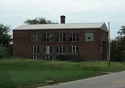 Former school | |
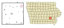 Location of Kinross, Iowa | |
| Coordinates: 41°27′34″N 91°59′15″W | |
| Country | |
| State | |
| County | Keokuk |
| Area | |
| • Total | 0.20 sq mi (0.51 km2) |
| • Land | 0.20 sq mi (0.51 km2) |
| • Water | 0.00 sq mi (0.00 km2) |
| Elevation | 823 ft (251 m) |
| Population | |
| • Total | 73 |
| • Estimate (2019)[3] | 72 |
| • Density | 363.64/sq mi (140.59/km2) |
| Time zone | UTC-6 (Central (CST)) |
| • Summer (DST) | UTC-5 (CDT) |
| ZIP code | 52335 |
| Area code(s) | 319 |
| FIPS code | 19-41475 |
| GNIS feature ID | 0458099 |
History
Kinross was created by people moving to be close to a new railroad depot in 1879 by moving both houses and businesses. This move along with other departures effectively turned their prior community, Hinkletown, Iowa, into a ghost town.
Geography
Kinross is located at 41°27′34″N 91°59′15″W (41.459422, -91.987387),[4] southwest of Iowa City.
According to the United States Census Bureau, the city has a total area of 0.20 square miles (0.52 km2), all of it land.[5]
Demographics
| Year | Pop. | ±% |
|---|---|---|
| 1900 | 132 | — |
| 1910 | 142 | +7.6% |
| 1920 | 138 | −2.8% |
| 1930 | 137 | −0.7% |
| 1940 | 109 | −20.4% |
| 1950 | 105 | −3.7% |
| 1960 | 103 | −1.9% |
| 1970 | 98 | −4.9% |
| 1980 | 79 | −19.4% |
| 1990 | 89 | +12.7% |
| 2000 | 80 | −10.1% |
| 2010 | 73 | −8.8% |
| 2019 | 72 | −1.4% |
| Source:"U.S. Census website". United States Census Bureau. Retrieved 2020-03-29. and Iowa Data Center Source: | ||
2010 census
As of the census[2] of 2010, there were 73 people, 32 households, and 19 families living in the city. The population density was 365.0 inhabitants per square mile (140.9/km2). There were 37 housing units at an average density of 185.0 per square mile (71.4/km2). The racial makeup of the city was 100.0% White.
There were 32 households, of which 28.1% had children under the age of 18 living with them, 46.9% were married couples living together, 9.4% had a female householder with no husband present, 3.1% had a male householder with no wife present, and 40.6% were non-families. 37.5% of all households were made up of individuals, and 12.5% had someone living alone who was 65 years of age or older. The average household size was 2.28 and the average family size was 3.11.
The median age in the city was 44.5 years. 24.7% of residents were under the age of 18; 9.5% were between the ages of 18 and 24; 16.4% were from 25 to 44; 41.1% were from 45 to 64; and 8.2% were 65 years of age or older. The gender makeup of the city was 53.4% male and 46.6% female.
2000 census
As of the census[7] of 2000, there were 80 people, 31 households, and 18 families living in the city. The population density was 416.5 people per square mile (162.6/km2). There were 39 housing units at an average density of 203.1 per square mile (79.3/km2). The racial makeup of the city was 100.00% White.
There were 31 households, out of which 32.3% had children under the age of 18 living with them, 54.8% were married couples living together, 3.2% had a female householder with no husband present, and 41.9% were non-families. 29.0% of all households were made up of individuals, and 6.5% had someone living alone who was 65 years of age or older. The average household size was 2.58 and the average family size was 3.33.
32.5% are under the age of 18, 6.3% from 18 to 24, 31.3% from 25 to 44, 21.3% from 45 to 64, and 8.8% who were 65 years of age or older. The median age was 36 years. For every 100 females, there were 110.5 males. For every 100 females age 18 and over, there were 92.9 males.
The median income for a household in the city was $31,563, and the median income for a family was $33,750. Males had a median income of $20,833 versus $18,750 for females. The per capita income for the city was $12,625. There were 14.3% of families and 11.7% of the population living below the poverty line, including no under eighteens and none of those over 64.
Education
It is within the English Valleys Community School District.[8]
References
- "2019 U.S. Gazetteer Files". United States Census Bureau. Retrieved July 17, 2020.
- "U.S. Census website". United States Census Bureau. Retrieved 2012-05-11.
- "Population and Housing Unit Estimates". United States Census Bureau. May 24, 2020. Retrieved May 27, 2020.
- "US Gazetteer files: 2010, 2000, and 1990". United States Census Bureau. 2011-02-12. Retrieved 2011-04-23.
- "US Gazetteer files 2010". United States Census Bureau. Archived from the original on 2012-07-02. Retrieved 2012-05-11.
- "Census of Population and Housing". Census.gov. Retrieved June 4, 2015.
- "U.S. Census website". United States Census Bureau. Retrieved 2008-01-31.
- "English Valleys." Iowa Department of Education. Retrieved on January 18, 2019.
External links
Municipalities and communities of Keokuk County, Iowa, United States | ||
|---|---|---|
| Cities | Map of Iowa highlighting Keokuk County | |
| Unincorporated communities | ||
| Ghost town | ||
| Footnotes | ‡This populated place also has portions in an adjacent county or counties | |
| ||