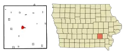
Sigourney, Iowa
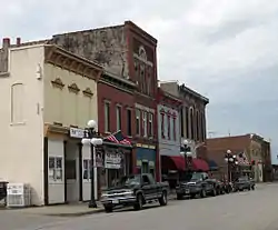
Sigourney (/ˈsɪɡərni/ SIG-ər-nee) is a city in Keokuk County, Iowa, United States. The population was 2,059 at the 2010 census. It is the county seat of Keokuk County.[4] Keokuk County Courthouse is located in the Public Square Historic District. Both are on the National Register of Historic Places.
Sigourney, Iowa | |
|---|---|
 | |
| Motto(s): Where tradition meets tomorrow | |
 Location of Sigourney, Iowa | |
| Coordinates: 41°20′0″N 92°12′12″W | |
| Country | |
| State | |
| County | Keokuk |
| Area | |
| • Total | 2.18 sq mi (5.65 km2) |
| • Land | 2.18 sq mi (5.65 km2) |
| • Water | 0.00 sq mi (0.00 km2) |
| Elevation | 794 ft (242 m) |
| Population | |
| • Total | 2,059 |
| • Estimate (2019)[3] | 2,017 |
| • Density | 923.96/sq mi (356.76/km2) |
| Time zone | UTC-6 (Central (CST)) |
| • Summer (DST) | UTC-5 (CDT) |
| ZIP code | 52591 |
| Area code(s) | 641 |
| FIPS code | 19-73110 |
| GNIS feature ID | 0461606 |
| Website | http://www.sigourney-iowa.com |
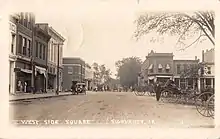
History
Keokuk County was opened for Euro-American settlement in 1843, and the town got its start in 1844 when S.A. James built the first cabin there. Other families began to settle there as well, and in 1844, the town was named by county commissioner Dr. George H. Stone in honor of popular poet Lydia Sigourney. A large oil-painted portrait of Lydia still graces the foyer of the county courthouse.[5]
Geography
Sigourney's longitude and latitude coordinates
in decimal form are 41.333244, -92.203220.[6]
According to the United States Census Bureau, the city has a total area of 2.18 square miles (5.65 km2), all of it land.[7]
Demographics
| Year | Pop. | ±% |
|---|---|---|
| 1850 | 162 | — |
| 1870 | 992 | +512.3% |
| 1880 | 1,735 | +74.9% |
| 1890 | 1,523 | −12.2% |
| 1900 | 1,952 | +28.2% |
| 1910 | 2,032 | +4.1% |
| 1920 | 2,210 | +8.8% |
| 1930 | 2,262 | +2.4% |
| 1940 | 2,355 | +4.1% |
| 1950 | 2,343 | −0.5% |
| 1960 | 2,387 | +1.9% |
| 1970 | 2,319 | −2.8% |
| 1980 | 2,330 | +0.5% |
| 1990 | 2,111 | −9.4% |
| 2000 | 2,209 | +4.6% |
| 2010 | 2,059 | −6.8% |
| 2019 | 2,017 | −2.0% |
| Source:"U.S. Census website". United States Census Bureau. Retrieved 2020-03-29. and Iowa Data Center Source: | ||
2010 census
As of the census[2] of 2010, there were 2,059 people, 878 households, and 537 families living in the city. The population density was 944.5 inhabitants per square mile (364.7/km2). There were 987 housing units at an average density of 452.8 per square mile (174.8/km2). The racial makeup of the city was 98.2% White, 0.7% African American, 0.2% Native American, 0.3% Asian, 0.1% from other races, and 0.4% from two or more races. Hispanic or Latino of any race were 0.4% of the population.
There were 878 households, of which 27.8% had children under the age of 18 living with them, 47.5% were married couples living together, 9.5% had a female householder with no husband present, 4.2% had a male householder with no wife present, and 38.8% were non-families. 34.3% of all households were made up of individuals, and 18.7% had someone living alone who was 65 years of age or older. The average household size was 2.23 and the average family size was 2.85.
The median age in the city was 45.1 years. 22.5% of residents were under the age of 18; 6.6% were between the ages of 18 and 24; 20.8% were from 25 to 44; 24.9% were from 45 to 64; and 25.2% were 65 years of age or older. The gender makeup of the city was 47.0% male and 53.0% female.
2000 census
As of the census[9] of 2000, there were 2,209 people, 903 households, and 567 families living in the city. The population density was 1,016.3 people per square mile (361.2/km2). There were 992 housing units at an average density of 456.4 per square mile (176.5/km2). The racial makeup of the city was 99.09% White, 0.14% African American, 0.14% Native American, 0.45% Asian, 0.14% from other races, and 0.05% from two or more races. Hispanic or Latino of any race were 0.54% of the population.
There were 903 households, out of which 29.6% had children under the age of 18 living with them, 51.4% were married couples living together, 9.0% had a female householder with no husband present, and 37.1% were non-families. 33.6% of all households were made up of individuals, and 21.5% had someone living alone who was 65 years of age or older. The average household size was 2.29 and the average family size was 2.93.
Age spread: 23.9% under the age of 18, 7.9% from 18 to 24, 22.7% from 25 to 44, 18.8% from 45 to 64, and 26.7% who were 65 years of age or older. The median age was 42 years. For every 100 females, there were 79.7 males. For every 100 females age 18 and over, there were 75.8 males.
The median income for a household in the city was $29,803, and the median income for a family was $43,519. Males had a median income of $29,783 versus $21,078 for females. The per capita income for the city was $17,218. About 8.5% of families and 10.8% of the population were below the poverty line, including 14.0% of those under age 18 and 10.7% of those age 65 or over.
Government
Sigourney is represented by Rep. David Loebsack in the United States House of Representatives.
Education
The Sigourney Community School District encompasses nearly a 70-square-mile (180 km2) radius, drawing students from smaller surrounding communities. Approximately 700 students are enrolled yearly, with an average of 350 attending elementary (K-6) and 350 students attending junior/senior high (7-12). The average graduating class is 50 students with 80% moving on to college. The school system's mascot is the Sigourney Savage.
Notable people
- William Lawrence Adrian (1883–1972), Roman Catholic bishop[10]
- Ambrose Burke, (1895–1998), Roman Catholic priest and educator[10]
- John Burke (1859–1938) tenth Governor of North Dakota, United States Treasurer, North Dakota Supreme Court justice[11]
- Katharine Goeldner, opera singer
- S.J. Mathes (1849–1927), newspaperman
- Ernest L. Parker (1864–1934), 13th Lieutenant Governor of Idaho
- Dan Peiffer (born 1951) NFL football player[12][13]
- Ezekiel S. Sampson (1831–1896), district judge and U.S. Representative[14]
References
- "2019 U.S. Gazetteer Files". United States Census Bureau. Retrieved July 17, 2020.
- "U.S. Census website". United States Census Bureau. Retrieved 2012-05-11.
- "Population and Housing Unit Estimates". United States Census Bureau. May 24, 2020. Retrieved May 27, 2020.
- "Find a County". National Association of Counties. Retrieved 2011-06-07.
- History of Sigourney Archived 2009-02-11 at the Wayback Machine
- "US Gazetteer files: 2010, 2000, and 1990". United States Census Bureau. 2011-02-12. Retrieved 2011-04-23.
- "US Gazetteer files 2010". United States Census Bureau. Archived from the original on 2012-01-25. Retrieved 2012-05-11.
- "Census of Population and Housing". Census.gov. Retrieved June 4, 2015.
- "U.S. Census website". United States Census Bureau. Retrieved 2008-01-31.
- Schmidt, Madeleine M. (1981). Seasons of Growth: History of the Diocese of Davenport. Davenport, Iowa: Diocese of Davenport. pp. 369–372.
- "John Burke". Architect of the Capitol. Retrieved 2011-09-15.
- "Dan Peiffer". National Football League. Retrieved 2011-08-02.
- "Dan Peiffer". Pro Football Reference. Retrieved 11 February 2018.
- "SAMPSON, Ezekiel Silas". Biographical Directory of the United States Congress. Retrieved 2011-08-03.
External links
| Wikimedia Commons has media related to Sigourney, Iowa. |
- Sigourney-iowa.com official city website
- Sigourney News-Review
- City-Data Comprehensive Statistical Data and more about Sigourney
Municipalities and communities of Keokuk County, Iowa, United States | ||
|---|---|---|
| Cities | Map of Iowa highlighting Keokuk County | |
| Unincorporated communities | ||
| Ghost town | ||
| Footnotes | ‡This populated place also has portions in an adjacent county or counties | |
| ||