North English, Iowa
North English is a city located mainly in Iowa county with a small portion in Keokuk county in the U.S. state of Iowa. The population was 1,041 at the 2010 census. It is named for the English River.
North English, Iowa | |
|---|---|
.jpg.webp) Aerial view of North English | |
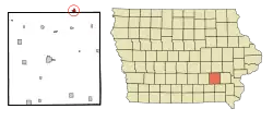 Location of North English, Iowa | |
| Coordinates: 41°30′55″N 92°4′42″W | |
| Country | |
| State | |
| Counties | Iowa, Keokuk |
| Area | |
| • Total | 0.61 sq mi (1.58 km2) |
| • Land | 0.61 sq mi (1.58 km2) |
| • Water | 0.00 sq mi (0.00 km2) |
| Elevation | 820 ft (250 m) |
| Population | |
| • Total | 1,041 |
| • Estimate (2019)[3] | 1,007 |
| • Density | 1,650.82/sq mi (637.29/km2) |
| Time zone | UTC-6 (Central (CST)) |
| • Summer (DST) | UTC-5 (CDT) |
| ZIP code | 52316 |
| Area code(s) | 319 |
| FIPS code | 19-57225 |
| GNIS feature ID | 0459577 |
History
North English was laid out in 1855; it was originally called Nevada.[4]
Geography
North English is located at 41°30′55″N 92°4′42″W (41.515202, -92.078331).[5]
According to the United States Census Bureau, the city has a total area of 0.55 square miles (1.42 km2), all land.[6]
Demographics
| Year | Pop. | ±% |
|---|---|---|
| 1900 | 683 | — |
| 1910 | 848 | +24.2% |
| 1920 | 933 | +10.0% |
| 1930 | 780 | −16.4% |
| 1940 | 865 | +10.9% |
| 1950 | 853 | −1.4% |
| 1960 | 1,004 | +17.7% |
| 1970 | 965 | −3.9% |
| 1980 | 990 | +2.6% |
| 1990 | 944 | −4.6% |
| 2000 | 991 | +5.0% |
| 2010 | 1,041 | +5.0% |
| 2019 | 1,007 | −3.3% |
| Source:"U.S. Census website". United States Census Bureau. Retrieved 2020-03-29. and Iowa Data Center Source: | ||
2010 census
As of the census[2] of 2010, there were 1,041 people, 444 households, and 276 families living in the city. The population density was 1,892.7 inhabitants per square mile (730.8/km2). There were 484 housing units at an average density of 880.0 per square mile (339.8/km2). The racial makeup of the city was 99.2% White, 0.3% African American, and 0.5% from two or more races. Hispanic or Latino of any race were 0.7% of the population.
There were 444 households, of which 29.7% had children under the age of 18 living with them, 45.5% were married couples living together, 13.1% had a female householder with no husband present, 3.6% had a male householder with no wife present, and 37.8% were non-families. 35.4% of all households were made up of individuals, and 18.1% had someone living alone who was 65 years of age or older. The average household size was 2.23 and the average family size was 2.86.
The median age in the city was 41.7 years. 24.9% of residents were under the age of 18; 5.6% were between the ages of 18 and 24; 23% were from 25 to 44; 23.3% were from 45 to 64; and 23.2% were 65 years of age or older. The gender makeup of the city was 45.7% male and 54.3% female.
2000 census
As of the census[8] of 2000, there were 991 people, 408 households, and 255 families living in the city. The population density was 1,784.2 people per square mile (683.3/km2). There were 449 housing units at an average density of 808.4 per square mile (309.6/km2). The racial makeup of the city was 98.99% White, 0.10% African American, 0.30% Native American, 0.10% Asian, and 0.50% from two or more races. Hispanic or Latino of any race were 1.01% of the population.
There were 408 households, out of which 28.2% had children under the age of 18 living with them, 50.5% were married couples living together, 9.8% had a female householder with no husband present, and 37.3% were non-families. 33.6% of all households were made up of individuals, and 17.6% had someone living alone who was 65 years of age or older. The average household size was 2.29 and the average family size was 2.94.
Age spread: 22.5% under the age of 18, 7.0% from 18 to 24, 24.4% from 25 to 44, 18.2% from 45 to 64, and 28.0% who were 65 years of age or older. The median age was 42 years. For every 100 females, there were 84.5 males. For every 100 females age 18 and over, there were 77.4 males.
The median income for a household in the city was $32,639, and the median income for a family was $43,162. Males had a median income of $31,480 versus $23,563 for females. The per capita income for the city was $16,158. About 5.9% of families and 8.2% of the population were below the poverty line, including 8.8% of those under age 18 and 7.6% of those age 65 or over.
Schools
North English is located within the English Valleys Community School District.[9] Schools include:
Notable person
- Mace Brown, born in North English, was a relief pitcher in Major League Baseball
References
- "2019 U.S. Gazetteer Files". United States Census Bureau. Retrieved July 17, 2020.
- "U.S. Census website". United States Census Bureau. Retrieved 2012-05-11.
- "Population and Housing Unit Estimates". United States Census Bureau. May 24, 2020. Retrieved May 27, 2020.
- The History of Iowa County, Iowa: Containing a History of the County, Its Cities, Towns, &c. Union Historical Company. 1881. pp. 627.
- "US Gazetteer files: 2010, 2000, and 1990". United States Census Bureau. 2011-02-12. Retrieved 2011-04-23.
- "US Gazetteer files 2010". United States Census Bureau. Archived from the original on 2011-02-20. Retrieved 2012-05-11.
- "Census of Population and Housing". Census.gov. Retrieved June 4, 2015.
- "U.S. Census website". United States Census Bureau. Retrieved 2008-01-31.
- "English Valleys Archived 2018-04-27 at the Wayback Machine." Iowa Department of Education. Retrieved on January 18, 2019.
Municipalities and communities of Iowa County, Iowa, United States | ||
|---|---|---|
| Cities | Map of Iowa highlighting Iowa County | |
| Townships | ||
| CDPs | ||
| Footnotes | ‡This populated place also has portions in an adjacent county or counties | |
| ||
Municipalities and communities of Keokuk County, Iowa, United States | ||
|---|---|---|
| Cities | Map of Iowa highlighting Keokuk County | |
| Unincorporated communities | ||
| Ghost town | ||
| Footnotes | ‡This populated place also has portions in an adjacent county or counties | |
| ||
| Authority control |
|---|