Komono, Mie
Komono (菰野町, Komono-chō) is a town located in Mie Prefecture, Japan. As of November 2012, the town had an estimated population of 40,289 and a population density of 377 persons per km². The total area was 106.89 km².
Komono
菰野町 | |
|---|---|
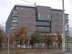 Komono Town Office | |
 Flag  Seal | |
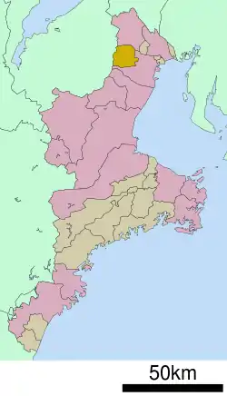 Location of Komono in Mie Prefecture | |
 Komono | |
| Coordinates: 35°1′N 136°30′E | |
| Country | Japan |
| Region | Kansai |
| Prefecture | Mie |
| District | Mie |
| Government | |
| • Mayor | Takayuki Shibata |
| Area | |
| • Total | 106.89 km2 (41.27 sq mi) |
| Population (November 2012) | |
| • Total | 40,289 |
| • Density | 377/km2 (980/sq mi) |
| Time zone | UTC+9 (Japan Standard Time) |
| - Tree | Zelkova serrata |
| - Bird | Japanese bush warbler |
| - Beast | Japanese serow |
| Phone number | 059-391-1111 |
| Address | 1480 Komoro, Komoro-chō, Mie-gun, Mie-ken 510-1292 |
| Website | www |
Geography
Komono is located in the mountainous region of northern Mie Prefecture, bordering on Shiga Prefecture. Parts of the town are within the limits of the Suzuka Quasi-National Park.
Neighboring municipalities
- Mie Prefecture
- Shiga Prefecture
History
Komoro was the center of 12,000 koku Komono Domain under the Tokugawa shogunate, ruled by the Hijitaka clan from 1600 until the Meiji restoration of 1871. In the establishment of municipalities under the Meiji government’s reforms, it became Komoro village within Mie District of Mie Prefecture. Komoro was elevated to town status in 1928.
Transportation
Railway
Highway
- Shin-Meishin Expressway (under construction)
- Japan National Route 306
- Japan National Route 477
Local attractions
Notable people
- Tomoya Uchida – professional soccer player
- Yuki Nishi – professional baseball player
- Takuma Asano - professional soccer player
External links
![]() Media related to Komono, Mie at Wikimedia Commons
Media related to Komono, Mie at Wikimedia Commons
- Komono official website (in Japanese)
| Special city | ||
|---|---|---|
| Cities | ||
| Districts | ||
| Authority control |
|---|