Tōin, Mie
Tōin (東員町, Tōin-chō) is a town located in Inabe District, Mie Prefecture, Japan. As of November 2012, the town had an estimated population of 25,552 and a population density of 1130 persons per km2. The total area was 22.66 km2.
Tōin
東員町 | |
|---|---|
Town | |
 Tōin Town Office | |
 Flag  Seal | |
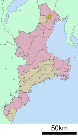 Location of Tōin in Mie Prefecture | |
 Tōin | |
| Coordinates: 35°4′N 136°36′E | |
| Country | Japan |
| Region | Kansai |
| Prefecture | Mie |
| District | Inabe |
| Area | |
| • Total | 22.66 km2 (8.75 sq mi) |
| Population (November 2012) | |
| • Total | 25,552 |
| • Density | 1,130/km2 (2,900/sq mi) |
| Time zone | UTC+9 (Japan Standard Time) |
| Symbols | |
| • Tree | Prunus mume |
| • Flower | Paeonia lactiflora |
| • Bird | Eurasian skylark |
| Phone number | 0594-86-2800 |
| Address | 1600 Yamada, Tōin-chō, Inabe-gun, Mie-ken 511-0295 |
| Website | www |
Geography
Tōin is located near the far northeastern tip of the Kii Peninsula.
History
The village of Tōin was established on November 3, 1954 by the merger of the villages of Daicho, Kanda, and Inabe. It was elevated to town status on April 1, 1967.
Transportation
Railway
Notable people
- Matsumoto Kōshirō VII – kabuki actor
- Tomoki Hoshino – professional baseball player
External links
![]() Media related to Tōin, Mie at Wikimedia Commons
Media related to Tōin, Mie at Wikimedia Commons
- Tōin official website (in Japanese)
| Special city | ||
|---|---|---|
| Cities | ||
| Districts | ||
| Authority control |
|---|
This article is issued from Wikipedia. The text is licensed under Creative Commons - Attribution - Sharealike. Additional terms may apply for the media files.
