Kootenay Pass
Kootenay Pass, known locally as "the Salmo–Creston" is a mountain pass in the Selkirk Mountains of British Columbia, Canada. The pass summit divides the drainage basin of the Pend d'Oreille River on the west (via tributaries Stagleap Creek, the South Salmo River and the Salmo River) from that of Kootenay River/Kootenay Lake to the east (via tributary Summit Creek). It is used by the Crowsnest Highway to transverse the Selkirks, connecting the communities of Salmo and Creston. At its opening the highway route was also dubbed the Kootenay Skyway.
| Kootenay Pass | |
|---|---|
| Elevation | 1,775 m (5,823 ft) |
| Traversed by | |
| Location | British Columbia, Canada |
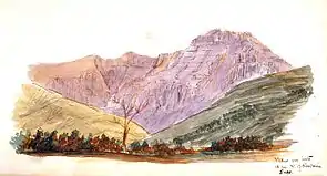
| Range | Selkirk Mountains |
| Coordinates | 49°3′29″N 117°2′31″W |
The pass summit is located within Stagleap Provincial Park near Bridal Lake. A webcam operates year-round showing the current conditions of the pass.[1]
The Kootenay Pass is one of the highest highway-served passes in Canada that is open year-round, although it is frequently closed in bad weather for avalanche control and clearing of debris. Bow Summit on the Icefields Parkway in Banff National Park, Alberta, is higher at 2,088 m (6,850 ft). Highwood Pass in Kananaskis Country, Alberta, is even higher at 2,206 m (7,238 ft), but it is traversed by Highway 40, which closes from December 1 to June 15 every year.
Avalanche control
Most avalanche control at Kootenay Pass is done by a Gazex system that allows avalanche technicians to trigger avalanches remotely from the comfort of their office at the summit, visible from the summit webcam.[2] This Gazex system has allowed for the removal of large artillery stations that were used to fire ballistic shells into start zones. On occasion, artillery shells would not explode and had to be found and destroyed during summer months with considerable expense and danger.
Alternatives
When Kootenay Pass is closed, travellers coming from the east must drive north from Creston to the Kootenay Lake Ferry at Kootenay Bay, then from Balfour through Nelson to Castlegar to get back on Highway 3A. When the pass is closed, ferry waits are often long. The Kootenay Lake Ferry's first sailing is from Balfour at 6:30 am and the last is at 10:20 pm from Kootenay Bay; however, when Kootenay Pass is closed the Kootenay Lake Ferry operates 24 hours a day until Kootenay Pass is reopened.
References
- "B.C.Highway Cams". images.drivebc.ca. Retrieved 2020-12-16.
- "Gazex". pistehors.com. Retrieved 2020-12-16.