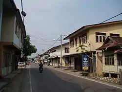
Kuala Besut
Kuala Besut is a mukim in Besut District, Terengganu, Malaysia.
Kuala Besut | |
|---|---|
 | |
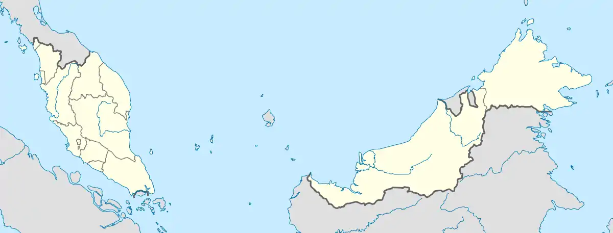 Kuala Besut Location in Malaysia | |
| Coordinates: 5°50′N 102°34′E | |
| Country | Malaysia |
| State | Terengganu |
| District | Besut |
| Time zone | UTC+8 (Malaysian Standard Time) |
It is the departure point for boats to the Perhentian Islands. There are a variety of tour operators that tourist can choose for getting to Perhentian Islands. Small shops selling souvenirs of Perhentian Islands are also available around the town.
History
World War II
Imperial Japanese forces from Kota Bharu successfully invades Kuala Besut on 10 December 1942 in order to capture the airfield on Gong Kedak before proceeding to the capital of Terengganu.
Climate
Kuala Besut has a tropical rainforest climate (Af) with moderate rainfall from February to May and heavy to very heavy to very heavy rainfall in the remaining months.
| Climate data for Kuala Besut | |||||||||||||
|---|---|---|---|---|---|---|---|---|---|---|---|---|---|
| Month | Jan | Feb | Mar | Apr | May | Jun | Jul | Aug | Sep | Oct | Nov | Dec | Year |
| Average high °C (°F) | 28.7 (83.7) |
29.5 (85.1) |
30.9 (87.6) |
32.0 (89.6) |
32.3 (90.1) |
32.0 (89.6) |
31.6 (88.9) |
31.3 (88.3) |
31.3 (88.3) |
30.6 (87.1) |
29.3 (84.7) |
28.6 (83.5) |
30.7 (87.2) |
| Daily mean °C (°F) | 25.6 (78.1) |
25.9 (78.6) |
26.8 (80.2) |
27.7 (81.9) |
28.0 (82.4) |
27.8 (82.0) |
27.4 (81.3) |
27.2 (81.0) |
27.2 (81.0) |
26.9 (80.4) |
26.2 (79.2) |
25.8 (78.4) |
26.9 (80.4) |
| Average low °C (°F) | 22.5 (72.5) |
22.4 (72.3) |
22.8 (73.0) |
23.5 (74.3) |
23.8 (74.8) |
23.6 (74.5) |
23.2 (73.8) |
23.2 (73.8) |
23.1 (73.6) |
23.2 (73.8) |
23.2 (73.8) |
23.0 (73.4) |
23.1 (73.6) |
| Average rainfall mm (inches) | 252 (9.9) |
116 (4.6) |
125 (4.9) |
80 (3.1) |
118 (4.6) |
137 (5.4) |
119 (4.7) |
190 (7.5) |
224 (8.8) |
288 (11.3) |
535 (21.1) |
621 (24.4) |
2,805 (110.3) |
| Source: Climate-Data.org[1] | |||||||||||||
Gallery
 Kuala Besut Harbour and Jetty
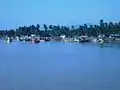 Kuala Besut river seen from the main bridge
References
- "Climate: Kuala Besut". Climate-Data.org. Retrieved 28 October 2020.
External links
| Wikimedia Commons has media related to Kuala Besut. |
| Wikivoyage has a travel guide for Kuala Besut. |
State of Terengganu | |
|---|---|
Capital: Kuala Terengganu | |
| Topics |
|
| Society |
|
| Administrative divisions | |
| |
This article is issued from Wikipedia. The text is licensed under Creative Commons - Attribution - Sharealike. Additional terms may apply for the media files.