L'Érable Regional County Municipality
L'Érable (Maple) is a regional county municipality in the Centre-du-Québec region of Quebec, Canada. Named for its maple trees, the area is rural in nature and is located 50 km southwest of Quebec City. Its seat is Plessisville.
L'Érable | |
|---|---|
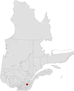 Location in province of Quebec. | |
| Coordinates: 46°15′N 71°45′W[1] | |
| Country | |
| Province | |
| Region | Centre-du-Québec |
| Effective | January 1, 1982 |
| County seat | Plessisville |
| Government | |
| • Type | Prefecture |
| • Prefect | Sylvain Labrecque |
| Area | |
| • Total | 1,300.70 km2 (502.20 sq mi) |
| • Land | 1,287.86 km2 (497.25 sq mi) |
| Population (2016)[3] | |
| • Total | 23,425 |
| • Density | 18.2/km2 (47/sq mi) |
| • Change 2011-2016 | |
| • Dwellings | 11,315 |
| Time zone | UTC−5 (EST) |
| • Summer (DST) | UTC−4 (EDT) |
| Area code(s) | 819 |
| Website | www |
| [4] | |
Subdivisions
There are 11 subdivisions within the RCM:[2]
|
|
|
Demographics
Mother tongue from 2016 Canadian Census[3]
| Language | Population | Pct (%) |
|---|---|---|
| French only | 22,735 | 98.3% |
| English only | 150 | 0.6% |
| Both English and French | 50 | 0.2% |
| Other languages | 200 | 0.9% |
Transportation
References
- Reference number 141075 of the Commission de toponymie du Québec (in French)
- "Ministère des Affaires municipales, des Régions et de l'Occupation du territoire: L'Érable Regional County Municipality". Archived from the original on 2014-11-08. Retrieved 2012-03-11.
- "Census Profile, 2016 Census: L'Érable, Municipalité régionale de comté [Census division], Quebec". Statistics Canada. Retrieved November 26, 2019.
- 2011 Statistics Canada Census Profile: L'Érable Regional County Municipality, Quebec
- Official Transport Quebec Road Map
Adjacent Counties & Equivalent Territories | ||||||||||
|---|---|---|---|---|---|---|---|---|---|---|
| ||||||||||
| Regional county municipalities and equivalent territories | |
|---|---|
| Municipalities | |
This article is issued from Wikipedia. The text is licensed under Creative Commons - Attribution - Sharealike. Additional terms may apply for the media files.