La Chapelle-Saint-Luc
La Chapelle-Saint-Luc is a commune in the Aube department in north-central France, right next to Troyes.
La Chapelle-Saint-Luc | |
|---|---|
.jpg.webp) The church in La Chapelle-Saint-Luc | |
Location of La Chapelle-Saint-Luc 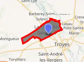
| |
 La Chapelle-Saint-Luc  La Chapelle-Saint-Luc | |
| Coordinates: 48°18′45″N 4°02′43″E | |
| Country | France |
| Region | Grand Est |
| Department | Aube |
| Arrondissement | Troyes |
| Canton | Troyes-3 |
| Intercommunality | CA Troyes Champagne Métropole |
| Government | |
| • Mayor (2008–2014) | Olivier Girardin |
| Area 1 | 10.48 km2 (4.05 sq mi) |
| Population (2017-01-01)[1] | 12,319 |
| • Density | 1,200/km2 (3,000/sq mi) |
| Time zone | UTC+01:00 (CET) |
| • Summer (DST) | UTC+02:00 (CEST) |
| INSEE/Postal code | 10081 /10600 |
| Elevation | 98–164 m (322–538 ft) (avg. 100 m or 330 ft) |
| 1 French Land Register data, which excludes lakes, ponds, glaciers > 1 km2 (0.386 sq mi or 247 acres) and river estuaries. | |
Population
| Year | Pop. | ±% |
|---|---|---|
| 1793 | 330 | — |
| 1800 | 310 | −6.1% |
| 1806 | 349 | +12.6% |
| 1821 | 259 | −25.8% |
| 1831 | 348 | +34.4% |
| 1836 | 367 | +5.5% |
| 1841 | 373 | +1.6% |
| 1846 | 398 | +6.7% |
| 1851 | 409 | +2.8% |
| 1856 | 378 | −7.6% |
| 1861 | 383 | +1.3% |
| 1866 | 373 | −2.6% |
| 1872 | 402 | +7.8% |
| 1876 | 480 | +19.4% |
| 1881 | 569 | +18.5% |
| 1886 | 627 | +10.2% |
| 1891 | 588 | −6.2% |
| 1896 | 803 | +36.6% |
| 1901 | 881 | +9.7% |
| 1906 | 938 | +6.5% |
| 1911 | 1,117 | +19.1% |
| 1921 | 1,252 | +12.1% |
| 1926 | 1,659 | +32.5% |
| 1931 | 1,986 | +19.7% |
| 1936 | 2,250 | +13.3% |
| 1946 | 2,088 | −7.2% |
| 1954 | 3,483 | +66.8% |
| 1962 | 4,594 | +31.9% |
| 1968 | 6,528 | +42.1% |
| 1975 | 15,136 | +131.9% |
| 1982 | 16,241 | +7.3% |
| 1990 | 15,815 | −2.6% |
| 1999 | 14,442 | −8.7% |
| 2008 | 13,203 | −8.6% |
| 2012 | 12,878 | −2.5% |
See also
References
- "Populations légales 2017". INSEE. Retrieved 6 January 2020.
External links
| Wikimedia Commons has media related to La Chapelle-Saint-Luc. |
| Authority control |
|
|---|
This article is issued from Wikipedia. The text is licensed under Creative Commons - Attribution - Sharealike. Additional terms may apply for the media files.