La Palma, Cuba
La Palma is a municipality and town in the Pinar del Río Province of Cuba. It is located in the northern part of the province, on the coast of the Straits of Florida, north of Consolación del Sur and north-east of Viñales.
La Palma | |
|---|---|
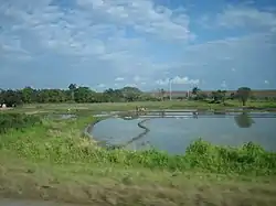 A rice field in La Palma | |
.png.webp) La Palma municipality (red) within Pinar del Río Province (yellow) and Cuba | |
| Coordinates: 22°44′50″N 83°33′9″W | |
| Country | Cuba |
| Province | Pinar del Río |
| Area | |
| • Total | 621 km2 (240 sq mi) |
| Elevation | 50 m (160 ft) |
| Population (2004)[2] | |
| • Total | 35,426 |
| • Density | 57/km2 (150/sq mi) |
| Time zone | UTC-5 (EST) |
| Area code(s) | +53-82 |
Overview
The Viñales Valley World Heritage Site is located east of La Palma, while the Sierra del Rosario Biosphere Reserve extends to the east. Cayo Levisa, a popular tourist attraction, is a cay of the Colorados Archipelago, located 2 kilometres (1.2 mi) north of the municipality's northern coast.
La Palma Municipal Museum is located in the Martí street.
Demographics
In 2004, the municipality of La Palma had a population of 35,426.[2] With a total area of 621 km2 (240 sq mi),[1] it has a population density of 57.0/km2 (148/sq mi).
References
- Statoids (July 2003). "Municipios of Cuba". Retrieved 2007-10-07.
- Atenas.cu (2004). "2004 Population trends, by Province and Municipality" (in Spanish). Archived from the original on 2007-09-27. Retrieved 2007-10-07.
External links
![]() Media related to La Palma, Cuba at Wikimedia Commons
Media related to La Palma, Cuba at Wikimedia Commons
Places adjacent to La Palma, Cuba | |
|---|---|