La Plata, New Mexico
La Plata is a census-designated place in San Juan County, New Mexico, United States. Its population was 612 as of the 2010 census.[2] La Plata has a post office with ZIP code 87418.[4][5] The community is located at the junction of state roads 170 and 574.
La Plata, New Mexico | |
|---|---|
Census-designated place | |
 La Plata, New Mexico | |
| Coordinates: 36°55′43″N 108°11′25″W | |
| Country | United States |
| State | New Mexico |
| County | San Juan |
| Area | |
| • Total | 10.157 sq mi (26.31 km2) |
| • Land | 10.152 sq mi (26.29 km2) |
| • Water | 0.005 sq mi (0.01 km2) |
| Elevation | 5,787 ft (1,764 m) |
| Population | |
| • Total | 612 |
| • Density | 60/sq mi (23/km2) |
| Time zone | UTC-7 (Mountain (MST)) |
| • Summer (DST) | UTC-6 (MDT) |
| ZIP code | 87418 |
| Area code(s) | 505 |
| GNIS feature ID | 890851[3] |
References
- "US Gazetteer files: 2010, 2000, and 1990". United States Census Bureau. 2011-02-12. Retrieved 2011-04-23.
- "U.S. Census website". United States Census Bureau. Retrieved 2011-05-14.
- "La Plata". Geographic Names Information System. United States Geological Survey.
- United States Postal Service (2012). "USPS - Look Up a ZIP Code". Retrieved 2012-02-15.
- "Postmaster Finder - Post Offices by ZIP Code". United States Postal Service. Retrieved October 24, 2013.
Municipalities and communities of San Juan County, New Mexico, United States | ||
|---|---|---|
| Cities | 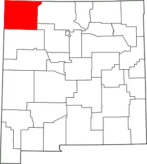 Map of New Mexico highlighting San Juan County | |
| CDPs |
| |
| Unincorporated communities | ||
| Indian reservations | ||
| Footnotes | ‡This populated place also has portions in an adjacent county or counties | |
| ||
This article is issued from Wikipedia. The text is licensed under Creative Commons - Attribution - Sharealike. Additional terms may apply for the media files.